Here's the routing I picked out, seems like the shortest way with all the restricted areas in the "R-2508 complex". Anybody have any troubles with this routing or other suggestions perhaps? I didn't even notice this transition route the first time I did this trip, combination of not enough planning and an outdated gps...ended up flying around it to the south of Edwards AFB.

Same route zoomed out a bit for reference...

I might check out some areas east of town if I get a chance, noticed this "Cortez VFR transition route" on the foreflight map, but it references the "side panel" of the chart and can't find any other details of the route in foreflight, and don't have an actual sectional for that area. Looks like this is only an "inbound route" ?? I guess I could ask for an east departure and see what they give me, but I'd rather not fly all the way around the south end of town if they're gonna keep me out of class B. Of course there is always the Hoover dam and Grand Canyon to fly over, but I'm still researching those areas with all their special flight rules. Would rather save those for another time and just check out any backcountry type places this time...if I even get a chance to do that.

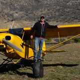
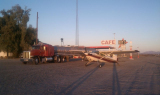
Found this strip on the chart, and actually saw it on a commercial flight not too long ago. Anybody have some insight on this strip? Looked pretty desolate, but maybe some hiking trails to a vista point or better??