Hey All,
I have to make a trip this weekend from Olympia over to Yakima (I fly a 90hp cub) and was wondering what the best route would be this time of year?
Tedd
Best Rte Across Cascades
Tue Oct 07, 2008 8:31 am
live life like you mean it
Tue Oct 07, 2008 9:49 am
Re: Best Rte Across Cascades
TGoth wrote:Hey All,
I have to make a trip this weekend from Olympia over to Yakima (I fly a 90hp cub) and was wondering what the best route would be this time of year?
Tedd
Greyhound.
But, if you go on a clear calm day pick any low point. If you want to be safer follow I90 or 12 over.
By all means think safety first. SPOT/PLB flight plan, survival gear.
Rob
- OregonMaule offline

- Posts: 6977
- Joined: Fri Sep 01, 2006 9:44 pm
- Location: Orygun
My SPOT page
"They who can give up essential liberty to obtain a little temporary safety, deserve neither liberty nor safety". Ben Franklin
http://en.wikiquote.org/wiki/Benjamin_Franklin
"They who can give up essential liberty to obtain a little temporary safety, deserve neither liberty nor safety". Ben Franklin
http://en.wikiquote.org/wiki/Benjamin_Franklin
Tue Oct 07, 2008 10:38 am
Re: Best Rte Across Cascades
TGoth wrote:Hey All,
I have to make a trip this weekend from Olympia over to Yakima (I fly a 90hp cub) and was wondering what the best route would be this time of year?
Tedd
For those who are playing along at home and aren't familiar with the Cascade mtns., they run north-south down through the middle of Washington. They aren't that high, with most of the tops from 5 to 8 thousand feet and some 3 to 4 thousand foot passes. However, in the fall and winter the prevailing winds from the west bring in quite a bit of moisture off of the Pacific and the ceilings are often lower than the passes.
I-90 over Snoqualmie Pass is probably your safest bet, although Stampede Pass is a more direct route from your location and isn't that much higher. Some days VFR will not be an option, so check the weather first.
The important thing to know is that there is a weather station at Stampede Pass, which is 10 miles south of Snoqualmie Pass. You can get preflight METAR using the code KSMP.
http://adds.aviationweather.gov/metars/index.php?submit=1&station_ids=KSMP&chk_tafs=on&chk_metars=on&hoursStr=2&std_trans=translated
You can check the weather enroute via the Stampede Pass ASOS at 135.275 (note that the frequency is displayed on the sectional).
Tue Oct 07, 2008 11:21 am
Thanks for the information, I did fly the Stampede Pass route this past summer and even then there were low lying clouds on the Enumclaw side.
Looking for some potential alternatives? Southern route maybe in the event the passes are all blocked?
I've never taken my cub up to 10k, so wasn't me.
Tedd
Looking for some potential alternatives? Southern route maybe in the event the passes are all blocked?
I've never taken my cub up to 10k, so wasn't me.
Tedd
live life like you mean it
Tue Oct 07, 2008 11:38 am
If you go far enough south you could go down the Columbia River Gorge. I have gone that route many times. Even when the wind was blowing a good clip.
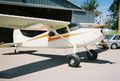
1959 Cessna 182 Skylane N9054N
My back country videos are here: http://www.youtube.com/skybobb
"I don't belong to any organized Political party, I'm a Democrat."
Will Rogers 1879 - 1935
My back country videos are here: http://www.youtube.com/skybobb
"I don't belong to any organized Political party, I'm a Democrat."
Will Rogers 1879 - 1935
Tue Oct 07, 2008 12:03 pm
skybobb wrote:If you go far enough south you could go down the Columbia River Gorge. I have gone that route many times. Even when the wind was blowing a good clip.
It's the only sea level mountain pass on the west coast.
- Zzz offline


- Posts: 2855
- Joined: Fri Oct 08, 2004 11:09 pm
- Location: northern
- Aircraft: Swiveling desk chair
Half a century spent proving “it is better to be thought a fool than to open your mouth and remove all doubt.”
Tue Oct 07, 2008 12:08 pm
skybobb wrote:If you go far enough south you could go down the Columbia River Gorge. I have gone that route many times. Even when the wind was blowing a good clip.
It can get pretty rough with the wind racing through the gorge and over the surrounding ridges. Bear in mind my comfort level is fairly low.
- GroundLooper offline
- Posts: 1168
- Joined: Wed Jun 13, 2007 6:52 pm
- Location: Vancouver, WA
BCP Poser.
Life is good. Life is better with wings.
Life is good. Life is better with wings.
Tue Oct 07, 2008 12:58 pm
skybobb wrote:If you go far enough south you could go down the Columbia River Gorge. I have gone that route many times. Even when the wind was blowing a good clip.
I just looked at the distances on runwayfinder.com
Direct from olm to ykm is 100 nm (which would go through white pass which is 4500 ft.)
Going through Stampede Pass (3800 ft) is 120 nm.
Going through Snoqualmie Pass (3000 ft) is 135 nm.
Going down through the gorge is 180 nm.
And, according to google maps, driving via I-90 is 184 miles, which is 160 nm.
So, if the passes were impassable, I'd pass on the flying and just drive.
Tue Oct 07, 2008 6:21 pm
Most direct route other than over the top is to follow the high tension lines east of Seattle up into the hills. Just prior to Stampede is Green pass to the right/south. Hop over it, pick up the drainage into the Naches River and follow it all the way into Yak-a-vegas. 'Bout half way down the river you will pick up Highway 12 where it makes the hard turn and follows the drainage the rest of the way down.
I've flow it in Cubs, Skywagons, and a RV-8 once. Its doable even down into pretty awful weather.
Stampede Pass and down through Ellensburg is next best. Full I-90 route was always my third choice.
I've flow it in Cubs, Skywagons, and a RV-8 once. Its doable even down into pretty awful weather.
Stampede Pass and down through Ellensburg is next best. Full I-90 route was always my third choice.
ceh
Wed Oct 08, 2008 8:31 pm
kevbert wrote:.....I just looked at the distances on runwayfinder.com
Direct from olm to ykm is 100 nm (which would go through white pass which is 4500 ft.) ............................
On my map, OLM diect YKM is about 100 nm alright -- but right through Mount Ranier (about 14000 feet), not White Pass. You have to go south-ish to Morton or Packwood then east to fly White Pass.
Eric


Cessna Skywagon -- accept no substitute!
Wed Oct 15, 2008 5:01 pm
hotrod150 wrote:kevbert wrote:.....I just looked at the distances on runwayfinder.com
Direct from olm to ykm is 100 nm (which would go through white pass which is 4500 ft.) ............................
On my map, OLM diect YKM is about 100 nm alright -- but right through Mount Ranier (about 14000 feet), not White Pass. You have to go south-ish to Morton or Packwood then east to fly White Pass.
Eric
Don't use a map, use a chart!
When I use the word direct, I allow for minor course variance for obstacle avoidance.
The direct route goes a few miles south of Rainier, not right through it, although there are some mile high foothills there. You would have to veer about three miles to the south of the direct route to hit White Pass, and that would take you away from the higher terrain around Rainier as well. The course deviations only raise the distance by one to two percent, so I think it can still be considered a direct route.
Wed Oct 15, 2008 9:38 pm
If you are flying over to show the plane to a potential buyer and he passes on the plane, you will have to fly it back. Have him take the bus. Then he can fly it over the mountains.
Tim
Tim
- qmdv offline

- Posts: 3633
- Joined: Wed Feb 15, 2006 10:22 pm
- Location: Payette
- FindMeSpot URL: http://share.findmespot.com/shared/face ... I5tqEOk0rc
- Aircraft: Cessna 182
DISPLAY OPTIONS
Who is online
Users browsing this forum: No registered users and 4 guests
Latest Features
-
Live to Tell
A Minnesota pilot is surprised to learn that the sudden asymmetric drag of an out-of-rig ski can…Read More -
Creators
Working in some of the Yukon's most beautiful and remote environments, photographer Simon Blakesley captures aircraft in…Read More -
Aircraft Ownership and Maintenance
Upgrading to big tires can make a huge difference in backcountry performance, but with those gains come…Read More -
Tales from Yesteryear
In this tale from bush flying yesteryear, Don Cogger signs up to help Atlee Dodge Jr recovery…Read More


Latest Knowledge Base
-
Destinations
A regional guide with ideas for winter camping destinations in California, Nevada, New Mexico, and Arizona.Read More -
Aircraft
Finding an affordable aircraft that can handle the backcountry for $80K or less? A challenge for sure, but with the…Read More -
Aircraft
01.29.2018 - Zane - Updated tire diameter graphic to add 8.50x10 Guide to tires for use in the backcountry and off-airport landing…Read More -
Pilots
12.22.2013 - Initial article format Operating aircraft on skis and negotiating a snow-covered landscape is an entirely unique skillset and environment.…Read More


