Backcountry Pilot • CA to UT in my 90hp Champ

CA to UT in my 90hp Champ

Did you fly somewhere cool, take photos, and feel like telling the tale to make us drool from the confines of our offices? Post them up!
25 postsPage 1 of 21, 2

CA to UT in my 90hp Champ

I was kind of itching for a x-country and wanted to visit my brother without dealing with the TSA so I did 1150 miles in the Champ from Byron California to Cedar City Utah. Started out in my hangar about 5:30 am.

Image

A picture of the route I took
Image

Sun coming up now over the Sierra, about 90 miles distant, as I head for Bakersfield. Now this is flying, off on a great adventure!
Image

Crossing the Tehachapi's
Image

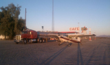
Rosamond Lake with Edwards AFB and Rogers Lake in the distance ("dry" lakes obviously). Lots of restricted airspace here to go around so because of the sheer distance and unpredictability of winds I will have to stop at Barstow and fill up - at $6.50/gal OUCH!! - because there's nothing after that for a ways.
Image

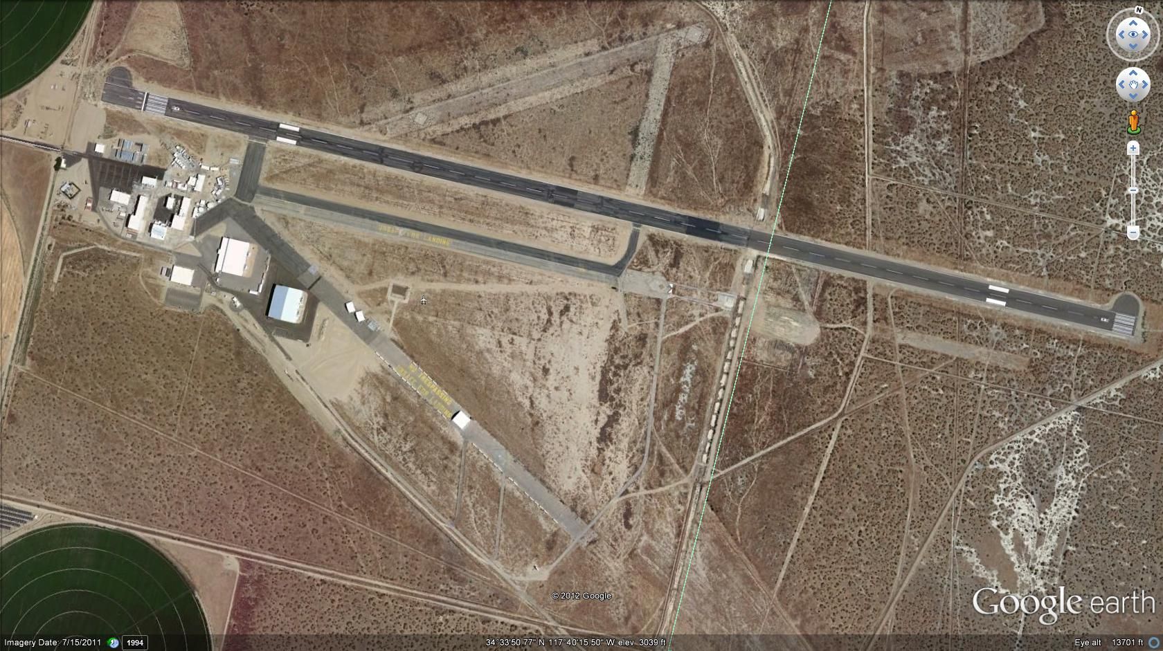
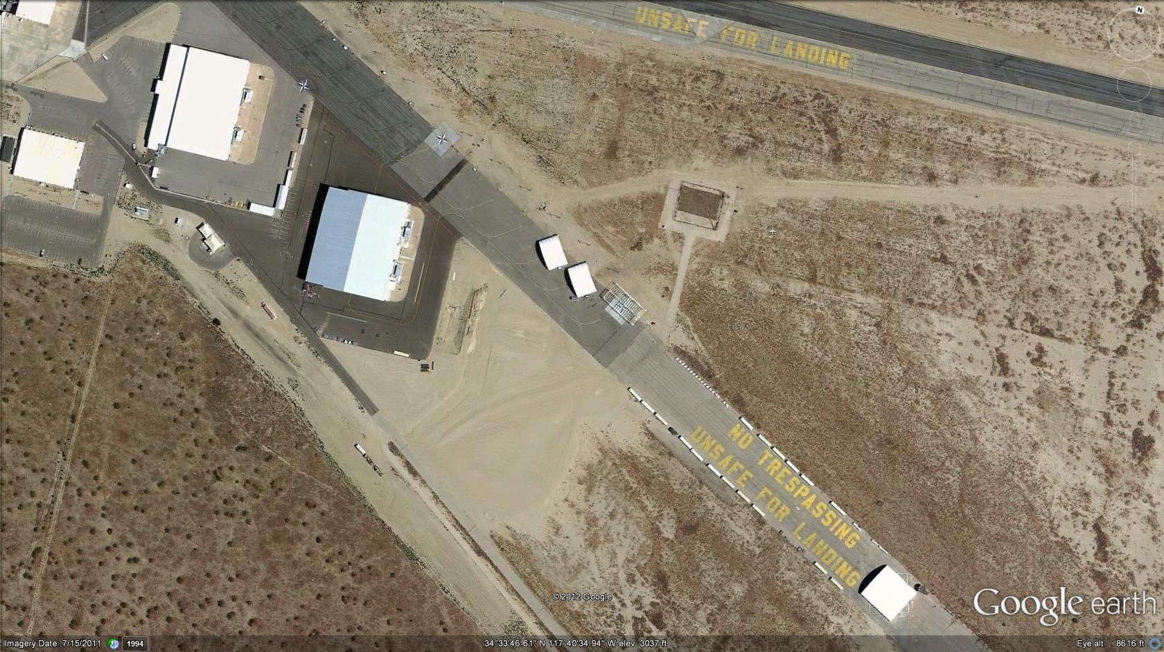
Nope, I don't know what it is either but it ain't an airport
Image

This how far a guy will go to water-ski where nature has already determined there should be no water-skiing
Image

Mohave in a Champ - whole lot of nothin' out there with plenty of time to stare at it going 67 knots
Image

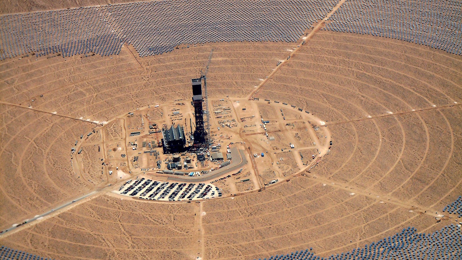
Huge solar power stations being built near Clark Mountain
Image

Stopped at Boulder City for gas before the last leg. Here's a picture of Boulder Dam and the new bridge as I head over Lake Mead towards Mesquite. Got kind of rough out there as I gave Virgin Peak a wide birth.
Image

Lake Mead as I head NE
Image

More Lake Mead - NE end
Image

Valley of Fire
Image

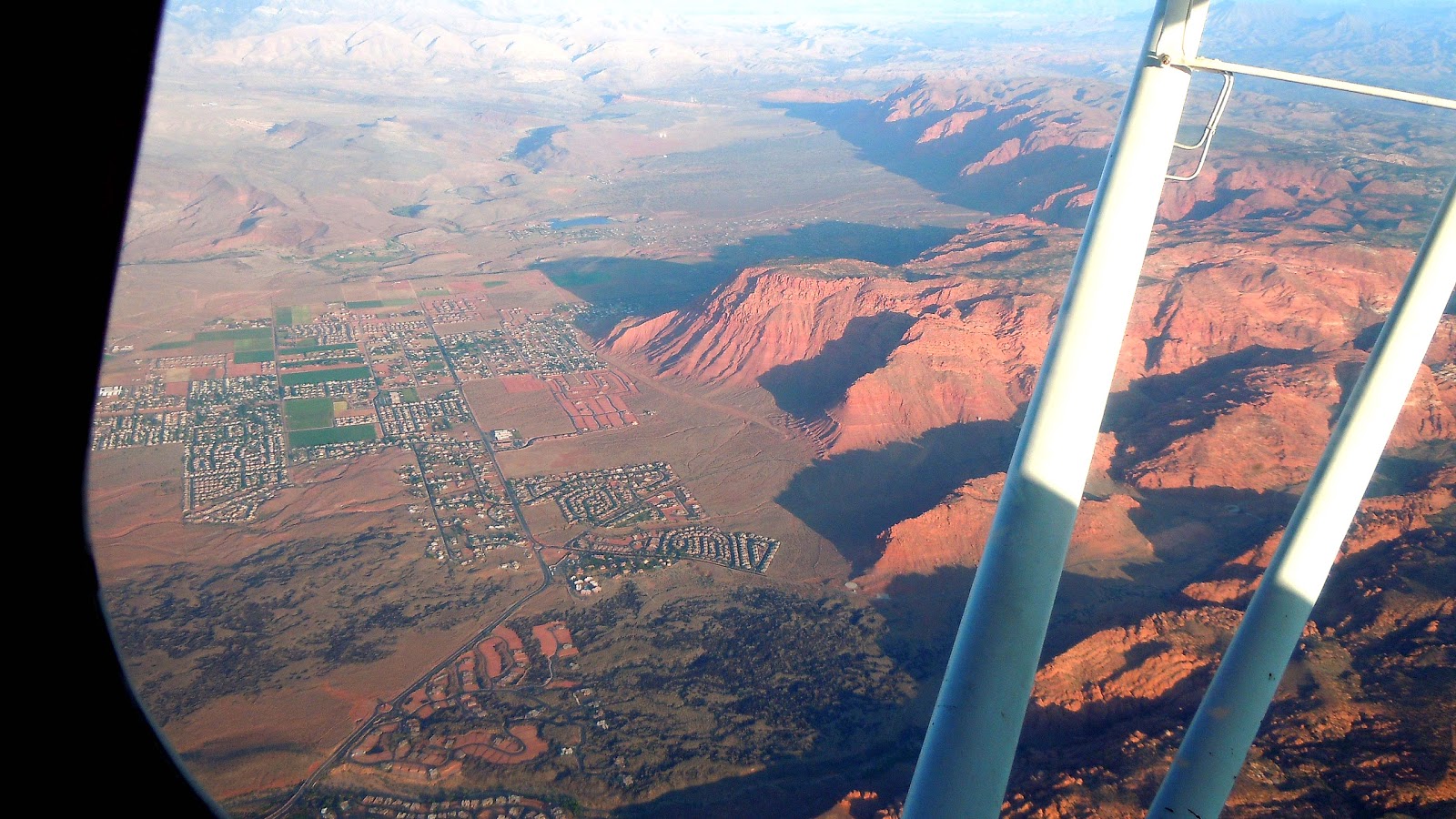
Big red cliff in Beaver Mountains between Mesquite and St George
Image

Hurricane Mesa with Zion National Park rising behind it
Image

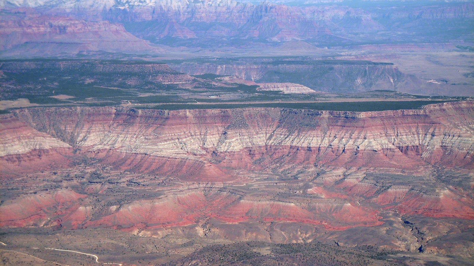
Kolob Canyon, none of this is visible from the interstate
Image

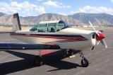
While visiting my brother there was a wildfire in one of the valleys to the west. When I got to the airport early Sunday morning for my trip back home they had parked this fella next to me. Uncanny resemblance, don't you think? :)
Image

I'll post the return photos in another message, enough for now.
silvaire offline
User avatar
Posts: 54
Joined: Wed Jul 04, 2007 8:41 pm
Location: USA
Things are not as they seem
Nor are they otherwise

Re: CA to UT in my 90hp Champ

Well Done!

Nice to see the water high.

Looking forward to more pictures and comments.

Thank you.
8GCBC offline
User avatar
Posts: 4623
Joined: Thu Aug 05, 2010 11:55 pm
Location: Honolulu
Aircraft: 2018 R44
CFII, MEI, CFISES, ATPME, IA/AP, RPPL, Ski&Amphib ops, RHC mechanic cert, RHC SC— 3000TT

Re: CA to UT in my 90hp Champ

Nice!! Great TR.
Zzz offline
Janitorial Staff
User avatar
Posts: 2854
Joined: Fri Oct 08, 2004 11:09 pm
Location: northern
Aircraft: Swiveling desk chair
Half a century spent proving “it is better to be thought a fool than to open your mouth and remove all doubt.”

Re: CA to UT in my 90hp Champ

silvaire wrote:When I got to the airport early Sunday morning for my trip back home they had parked this fella next to me. Uncanny resemblance, don't you think? :)
Image

I'll post the return photos in another message, enough for now.


You are so lucky the other fella did not come back first and take off to fight fire in the wrong plane!

Enjoyed your flight post. Same route back?
dirtstrip offline
Posts: 1455
Joined: Fri Jun 19, 2009 8:39 pm
Location: Location: Location:
Lynn Sanderson (Dirtstrip) passed away from natural causes in May 2013. He was a great contributor and will be missed dearly.

Re: CA to UT in my 90hp Champ

Quite a flight!

The "isn't an airport" picture shows the Lockheed Martin Helendale Radar Cross Section (RCS) facility at 34.826091° -117.296144°. Here is a write-up on RCSs generally, which are used to assess the radar reflectivity of things like aircraft:
http://www.thehowlandcompany.com/Bluefire.htm#RCS101

You probably flew quite near another RCS facility on the Mojave side of the Tehachapi mountains at
34.924512° -118.530046°
Noe Flightrisk offline
User avatar
Posts: 54
Joined: Thu Dec 29, 2011 11:22 pm
Location: California

Re: CA to UT in my 90hp Champ

silvaire wrote:....so I did 1150 miles in the Champ from Byron California to Cedar City Utah.....


1150 miles from Byron to Cedar City? You musta steered a pretty crooked course, unless that's for a round trip. :wink:
hotrod180 offline
Supporter
User avatar
Posts: 10534
Joined: Wed Jan 26, 2005 11:47 pm
Location: Port Townsend, WA
Cessna Skywagon -- accept no substitute!

Re: CA to UT in my 90hp Champ

Enjoyed the pictures and trip report.

Hotrod. That sounds about right. Look at his route on the first picture. Click on it and it will get larger so you can see the magenta line (route). :D
58Skylane offline
User avatar
Posts: 5297
Joined: Thu Oct 11, 2007 12:36 pm
Location: Cody Wyoming

Re: CA to UT in my 90hp Champ

Noe Flightrisk wrote:Quite a flight!

The "isn't an airport" picture shows the Lockheed Martin Helendale Radar Cross Section (RCS) facility at 34.826091° -117.296144°. Here is a write-up on RCSs generally, which are used to assess the radar reflectivity of things like aircraft:
http://www.thehowlandcompany.com/Bluefire.htm#RCS101

You probably flew quite near another RCS facility on the Mojave side of the Tehachapi mountains at
34.924512° -118.530046°


Looks like a real fun trip :D the only one I know of that has landed there is a glider pilot (structural engineer for Lockheed retired now) named Henry Combs.
Glidergeek offline
Supporter
User avatar
Posts: 1937
Joined: Sat Sep 06, 2008 8:02 pm
Location: Hesperia
Aircraft: 1968 P206C
DG 400

Re: CA to UT in my 90hp Champ

Silvaire, really outstanding photos...I made my wife look too and she thought the same thing. Looks like you had a great and memorable adventure visiting your brother. Well done.
Bushcaddy offline
User avatar
Posts: 74
Joined: Tue May 12, 2009 8:34 am
Location: Marshfield, MA, USA

Re: CA to UT in my 90hp Champ

Yeah, 1150 miles was round trip. I decided to go around the big hills even though I probably could have squeaked through Luther Pass just south of Tahoe in the early morning and made it to Tonopah. It would have been a stretch for the Champ though and Tonopah to Cedar City is an even longer stretch with a whole lot of nothing. Last time I did this trip in the Maule (back when me an my brother were known as the Maulebros) I did it non-stop in a straight line so I know how much of nothing there is out there.

Anyway, here is the return trip. I got off real early Sunday morning, dead calm and cool as the sun came up over the mountains and lit up Kolob Canyon from the back side. You can see I-15 in the lower right.
Image

Pine Valley Mountain wilderness area
Image

This guy is 10,365 feet
Image

Red cliffs just north of St George
Image

A lot of this stuff looks drab and uninteresting in the mid afternoon sun but spectacular in the early morning light. Probably never gave this a second look on the way up.
Image

Same here but now it looks like the surface of Mars
Image

Lake Mead again
Image

Boulder Dam and the bridge - opposite view
Image

Another huge mountain somewhere in the desert and nobody else anywhere around but me. If you're looking for solitude it can be found
Image

A closer view of the solar power stations under construction, there's three of these being built out here
Image

The winds were good and I was screaming across the Mojave at 87 knots so was able to make it all the way to Bakersfield and then do the long slog up the central valley where afternoon winds steadily began to increase on the nose. It was a good thing I left on Sunday because the next day I looked at Cedar City and the winds were 38G47! I wouldn't have been able to even untie the Champ in those conditions.

It was a good trip.
silvaire offline
User avatar
Posts: 54
Joined: Wed Jul 04, 2007 8:41 pm
Location: USA
Things are not as they seem
Nor are they otherwise

Re: CA to UT in my 90hp Champ

Great pictures, great Trip. Thanks for sharing the pic's and trip info. Things like this are what I come to this site to enjoy.

Hawk
rlhawk11 offline
User avatar
Posts: 32
Joined: Mon Mar 15, 2010 4:11 am
Location: California

Re: CA to UT in my 90hp Champ

A lot of this stuff looks drab and uninteresting in the mid afternoon sun. Probably never gave this a second look on the way up.


Most people think that about the mountains of Nevada in general (and that's a good thing). But get down into those canyons and along the ridgelines you'll find the views are breathtakingly beautiful. And big.

Great trip report.

Gump
GumpAir offline
User avatar
Posts: 4557
Joined: Wed Feb 14, 2007 9:14 am
Location: Lost somewhere in Nevada
Aircraft: Old Clunker

Re: CA to UT in my 90hp Champ

dirtstrip wrote:
silvaire wrote:When I got to the airport early Sunday morning for my trip back home they had parked this fella next to me. Uncanny resemblance, don't you think? :)
Image

I'll post the return photos in another message, enough for now.


You are so lucky the other fella did not come back first and take off to fight fire in the wrong plane!

Enjoyed your flight post. Same route back?


Funny...I had the same experience a couple of months ago.

Image
Image

An 802 can really make an M-4 look little.
RWM offline
User avatar
Posts: 253
Joined: Tue Nov 01, 2011 8:06 pm
Location: Sterling City, Texas
FindMeSpot URL: http://share.findmespot.com/shared/face ... mlQOs5kZFh
Aircraft: Maule MX7-235

Re: CA to UT in my 90hp Champ

Noe Flightrisk wrote:Quite a flight!

The "isn't an airport" picture shows the Lockheed Martin Helendale Radar Cross Section (RCS) facility at 34.826091° -117.296144°. Here is a write-up on RCSs generally, which are used to assess the radar reflectivity of things like aircraft:
http://www.thehowlandcompany.com/Bluefire.htm#RCS101

You probably flew quite near another RCS facility on the Mojave side of the Tehachapi mountains at
34.924512° -118.530046°


There are indeed several RCS ranges and other "interesting" little facilities n that area. They all started off as cookie cutter triangular WW2 auxiliary landing fields. Helendale is one of the ones that got re-purposed. The one five or eight miles west, Hawes, was the site of a huge radio tower, over a thousand feet IIRC, which eventually got taken down. The twin airfields Gray Butte and El Mirage, 20 miles southwest, are now home to the General Atomics Predator and Reaper UAV's (Don't land at either one, trust me). Noe Flightrisk is correct, when the Champ crossed over the Tehachapi mountains, you probably flew right past White Oak RCS, the only one that was built from scratch for RCS and not an old repurposed Army field. We had one of our glider guys land there once in the early 1980's, and they were very very unhappy about it.
EZFlap offline
User avatar
Posts: 2226
Joined: Thu Aug 13, 2009 9:21 am
.

Re: CA to UT in my 90hp Champ

Superb write-up and photos!! Keep them coming :mrgreen:
SixTwoLeemer offline
User avatar
Posts: 1285
Joined: Thu Feb 07, 2008 10:53 am
Location: Wasatch Front
Altitude is Time…. Airspeed is Life!

Re: CA to UT in my 90hp Champ

Here's another place in the Mojave, east of Palmdale where you might plan to stay a while if you land. Runway number "R" means you are definitely NOT welcome. Usually there are predator drones lined up on the pavement.

Image

Image
Yellowbelly offline
User avatar
Posts: 355
Joined: Wed Apr 27, 2005 9:03 pm
Location: Beautiful southern Utah
Maule M-7-235C

I'm lost
but I'm not afraid

Re: CA to UT in my 90hp Champ

Enjoyed your trip write up. I wish my Champ was 90 hp.
Kevin offline
Posts: 170
Joined: Wed Oct 12, 2005 9:14 am
Location: Indiana

Re: CA to UT in my 90hp Champ

Yellowbelly wrote:Here's another place in the Mojave, east of Palmdale


That's Gray Butte. Got a good friend who works there and occasionally at El Mirage next door.
EZFlap offline
User avatar
Posts: 2226
Joined: Thu Aug 13, 2009 9:21 am
.

Re: CA to UT in my 90hp Champ

silvaire wrote:....A closer view of the solar power stations under construction, there's three of these being built out here
Image
..........


I worked on something like that way back in the early 1980's in the desert near Barstow,California. Kinda interesting-- the tower at the center of the site was surrounded by hundreds of post-mounted parabolic mirrors which are computer-controlled to track the sun. They shine the sunlight onto solar panels which are mounted on the top part of the tower, heating oil which is piped down to a heat exchanger where the heat is used to turn water into steam. In turn the steam runs a turbine which produces electricity. Now, 30 years later, there is probably some more efficient way to convert the solar energy into electricity-- photovoltaic cells or something, Courier Tom might be able to tell us a little more about that.
hotrod180 offline
Supporter
User avatar
Posts: 10534
Joined: Wed Jan 26, 2005 11:47 pm
Location: Port Townsend, WA
Cessna Skywagon -- accept no substitute!

Re: CA to UT in my 90hp Champ

hotrod150 wrote:
silvaire wrote:....A closer view of the solar power stations under construction, there's three of these being built out here
Image
..........


I worked on something like that way back in the early 1980's in the desert near Barstow,California. Kinda interesting-- the tower at the center of the site was surrounded by hundreds of post-mounted parabolic mirrors which are computer-controlled to track the sun. They shine the sunlight onto solar panels which are mounted on the top part of the tower, heating oil which is piped down to a heat exchanger where the heat is used to turn water into steam. In turn the steam runs a turbine which produces electricity. Now, 30 years later, there is probably some more efficient way to convert the solar energy into electricity-- photovoltaic cells or something, Courier Tom might be able to tell us a little more about that.


There's one of these being built just north of Tonopah, NV, too.

And I guess I was way off on the mileage, too :oops: I was thinking it's about 700 miles from L.A. to SLC (driving), so visually shifting that line around made me think it was 1100 miles. Anyway........ :D
58Skylane offline
User avatar
Posts: 5297
Joined: Thu Oct 11, 2007 12:36 pm
Location: Cody Wyoming

DISPLAY OPTIONS

Next
25 postsPage 1 of 21, 2

Who is online

Users browsing this forum: No registered users and 1 guest

Latest Features

Latest Knowledge Base