I have generally used the valley/ridge system to get orograraphic lift to help lift me up to the pass when heading west with prevailing westerly winds.
I looked at the sectional for British Columbia and Alberta and was shocked. From Grande Prairie to Vancouver, you could get stuck in a major drainage going on a nowhere near your desired track flanking move for many, many miles finding a valley ridge system to a pass. Maybe on a 1/25000 topo I will be able to find some help.
It looks like someone pulled a massive harrow (multiple furrow digging farm implement) down the Canadian Rockies creating parallel canyons. Was that glaciation or wavy fold and fault?
Anyway I will get an education, and perhaps stuck in the first canyon.
Canada eh!
Fri Sep 07, 2018 9:46 pm
- contactflying offline
- Posts: 4972
- Joined: Wed Apr 03, 2013 7:36 pm
- Location: Aurora, Missouri 2H2
Download my free "https://tinyurl.com/Safe-Maneuvering" e-book.


Sat Sep 08, 2018 11:44 am
Re: Canada eh!
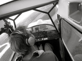
I love that picture, Zane.
- contactflying offline
- Posts: 4972
- Joined: Wed Apr 03, 2013 7:36 pm
- Location: Aurora, Missouri 2H2
Download my free "https://tinyurl.com/Safe-Maneuvering" e-book.
Sat Sep 08, 2018 12:38 pm
Re: Canada eh!
That topo feature was a break between the Cordilleran Ice Sheet to the west and the Laurentide Sheet to the east: https://en.wikipedia.org/wiki/Laurentide_Ice_Sheet
Deglaciation resulted in weathering and formed the current features. See the more recent process here: https://www.youtube.com/watch?v=wbsURVgoRD0
Earlier Plate tectonics was also involved: https://en.wikipedia.org/wiki/Geology_o ... _Mountains
I've flown that area in Canada a few times and yes it's likely to get faced with rising terrain. Maps and Sectionals will show the elevations but prevailing or seasonal downslope winds can be a bigger challenge to ROC.
Gary
Sat Sep 08, 2018 3:28 pm
Re: Canada eh!
Thanks Gary. We will get out in it a bit, with good weather.
- contactflying offline
- Posts: 4972
- Joined: Wed Apr 03, 2013 7:36 pm
- Location: Aurora, Missouri 2H2
Download my free "https://tinyurl.com/Safe-Maneuvering" e-book.
Sat Sep 08, 2018 3:51 pm
Re: Canada eh!
What I observed as a passenger doing game surveys in rising terrain heading up a valley, and in my more limited experience in mine, was to follow the valley edge and fly over terrain and in wind flow that allowed a safe turn and descent to escape back downhill if needed. I'd rather turn into a wind than get pushed down. You know or appreciate this so I'm not trying to be a Smart Azz suggesting you don't.
There can be lots of wind or rotor action over terrain that will drive the plane down faster than its ROC allows at altitude. Find one side or the other that minimizes that and allows for a 180 if needed due to prevailing wind or clouds. If the terrain beyond (especially under a low cloud deck) doesn't permit you to see new ground exposure in the distance then maybe you're not out climbing the ground below and what lies ahead.
Gary
Sat Sep 08, 2018 5:06 pm
Re: Canada eh!
Lots of room in those big valleys or lakes. And they are very strait. Getting on the side with updrafts should not be a problem. Making it across the valley or lake without losing gained altitude on the lee side looks like the problem. And finding a drainage over there big enough to work a useful angle on the wind for lift.
I can see more of MTV and Gump techniques here, and Cary's go high. Looking forward to the problem.
I can see more of MTV and Gump techniques here, and Cary's go high. Looking forward to the problem.
- contactflying offline
- Posts: 4972
- Joined: Wed Apr 03, 2013 7:36 pm
- Location: Aurora, Missouri 2H2
Download my free "https://tinyurl.com/Safe-Maneuvering" e-book.
Sat Sep 08, 2018 5:43 pm
Re: Canada eh!
Perhaps I missed the point of the topic or its planned timing. Maybe sharing more details on your proposed adventure would help.
If it's to enjoy and explore the area then battles can be picked and weather limited conditions avoided. Unless you have a specific travel goal or time-limited schedule, or are getting paid to be there for work, then enjoy the experience when the conditions suit your skill set and interests. Is it a vacation?
I'd enquire about seasonal weather from the local experts before planning a tour. Then there's the presence or lack of WX reporting stations or timely pilot reports, and so on.
Hope this isn't muddying the discussion. I did something similar to this for a living in Alaska w/o much choice of time and help from others so I tend to be both brief and cautious.
Gary
Sat Sep 08, 2018 7:09 pm
Re: Canada eh!
Gary,
Butch Washtock, from Vancouver, and I will be doing a mountain flying seminar/clinic at Grande Prairie Alberta 06 October. We will be there a few days before and after. Before the seminar he and I will go over techniques in Mike Edgar's 182 and I think A1Skinner plans to come over in his 172.
Bruce was a crop duster and now does an extensive mountain flying clinic at Vancouver. We have similar ideas about contact flying (stick and rudder stuff) and gaps in the regular training programs, both US and Canadian. We are doing this seminar at the request of Mike Edgar, Director of Alberta Angel Flight.
It will be fun. Come over to Grande Prairie the 6th if you can.
- contactflying offline
- Posts: 4972
- Joined: Wed Apr 03, 2013 7:36 pm
- Location: Aurora, Missouri 2H2
Download my free "https://tinyurl.com/Safe-Maneuvering" e-book.
Sat Sep 08, 2018 8:24 pm
Re: Canada eh!
Great idea and looks like a valuable way to fill the experience gaps....which there are plenty from all the incidents and accidents that regularly occur. Now it's hunting season here and others and lots of bruises happen. Maybe you folks can share the techniques and results via the written word and video recording in the air. It sure would be and asset if available.
Most of the training I got was by necessity from experience. Back then old pilots that learned to pay attention were guarded about sharing the path they took to survive. Some was commercial competition and some was proving you were worth their time. Sure if they liked you they'd tell stories about this and that, but not too much about the why or how they made it all work. Still the same for some today.
Then there were the typical "don't do this" seminars or training. Like don't stall and spin, or fly in turbulence, or push visibility, or overload the plane. Not much, besides the after the fact on the ground survival training, was available. I'd have rather learned to "do this" instead. Maybe I didn't get it but at the time I'd rather have learned how to fly and survive than only what to avoid. I see a distinction but others may disagree.
Have a fun time and share what you folks do some way.
Gary
Sat Sep 08, 2018 9:06 pm
Re: Canada eh!
We will do that.
- contactflying offline
- Posts: 4972
- Joined: Wed Apr 03, 2013 7:36 pm
- Location: Aurora, Missouri 2H2
Download my free "https://tinyurl.com/Safe-Maneuvering" e-book.
Mon Sep 10, 2018 8:44 am
Re: Canada eh!
contactflying wrote:We will do that.
What are the details on your October 6 event? Sounds interesting. Is it targeted to (and only for) Angel Flight? There Ain't No Such Thing As A Free Lunch, so is there a fee?
- PapernScissors offline
- Posts: 419
- Joined: Sun Mar 06, 2016 8:49 pm
- Location: Spokane
- Aircraft: Cessna 172
Mon Sep 10, 2018 10:32 am
Re: Canada eh!
PapernScissors wrote:contactflying wrote:We will do that.
What are the details on your October 6 event? Sounds interesting. Is it targeted to (and only for) Angel Flight? There Ain't No Such Thing As A Free Lunch, so is there a fee?
If you go to this link it has all the info.
https://flight184.copanational.org
I think its $60.
David

Mon Sep 10, 2018 3:32 pm
Re: Canada eh!
Thanks, David. Butch will present first till noon on the 6th. I will follow for the afternoon. We will both be flying before and after, with decent weather, but Mike Edgar will do all the scheduling.
Butch covers a lot of slow flight and backcountry mountain flying. I will cover the basic low ground effect takeoff, energy management turns, energy management in mountain flying, terrain navigation, and the apparent brisk walk rate of closure approach. Butch also teaches slowing on short final to touch down slowly and softly on the numbers. We aren't worried about how fast you approach way out, but in speed/elevator management and descent/throttle management on short final. We don't need a number on a gauge to know we are going too fast. If pulling back on the stick causes ascent, we are going too fast here. If reduction in power doesn't cause sink, we are going too fast.
I think Mike will put more information out soon.
- contactflying offline
- Posts: 4972
- Joined: Wed Apr 03, 2013 7:36 pm
- Location: Aurora, Missouri 2H2
Download my free "https://tinyurl.com/Safe-Maneuvering" e-book.
Mon Sep 10, 2018 3:43 pm
Re: Canada eh!
No problem Jim. Mike just informed me that you and I are flying together Oct.5th in the afternoon. I've got a good river to fly down and we aren't to far from the rocks if we want to find some different terrain.
See you then!
David
See you then!
David
Mon Sep 10, 2018 5:48 pm
Re: Canada eh!
Sounds good David.
- contactflying offline
- Posts: 4972
- Joined: Wed Apr 03, 2013 7:36 pm
- Location: Aurora, Missouri 2H2
Download my free "https://tinyurl.com/Safe-Maneuvering" e-book.
DISPLAY OPTIONS
Who is online
Users browsing this forum: No registered users and 0 guests
Latest Features
-
Live to Tell
A Minnesota pilot is surprised to learn that the sudden asymmetric drag of an out-of-rig ski can…Read More -
Creators
Working in some of the Yukon's most beautiful and remote environments, photographer Simon Blakesley captures aircraft in…Read More -
Aircraft Ownership and Maintenance
Upgrading to big tires can make a huge difference in backcountry performance, but with those gains come…Read More -
Tales from Yesteryear
In this tale from bush flying yesteryear, Don Cogger signs up to help Atlee Dodge Jr recovery…Read More


Latest Knowledge Base
-
Destinations
A regional guide with ideas for winter camping destinations in California, Nevada, New Mexico, and Arizona.Read More -
Aircraft
Finding an affordable aircraft that can handle the backcountry for $80K or less? A challenge for sure, but with the…Read More -
Aircraft
01.29.2018 - Zane - Updated tire diameter graphic to add 8.50x10 Guide to tires for use in the backcountry and off-airport landing…Read More -
Pilots
12.22.2013 - Initial article format Operating aircraft on skis and negotiating a snow-covered landscape is an entirely unique skillset and environment.…Read More


