chicken strip navigation
Wed Apr 17, 2013 2:58 pm
chicken strip navigation
Am in palm springs, very windy the past few Weeks, and enjoying the golfing.plan on camping at chicken strip and wondering if anyone has navigated the airspace between here and there. Govt.seems to have tied a good amount of it up.any ideas?
- yellowbird offline
- Posts: 57
- Joined: Fri Sep 15, 2006 10:44 pm
- Location: mendocino county, CA
Wed Apr 17, 2013 4:03 pm
Re: chicken strip navigation
mjb123 wrote:DaveF wrote:I'm thinking of flying out to the strip this week. Looks like it's in good shape. Any other interesting strips to try in the area? Can you land on the Racetrack playa?
What's the usual nav and comm procedures for avoiding military a/c in the Saline Valley?
All advice greatly appreciated.
Dave
I used to fly in R-2508 everyday when I was stationed in Lemoore. No Navy guys are monitoring a VHF frequency when flying there, only UHF, and most guys probably do not even know there is an air strip in Saline, only the nudie camp that is very popular to get buzzed daily.
The RAG (training squadron), has a low level syllabus consisting of 3 flights, 1 dualed up low level flight on the VR-1255 at 200' to 500' and 420 knots, a dualed up low altitude tactics flight, then a solo with an instructor chase doing the same. These flights are around the student's 13th or 14th flight in the F/A-18, so you can imagine that many are behind the power curve a bit flying down low and fast.
The typical LATT flight, at least the way I did them, would start over the Owens lake bed at 200' and follow the highway between Owens and Panimint, through Star Wars/Rainbow canyon to warm up. Then you decide to either go south to work Panimint, or north to work Saline with Panimint being preferred since it is a bit larger and require less time repositioning for the maneuvers. The maneuvers consist of jinks where you pull up to 15 to 30 degrees nose high for a period of seconds and then dive back down to recover at 200', a 100' intro, surface to air counter tactics, low level tactical formation flight, and some other maneuvers and low level flying. Once the required maneuvers are complete, most guys will just fly around down low until their fuel state forces them to knock it off and return to base. It is pretty popular to fly over the nudie camp and up the little valley to the Eureka Dunes, then pick your way over to Owens and fly south to around Lone Pine before popping up to RTB. On the dualed up flights, it is single ship, but on the students solo there will be two jets so the instructor can chase and direct and keep the student from hitting the ground.
For the Higher altitude flights, the "deck" is usually 5,000' AGL, so guys are generally higher than that. If I was flying around there in a small plane, I would probably stay below 100' or up around 4,000'. Nowhere is certain to be safe, but the absolute worst place is probably between 5,000 and 15,000, where there tends to be be a lot of vertical maneuvering, with very high vertical airspeeds and not much opportunity to look outside of the fighting engagement, or use the radar to look for other traffic.
Here is a link to the users guide for R-2508:
http://www.edwards.af.mil/shared/media/ ... 03-052.pdf
I hope this helps out someone, but please keep your head on a swivel because the jets are moving fast out there, and many times being piloted by students with very little experience.
- Zzz offline


- Posts: 2854
- Joined: Fri Oct 08, 2004 11:09 pm
- Location: northern
- Aircraft: Swiveling desk chair
Half a century spent proving “it is better to be thought a fool than to open your mouth and remove all doubt.”
Sun Apr 21, 2013 4:09 pm
Re: chicken strip navigation
Am not far from boreggo springs, so just might fly to Jean(0l7) get gas then go to the chicken airstrip.Jean is about the only place for gas in area.am wanting to stay on the eastern side of the sierra's, so choices are limited. Plan on camping tues or/and wed nites.
- yellowbird offline
- Posts: 57
- Joined: Fri Sep 15, 2006 10:44 pm
- Location: mendocino county, CA
Mon Apr 22, 2013 9:22 am
Re: chicken strip navigation
Don't they have fuel in Bishop or Lone Pine?
- macktruckfarm offline
- Posts: 139
- Joined: Fri Sep 28, 2012 10:09 am
- Location: Longmont, CO
Mon Apr 22, 2013 12:02 pm
Re: chicken strip navigation
Delete

Mon Apr 22, 2013 8:21 pm
Re: chicken strip navigation
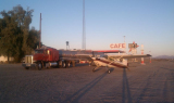
Landed Lone Pine last week. Self serve pump. Crew car was inop. Nice cafe in town called Alabama Hills cafe. 1.2mile walk.
http://www.yelp.com/biz/alabama-hills-c ... -lone-pine
Enjoy!
DU
http://www.yelp.com/biz/alabama-hills-c ... -lone-pine
Enjoy!
DU
- DoubleUgly offline
- Posts: 18
- Joined: Mon Oct 15, 2012 9:25 am
- Location: Sacramento, ca
Tue Apr 30, 2013 1:01 pm
Re: chicken strip navigation
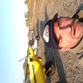
Camped out at the chicken airstrip last wed and thurs nite.strip was in beautiful shape with new wind sock and white rocks lining the runway.if u go be sure to get there early in the morning cause spring time wind is raising its head.and the jets seemed to start racing around the Valleys by midmorning.the springs are everything you've heard of and more.
- yellowbird offline
- Posts: 57
- Joined: Fri Sep 15, 2006 10:44 pm
- Location: mendocino county, CA
Mon Oct 07, 2013 10:22 am
Re: chicken strip navigation
Has anyone been to the Chicken Strip recently? I plan to be there just before Turkey Day, like to start keeping up-to-date on strip conditions. I drove car last year, strip was fine, S road was awful, N road was OK. Was last there in '73, liked the old strip better, not so washout prone. According to Inyo County road Dept.(this AM-760-878-0202) S entrance is still closed since before last year, even though I was able to traverse it slowly in my car, N entrance is also closed by a large washout, repair work to start soon.
Ed
Ed
- macktruckfarm offline
- Posts: 139
- Joined: Fri Sep 28, 2012 10:09 am
- Location: Longmont, CO
Mon Oct 14, 2013 10:54 am
Re: chicken strip navigation
Wind sock is back up strip is a bit rough but landable, Tie downs have been removed, paper log is gone. There was some massive flooding but the strip was spared. Apparently Saturday night somebody landed in the dark people at the springs were not impressed with the landing after dark. Roads in and out are reported to be very challenging.
- Glidergeek offline

- Posts: 1937
- Joined: Sat Sep 06, 2008 8:02 pm
- Location: Hesperia
- Aircraft: 1968 P206C
DG 400
Mon Oct 14, 2013 11:33 am
Re: chicken strip navigation
Glidergeek wrote:Wind sock is back up strip is a bit rough but landable, Tie downs have been removed, paper log is gone. There was some massive flooding but the strip was spared. Apparently Saturday night somebody landed in the dark people at the springs were not impressed with the landing after dark. Roads in and out are reported to be very challenging.
Aren't the National Parks supposed to be closed during this Guv Shutdown?

Mon Oct 14, 2013 12:08 pm
Re: chicken strip navigation
58Skylane wrote:Glidergeek wrote:Wind sock is back up strip is a bit rough but landable, Tie downs have been removed, paper log is gone. There was some massive flooding but the strip was spared. Apparently Saturday night somebody landed in the dark people at the springs were not impressed with the landing after dark. Roads in and out are reported to be very challenging.
Aren't the National Parks supposed to be closed during this Guv Shutdown?
- Glidergeek offline
- Posts: 1937
- Joined: Sat Sep 06, 2008 8:02 pm
- Location: Hesperia
- Aircraft: 1968 P206C
DG 400
Mon Oct 14, 2013 4:19 pm
Re: chicken strip navigation
Thanks for the update, I think I'll be OK then w/ 700 tires. Strange tie downs and log gone, doesn't sound like Smokey. More do-gooders? In the early 70's, when it was OK to drive anywhere, heard rumors of do-gooders putting tack or nail boards in the dunes, never saw them, though. It takes all kinds.
- macktruckfarm offline
- Posts: 139
- Joined: Fri Sep 28, 2012 10:09 am
- Location: Longmont, CO
Tue Oct 15, 2013 8:17 pm
Re: chicken strip navigation
58Skylane,
The Saline Valley portion of the monument is not gated nor manned(womaned?). Only one car road in from the south, north, frequently not passable to cars(as like today) some other 4WD roads. Only venturesome go there, although a gentleman with a 210 and skinny tires who writes a travelogue landed, wondered why prop erosion turning around! Let's keep it this way, still wonder who would take tie downs, log?
Ed
- macktruckfarm offline
- Posts: 139
- Joined: Fri Sep 28, 2012 10:09 am
- Location: Longmont, CO
Tue Oct 15, 2013 11:55 pm
Re: chicken strip navigation
macktruckfarm wrote:58Skylane,
The Saline Valley portion of the monument is not gated nor manned(womaned?). Only one car road in from the south, north, frequently not passable to cars(as like today) some other 4WD roads. Only venturesome go there, although a gentleman with a 210 and skinny tires who writes a travelogue landed, wondered why prop erosion turning around! Let's keep it this way, still wonder who would take tie downs, log?
Ed
10-4, Ed. I've been there twice. Drove in the first time from the north (damn that's a long drive!!). Second time there I flew in with Glidergeek.
But many of the other National Parks and monuments aren't manned or womened 24/7 neither. But are barricaded, coned off, and gates locked.
Wed Oct 16, 2013 9:10 am
Re: chicken strip navigation
58Skylane wrote:macktruckfarm wrote:58Skylane,
The Saline Valley portion of the monument is not gated nor manned(womaned?). Only one car road in from the south, north, frequently not passable to cars(as like today) some other 4WD roads. Only venturesome go there, although a gentleman with a 210 and skinny tires who writes a travelogue landed, wondered why prop erosion turning around! Let's keep it this way, still wonder who would take tie downs, log?
Ed
10-4, Ed. I've been there twice. Drove in the first time from the north (damn that's a long drive!!). Second time there I flew in with Glidergeek.
But many of the other National Parks and monuments aren't manned or womened 24/7 neither. But are barricaded, coned off, and gates locked.
I saw a couple women in the tub
- Glidergeek offline
- Posts: 1937
- Joined: Sat Sep 06, 2008 8:02 pm
- Location: Hesperia
- Aircraft: 1968 P206C
DG 400
Wed Oct 16, 2013 10:49 am
Re: chicken strip navigation
Last Nov. when I was there, there was a semi-official Ranger camped in a permanent dwelling, but he was on vacation, out of the valley, so I didn't get to meet him. It will be interesting to visit with him this Nov. to find out about recent activities.
- macktruckfarm offline
- Posts: 139
- Joined: Fri Sep 28, 2012 10:09 am
- Location: Longmont, CO
Wed Dec 18, 2013 4:42 pm
Re: chicken strip navigation
Mack,
Did you make it to Chicken Strip? I'm looking for a condition update. We are thinking of going to Death Valley to run the marathon on February 1st, camping there that night.
I see there is an update on Shortfield. Anyone here been there recently? That update says that the tie downs are still there.
Thanks,
GSP
- Grassstrippilot offline


- Posts: 3536
- Joined: Wed May 31, 2006 6:17 am
- Location: Syracuse, UT
- FindMeSpot URL: https://share.garmin.com/WolfAdventures
- Aircraft: Cessna 205
Wed Dec 18, 2013 5:25 pm
Re: chicken strip navigation
Lizard Lee replaced the tie-downs. Still no clue on who removed them, or why. LL says it wasn't the Park Service. Strip is in good shape, though very, very dusty since it's been graded a couple times too many by ambitious volunteers. A new paper flight log needs to be put in the can. Please remember to bring something for the springs when visiting!
cheers
hammer
cheers
hammer


Wed Dec 18, 2013 7:36 pm
Re: chicken strip navigation
Hammer wrote:Lizard Lee replaced the tie-downs. Still no clue on who removed them, or why. LL says it wasn't the Park Service. Strip is in good shape, though very, very dusty since it's been graded a couple times too many by ambitious volunteers. A new paper flight log needs to be put in the can. Please remember to bring something for the springs when visiting!
cheers
hammer
Hammer you read my mind! That's the next thing I was going to ask. What can they use? I remember from being there before...and from earlier posts...that maybe toilet paper, paper towels, Purell? Cleaning supplies? If so, like what? Also, anything for LL? I'd like to bring something for him to if he needs or likes something...just to spread some good will. Do you give the stuff to the caretakers...so they know it is from someone that flew in?
Thanks for the strip update.
- Grassstrippilot offline
- Posts: 3536
- Joined: Wed May 31, 2006 6:17 am
- Location: Syracuse, UT
- FindMeSpot URL: https://share.garmin.com/WolfAdventures
- Aircraft: Cessna 205
Thu Dec 19, 2013 11:30 am
Re: chicken strip navigation
I brought a bunch of firewood last year, Lizard Lee wasn't there to chat with.
- macktruckfarm offline
- Posts: 139
- Joined: Fri Sep 28, 2012 10:09 am
- Location: Longmont, CO
DISPLAY OPTIONS
Who is online
Users browsing this forum: No registered users and 0 guests
Latest Features
-
Live to Tell
A Minnesota pilot is surprised to learn that the sudden asymmetric drag of an out-of-rig ski can…Read More -
Creators
Working in some of the Yukon's most beautiful and remote environments, photographer Simon Blakesley captures aircraft in…Read More -
Aircraft Ownership and Maintenance
Upgrading to big tires can make a huge difference in backcountry performance, but with those gains come…Read More -
Tales from Yesteryear
In this tale from bush flying yesteryear, Don Cogger signs up to help Atlee Dodge Jr recovery…Read More


Latest Knowledge Base
-
Destinations
A regional guide with ideas for winter camping destinations in California, Nevada, New Mexico, and Arizona.Read More -
Aircraft
Finding an affordable aircraft that can handle the backcountry for $80K or less? A challenge for sure, but with the…Read More -
Aircraft
01.29.2018 - Zane - Updated tire diameter graphic to add 8.50x10 Guide to tires for use in the backcountry and off-airport landing…Read More -
Pilots
12.22.2013 - Initial article format Operating aircraft on skis and negotiating a snow-covered landscape is an entirely unique skillset and environment.…Read More


