Anyway, here's the pics:
Yes, I am a pilot. Can't you see the twinkle in my eye?

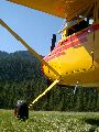
Hmmm...

The town of Powers...you can see the airport as the mowed strip in the distance. It's not really backcountry...more "sidecountry" as we call it in skiing when you step just out of bounds, but not very far:

The strip is in fine form...the grass was a little long, but very thin, light, and wispy:

Obligatory me+plane+location shot. I know I'm a poser but I'm trying to break the cycle.

Where's Heidi? It was like the Sound of Music over there.

I don;t know if there are fish in there, but I'm going to find out next time.

My good old dad... He loves to fly in and camp out here.

Cape Blanco, it's the westernmost point in the continental US:

The wind was whipping up white caps on the ocean. We were cruising down the coast at about 1,500 MSL but I climbed up when I realized the beach wasn't looking too appetizing for landing.

It was our maiden voyage together in the 170 that we've put so much work into the last couple years, and a great day with a guy I don't get to spend much time with doing the things we dream about. It made for a really great Father's Day.
I'm editing this to further geek it out. Let's add some images from Google Earth of my overlayed GPS track, which I downloaded from my Garmin eTrex Vista C. I'll be adding a How-To for making these soon:
The complete route, looking north:

The approach into Powers, looking SE:

A 360 over some ranch airstrips on the Rogue river, looking NE: