I decided not to use ForeFlight concurrently (terminated subscription several years ago). FF didn’t interface with my GLD39 100% (didn’t show battery percentage).
Here’s an example below in the picture. Bathymetry data using an aerial imagery base map:
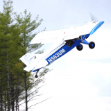
Below is the old Lono Harbor airstrip on Molokai. App is Navionics (Garmin purchased Navionics).