Thanks for the overwhelming advice everyone! And yes I have read that book, and no, I've had it to 6500' when I was much younger and lighter and that's all she's got! Not kidding, full throttle and nose high. Not fun!
Dad is waiting for the Slick mags to show up so it will have impulse couplings on both mags, not just one. So that will help with the hand starting. Yep, I took my FAA check ride in an airplane I had to hand prop to start. I've been thinking the southern route would be the way to go. If I can stay away from the LA mess. I'm not concerned about fuel prices. I just drove our motorhome to CO and back to Indianapolis. That sucked some gas! I have an ipad but have not bought foreflight yet. I found an instructor with a taildragger and hope to get current this coming summer. The Kitfox I restored is now turnkey and waiting for spring to have the condition inspection done. I've been mowing this darn airport I own for over twenty years, it's about time I use it!!!
36II Newby Landing
Thanks,
Jay
How do you plan a looooong cross country?
Mon Dec 24, 2018 1:00 pm
- beeryboats offline
- Posts: 8
- Joined: Fri Dec 21, 2018 5:51 pm
- Location: Brownsburg
- Aircraft: kitfox IV & Piper Vagabond
Mon Dec 24, 2018 1:22 pm
Re: How do you plan a looooong cross country?
- vag1.JPG (106.18 KiB) Viewed 1259 times
- vag2.JPG (86.69 KiB) Viewed 1259 times
- vag3.JPG (105.95 KiB) Viewed 1259 times
- vag4.JPG (75.92 KiB) Viewed 1259 times
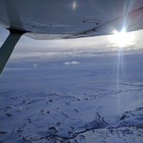
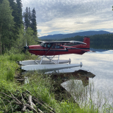
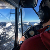
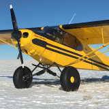
I thought I should share a couple photos.
Jay
- beeryboats offline
- Posts: 8
- Joined: Fri Dec 21, 2018 5:51 pm
- Location: Brownsburg
- Aircraft: kitfox IV & Piper Vagabond
Mon Dec 24, 2018 2:52 pm
How do you plan a looooong cross country?
When traveling xc in a cub type airplane I like to plan the trip, and then be fluid along the way, changing the stops depending on headwinds or tailwinds. I like to shoot for 3.5 hr legs in my supercub, plan a general route and adjust along the way. It is way more fun that way, not being tied down to a time line. You also usually find the coolest airports that way.
Don’t be afraid to stop for weather or anything like that, fly low and have fun
Sent from my iPhone using Tapatalk
Don’t be afraid to stop for weather or anything like that, fly low and have fun
Sent from my iPhone using Tapatalk
Mon Dec 24, 2018 7:28 pm
Re: How do you plan a looooong cross country?
Beautiful Vag!
- CamTom12 offline

- Posts: 3705
- Joined: Sun Jul 08, 2012 1:08 pm
- Location: Huntsville
- FindMeSpot URL: https://share.delorme.com/camtom12
- Aircraft: Ruppe Racer
Experimental Pacer
home hand jam "wizard"
Tue Dec 25, 2018 9:11 am
Re: How do you plan a looooong cross country?
In 2013 I bought a Maule in the Seattle area and flew it to Virginia with my wife. We flew a VERY zig zag course because there were things we wanted to see along the way. If you are able to make the flight with your dad, and you can get some time off, I'd suggest planning the flight around things you'd like to see and do together. This country has some amazing places to visit and some things that awesome to see from the air. We did the coast down to San Francisco, then inland to see into Yosimite Valley, over Tehachaoi Pass to see stuff around the aircraft boneyard and Mojavi. We overflew meteor crater in Arizona, Sky City in New Mexico and other sites that we were interested in or curious about. Weather blocked some of our plans, so we had a real mix of things on our list to keep us engaged when we had to change directions. Being flexible is key. We planned to fly from Santa Fe to Norman Oklahoma, but thunderstorms pushed is all the way to North Platte, Nebraska. We had a great time there. Don't make it a delivery flight, make it an adventure!


Tue Dec 25, 2018 10:06 am
Re: How do you plan a looooong cross country?
If you do the I-40 route, Canyon De Chelley and El Morro are good close side trips as well as Acoma Sky City.
- contactflying offline
- Posts: 4972
- Joined: Wed Apr 03, 2013 7:36 pm
- Location: Aurora, Missouri 2H2
Download my free "https://tinyurl.com/Safe-Maneuvering" e-book.
Tue Dec 25, 2018 11:10 am
Re: How do you plan a looooong cross country?
In addition to SkyVector and your favorite iPad app for aviation navigation, I like to use AirNav for the initial route planning. If you go to AirNav.com, then choose the Aviation Fuel tab, there is an option down the page to "Plan a flight with fuel stops". You can then enter a number of parameters including speed, leg distance desired, fuel type, standard hour or 24hours, etc... it will then give you a number of route options whether you want shortest route, cheapest route, or make your own route. Then I will check out the airports and choose a baseline route to then enter into SkyVector or iPad nav app for further route option planning and then ultimately sync with GPS.
Bryan
Bryan
Tue Dec 25, 2018 12:57 pm
Re: How do you plan a looooong cross country?
As others have said ad nauseum... Plan as a bunch of little legs. Each flight is just a small flight, A to B, eventually adding up to Z. It makes it a lot easier to handle the things that come up, and mentally less taxing if you aren't dealing with a massive journey all at once.
With respect to iPads, definitely. Foreflight now lets you use a web browser to plan on your PC which will sync to your tablet as well, so while I like Skyvector a whole lot, I like being able to instantly translate all of that work to my in-flight tools even better. Also bring a portable battery pack or two since you probably don't have an electrical system (you mentioned hand propping).
In-flight weather is an amazing awareness tool, and absolutely something you should invest in. ADS-B weather is free (once you have the equipment) and highly useful. XM also works on the ground and in other places ADS-B can't be received, but does cost money. ADS-B traffic+weather receivers can be had for around $200 new, XM of course adds to the cost if you choose it.
You will probably be passed by cars on the highway with any sort of headwind, so treat this like the adventure it'll be. Also, given the significance of what will precipitate you bringing that airplane home, just take it easy and enjoy the ride, and don't be afraid to spend some time on the ground with your thoughts. The need to get it home can sometimes lead to questionable choices, especially with a lot of emotion weighing on you.
If you end up somewhere or know you will and need help with the plane (things happen), logistics, or even just a place to crash for a night, ask this forum for sure. If you post up your plan ahead of time, you will likely find a bunch of people to meet along the way who can also help out. If you find yourself in the Denver area, put your wheels down at FTG and I'll buy your lunch.
Tue Dec 25, 2018 1:52 pm
Re: How do you plan a looooong cross country?
In 2012 I flew my 12 gallon, 65hp J3 to Oshkosh and back from SoCal. Most of the trip was done at 200-500’ agl. I went out via I-10. PHX, ELP, OSH, was my *very* rough route (27 fuel stops and 33 hours to get there). It was 100+ for the first several days, so I was only comfortable for the first few hours after sunrise each day. It was rediculously hot until I got roughly abeam ICT. Miserable. Door closed and I was sitting in an oven. Door open and I was in front of a blast furnace. I-40 was way too high in spots, so it wasn’t even an option for me at that time of year.
On the way home I was convinced by some NorCal Cub pilots I met at OSH to take an extra day and go via RAP, BIL, HLN, MSO, COE, and then head south. I didn’t realize that that was an option - I assumed the terrain was way too high, but it’s not. There was only one pass that was ~5500 MSL, and I easily crossed in in the morning. Much easier to cross than even the hill just west of ELP, which required some significant thermalling and ridge soaring to clear in the heat.
The time of year will drive this decision considerably, but having done both, I’d go the northern route every time. And that’s coming from SoCal. From NorCal, it’s much more even from a mileage standpoint.
The way home was 43 hours and 34 stops. It was WAY cooler and the scenery was MUCH better. Utterly spectacular west of Billings. The extra day was absolutely worth it - the flight home was SO much more enjoyable for that reason.
As far a as flight planning, the 12 gal limitation made it a ton of work, as there were several stretches where there weren't any airports with fuel that I could comfortably reach. I carried a full 5 gallon fuel jug in the front seat, which was always within reach so I could chuck it out of the engine quit. I knew I’d need it a couple times to reach an import with fuel, but I ended up using it at least 5 more times during the trip. Often, it was so I could fly to another airport with fuel when the planned one didn’t, sometimes I had to go into to town to fill it up.
As stated by others above, not a single day went even close to plan. But the diverts and resulting people I met made the whole trip worthwhile.

Tue Dec 25, 2018 4:03 pm
Re: How do you plan a looooong cross country?
ADS-B and XM weather have been mentioned, and they’re nice, but I’d say just get a cellular enabled iPad, and pay the data plan costs to download your weather from the web as needed. Most times you won’t need updates between fuel stops. Just hit the “pack” button at each fuel stop to save the weather offline, and possibly even capture a few screenshots of radar if desired. Used wifi if it’s available and save data costs. Also, you can use your phone as a hotspot if your iPad isn’t cellular enabled.
Not sure about all the legalities, to be honest, but my iPad has received updates in flight if I inadvertently left airplane mode disabled.
Although cockpit weather is nice to have, it’s not as necessary when the legs are short.
Not sure about all the legalities, to be honest, but my iPad has received updates in flight if I inadvertently left airplane mode disabled.
Although cockpit weather is nice to have, it’s not as necessary when the legs are short.
Tue Dec 25, 2018 4:18 pm
Re: How do you plan a looooong cross country?
Pinecone wrote:Not sure about all the legalities, to be honest, but my iPad has received updates in flight if I inadvertently left airplane mode disabled.
There is nothing saying you can't use data while in flight, from a legal perspective, if that's what you're referring to. Assuming you don't think it interferes with stuff. FAR's:
§ 91.21 Portable electronic devices.
(a) Except as provided in paragraph (b) of this section, no person may operate, nor may any operator or pilot in command of an aircraft allow the operation of, any portable electronic device on any of the following U.S.-registered civil aircraft:
(1) Aircraft operated by a holder of an air carrier operating certificate or an operating certificate; or
(2) Any other aircraft while it is operated under IFR.
(b) Paragraph (a) of this section does not apply to -
(1) Portable voice recorders;
(2) Hearing aids;
(3) Heart pacemakers;
(4) Electric shavers; or
(5) Any other portable electronic device that the operator of the aircraft has determined will not cause interference with the navigation or communication system of the aircraft on which it is to be used.
(c) In the case of an aircraft operated by a holder of an air carrier operating certificate or an operating certificate, the determination required by paragraph (b)(5) of this section shall be made by that operator of the aircraft on which the particular device is to be used. In the case of other aircraft, the determination may be made by the pilot in command or other operator of the aircraft.
Tue Dec 25, 2018 10:27 pm
Re: How do you plan a looooong cross country?
Thanks for that. Yes, portable electronic devices are permitted by the captain on my flights in my airplane. I agree that doesn’t break any CARS or FARS.
What about Industry Canada or FCC? I was worried that it broke frequency laws because one device can hit so many towers simultaneously and place a high load on the system. Is that no longer relevant with recent technology?
What about Industry Canada or FCC? I was worried that it broke frequency laws because one device can hit so many towers simultaneously and place a high load on the system. Is that no longer relevant with recent technology?
Wed Dec 26, 2018 2:17 pm
Re: How do you plan a looooong cross country?
The FCC still prohibits use of cell phones in an aircraft, though at 1000AGL it still isn't a huge deal. You will hit multiple towers as you climb. Also your signal will diminish, as cell tower antennas are angled downward to radiate towards the ground. I have used in flight cellular data on my iPad to obtain weather, but over remote/rural areas this can be pretty unreliable whether airborne or on the ground (which at low altitude is basically the same thing).
I've had a couple flights now trying to plan around some pesky weather that wasn't agreeing with the forecasts where an ADS-B receiver got me the information I needed better than cell. For a trip as long as the one being discussed here, it's virtually guaranteed to run into weather that isn't what the man said it would be, especially when the legs will take so long to fly.
Certainly any of the above will work in varying degrees. UAT (ADS-B) weather is only functional while airborne, as those towers are meant for airplanes. Cellular will generally work better on the ground if you're within a coverage area; airborne use may extend coverage slightly to a point as you get above blocking terrain (line of sight issues), but then rapidly fall off with altitude and distance. XM is the only one guaranteed to work everywhere in CONUS, but you will pay for that privilege. I think for a budget-minded pilot looking for options, an iPad with an ADS-B receiver will work pretty good, and you can usually tether your iPad to your cell phone's data to avoid buying another service plan. If you want cell data and ADS-B at the same time, the iPad will usually need its own plan though.
Wed Dec 26, 2018 3:50 pm
Re: How do you plan a looooong cross country?
I realize that computers have improved in-flight weather for small airplanes. In ten years and over ten thousand hours in 172s on 3500 mile pipeline loops at 200' AGL in the Midwest and southern Rockys. I had early non-weather handheld GPS and eyeball in-flight weather, but coffee, my two hour bladder, and willingness to make precautionary landings made it work. Get what you feel you need. Your airplane has always been cross country capable and still is so.
- contactflying offline
- Posts: 4972
- Joined: Wed Apr 03, 2013 7:36 pm
- Location: Aurora, Missouri 2H2
Download my free "https://tinyurl.com/Safe-Maneuvering" e-book.
Wed Dec 26, 2018 5:32 pm
Re: How do you plan a looooong cross country?
Another i use is airnav. Go to their website and pick the aviation fuel tab, then plan a flight, then at the bottom I usually use cheapest route first or shortest. Fill in where from and where to then click find shortest route at the bottom and then it gives you the opportunity to fill in leg length. Click on find and it will give you 10 different routes with some basic info. Click on the one you like and it will give some more detail including fuel price. Do the whole route or just a days worth or whatever you want.
Wayne
Wayne
Thu Dec 27, 2018 1:31 am
Re: How do you plan a looooong cross country?
asa wrote:Foreflight, and schedule flexibility.
Last weekend, TJ (TxAgFisher) and I flew his new 180 home from Minneapolis. One fuel stop, no issues, perfect weather.
On Tuesday I flew from CO to KY, 2 fuel stops, dodged iffy weather, set back a few hours by a blown tire in Missouri.
I typically choose fuel stops by fuel prices in Foreflight, however that usually means rinky dink unmanned airports. An FBO/mechanic sure would have been nice when I blew a tire, though. For reference, a fuel price difference of $0.25/gal would only have been $25 over my 1000 mile, 8 hour trip. $25 isn't too much. However, at one of my cheap fuel stops, I happened to meet another BCP'er (ShadowAviator) who then notified me of an airport with a restaurant on the field which I will be stopping at on the return flight next week. So there's really no best way to pick your stops. Personally, I don't repeat airports on long XC's unless there is a good reason. There are so many cool places and I want to see them all. I fly CO-KY fairly often and have stopped different places each trip. Some stops are good, some are terrible. All are an adventure.
-asa
That was pretty crazy meeting another BCP'er for the first time. We just happened to be on the airfield at the same time. Good thing I mentioned the website, or we wouldn't have known!
Anyway, for anyone who may be traveling near Kansas City, the airport is in Paola (https://www.airnav.com/airport/K81).
The food has been good so far, and the fuel is cheap ($3.98 as of the date of this post).
- ShadowAviator offline
- Posts: 191
- Joined: Thu Feb 20, 2014 3:30 pm
- Location: Waldo
- Aircraft: 1969 C-172K "Valor"
SERVICE CEILING -noun - The altitude at which the pilot starts smacking the dash, exclaiming, "CLIMB OL' GIRL CLIMB!"
Thu Dec 27, 2018 11:39 am
Re: How do you plan a looooong cross country?
Why plan it out? How often do things like this go according to plan. Maybe figure which path through the rocks out west you want but beyond that I don't see the need. Make a plan when you are about to take off for the next leg that's about all you need. Flew 1000 miles to Oshkosh. Took off only checking the weather before. Figured it was due east and I was going to be spending a long time in the plane so planning would give me something to do. Sure enough I was on the exact heading when I took off 090. Planned at each fuel stop and less than half of my plans finished as planned mainly due to weather. Flexibility is key. Watch as you get west fuel stops are farther between in some areas.
Thu Dec 27, 2018 1:56 pm
Re: How do you plan a looooong cross country?
§ 91.103 Preflight action.
Each pilot in command shall, before beginning a flight, become familiar with all available information concerning that flight. This information must include -
(a) For a flight under IFR or a flight not in the vicinity of an airport, weather reports and forecasts, fuel requirements, alternatives available if the planned flight cannot be completed, and any known traffic delays of which the pilot in command has been advised by ATC;
(b) For any flight, runway lengths at airports of intended use, and the following takeoff and landing distance information:
(1) For civil aircraft for which an approved Airplane or Rotorcraft Flight Manual containing takeoff and landing distance data is required, the takeoff and landing distance data contained therein; and
(2) For civil aircraft other than those specified in paragraph (b)(1) of this section, other reliable information appropriate to the aircraft, relating to aircraft performance under expected values of airport elevation and runway slope, aircraft gross weight, and wind and temperature.
Last edited by asa on Thu Dec 27, 2018 5:04 pm, edited 1 time in total.
Thu Dec 27, 2018 2:05 pm
Re: How do you plan a looooong cross country?
Pretty amazing all of that can now be covered in minutes (seconds?) using your mobile phone just before hopping in the plane to depart.

Thu Dec 27, 2018 2:57 pm
Re: How do you plan a looooong cross country?
beeryboats wrote:Hi all, this is my first posting so be kind. My dad, who is 88 and still flying, bought the very same Piper Vagabond I learned to fly in just this year. He lives in northern California and I'm in Indiana. So I went back home and flew the plane for the first time in 34 years. And yes I greased every landing! I'm not current but working on that. Not that I'm looking forward to the inevitable, but I'm going to need to fly this plane back to Indiana at some point in my life. We're talking 80kts and 6000' max altitude. How does one plan such a trip in an aircraft with short legs and limited altitude? All while playing by the LSA rules? I hope it's a trip dad and I can do together when hangs up his spurs. But you never know what tomorrow brings.
Thanks,
Jay
Jay,
As others have suggested, just think of it as a bunch of quick hops. The one thing that I would do is bite the bullet and purchase the XM weather for your trip. ADSB weather is nice but it is nice to see the big picture so you can make in flight routing decisions based on the weather ahead.
Tim
- behindpropellers offline
- Posts: 135
- Joined: Wed Mar 25, 2009 3:43 pm
- Location: Chippewa Lake
- Aircraft: C206 & Cub
DISPLAY OPTIONS
Who is online
Users browsing this forum: No registered users and 2 guests
Latest Features
-
Live to Tell
A Minnesota pilot is surprised to learn that the sudden asymmetric drag of an out-of-rig ski can…Read More -
Creators
Working in some of the Yukon's most beautiful and remote environments, photographer Simon Blakesley captures aircraft in…Read More -
Aircraft Ownership and Maintenance
Upgrading to big tires can make a huge difference in backcountry performance, but with those gains come…Read More -
Tales from Yesteryear
In this tale from bush flying yesteryear, Don Cogger signs up to help Atlee Dodge Jr recovery…Read More


Latest Knowledge Base
-
Destinations
A regional guide with ideas for winter camping destinations in California, Nevada, New Mexico, and Arizona.Read More -
Aircraft
Finding an affordable aircraft that can handle the backcountry for $80K or less? A challenge for sure, but with the…Read More -
Aircraft
01.29.2018 - Zane - Updated tire diameter graphic to add 8.50x10 Guide to tires for use in the backcountry and off-airport landing…Read More -
Pilots
12.22.2013 - Initial article format Operating aircraft on skis and negotiating a snow-covered landscape is an entirely unique skillset and environment.…Read More


