I'm a new pilot just getting started in backcountry flying. I got my private license this spring and just finished some mountain training. I had done some short mountain flights close to home, but today I decided to go for a longer flight to another airport. I decided to fly from my home base of Red Deer, Alberta to Golden, BC. It's 126 nm as the crow flies. As the Tri-pacer flies it's a little longer because I follow the valleys.
I got up early and checked the weather. The entire area was under a layer fog, but the winds were calm. I did a thorough pre-flight and topped up my fuel and oil. I did a flight plan and checked the weather again. Eventually the fog burned off and it turned into a nice morning.
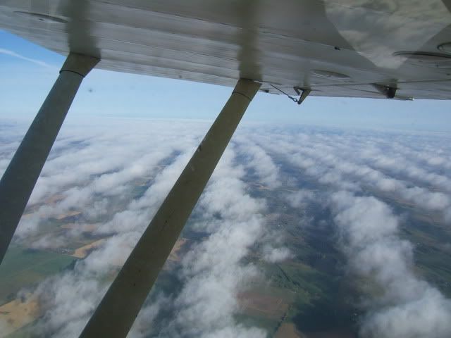
I took off from my home base at Red Deer Regional airport (CYQF) and headed west following the Red Deer river. Here's a picture of some interesting rows of clouds taken near Red Deer.
I turned off at the confluence of the James river and the Red Deer river and followed the James river to the pass at Eagle lake west of Sundre, AB. Here's a picture taken approaching the pass.
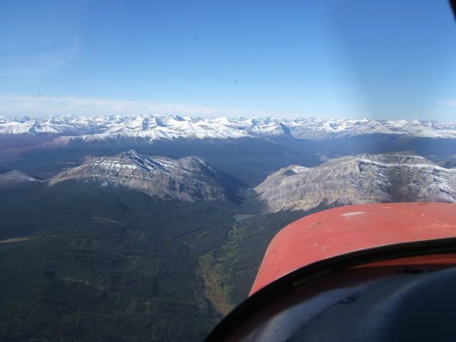
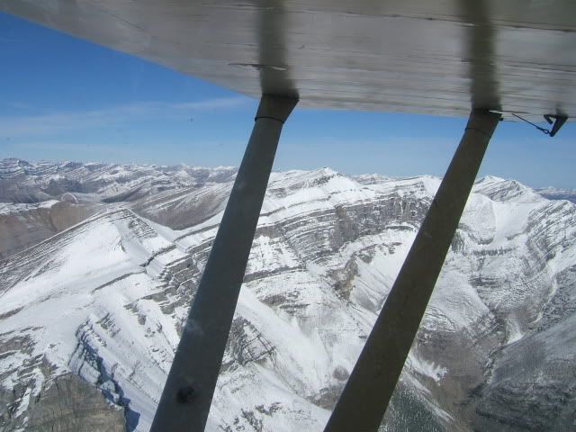
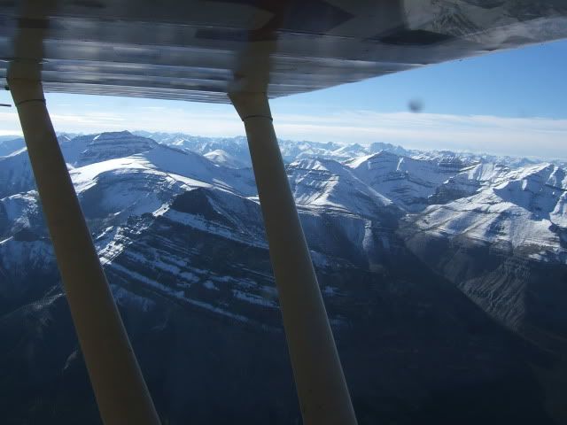
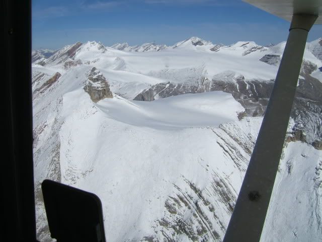
I flew over Ya Ha Tinda ranch where Parks Canada keeps their horses for the winter. I joined up with the Red Deer river again at the ranch and continued to follow the river west into Banff National Park. Here are some pictures taken in Banff National Park. It was a very remote stretch with big mountains and no roads. The river valley had some open meadows and gravel bars that would have provided emergency landing spots had the need arisen. The winds were calm and the flight was smooth.
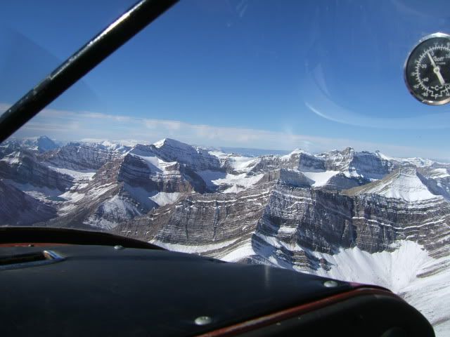
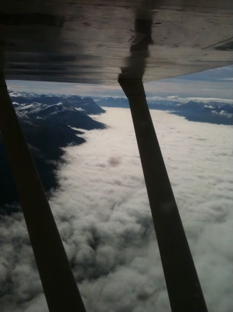
I continued up the Red Deer river valley to the headwaters of the river, then followed the Pipestone River until I came out at the Transcanada highway near Lake Louise. I got a cool picture at this point, the valley that the Transcanada highway follows from Banff to Lake Louise was covered under a blanket of fog. The way I was going was clear though. Here's the picture... the Transcanada highway is down there somewhere.
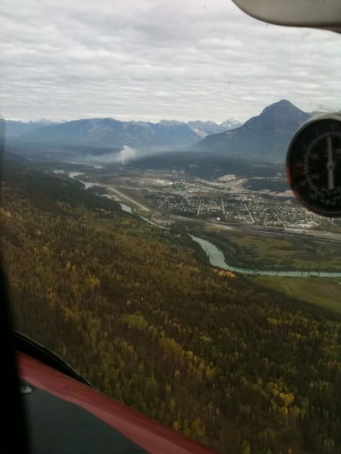
I followed the TransCanada highway from Lake Louise to Golden. When I got to Golden I checked the wind by looking at the smoke coming from the stack at on of the mills, and found that the wind was favoring runway 14. Here's a picture taken joining the downwind leg for runway 14 in Golden.
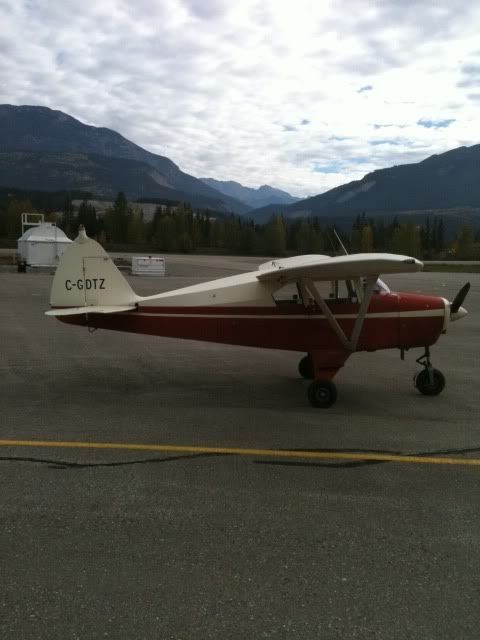
The traffic pattern was a little unconventional, with the airport elevation at 2500' and the pattern altitude at 4000' due to terrain, but the Tri-pacer drops like a rock when I extend full flaps and bring the throttle to idle, so I had no trouble descending the extra 500'. Here's a picture of the old girl on the ground at Golden.
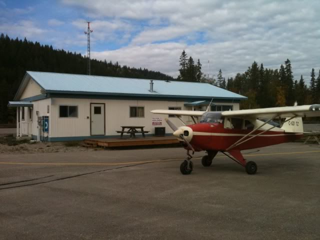
And a picture of the terminal building in Golden.
I went in and had a drink and a snack, and used their computer to check the weather. I didn't want to stay too long, I wanted to head back before the wind came up, so after a bite to eat, I refuelled the plane and headed for home. It was a nice flight home, and a great first cross country through the rocks. Looking forward to many more.
If you're interested in seeing more pictures of the flight, check out my photobucket album at http://s112.photobucket.com/albums/n186/AB_Summit/Flight%20to%20Golden%20BC/
Thanks
Randy