Hi All,
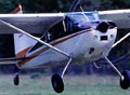
My wife's Dad is taking her fishing down the Green River in Dutch John, UT in mid-May. We're both new VFR pilots and she is seriously contemplating spreading her wings and flying there solo weather permitting. The Equipment is a 1970 Skyhawk w/ STOL and Powerflow Exhaust Mods. It's not real fast but it's reliable and likes to climb. Avionics are New Garmin SL-30 & Nav Head, and a 396 GPS w/ WX subscription. Emergency equip is an Iridium sat phone, ResQfix 406MHz GPS beacon, and survival gear.
Here's the planned route for the interested:
Redmond, Oregon to Rangely, Colorado (where Dad will pick her up to do some driving and talking/visiting)
KRDM - ILR - BOI - KBYI - MLD - KFBR - 33U - 4V0
The flight planning has gone fairly smoothly except the debate around crossing the Wasatch on V-142 between Malad City and Ft. Bridger VORs. She's planning a conservative fuel stop in Burley, ID. We think with her relatively light load (her, fuel, and a couple of relatively light bags), she'll be able to climb up to 13,500 for crossing that 10,000 ft Wasatch range.
We'd appreciate any local or veteran flyer input on the route or crossing that particular set of mountains via that victor airway.
Let me know if you have any additional questions about the route and we'd be happy to provide more details. I'll try to post a photo of the route (AOPA flight planner) in my gallery.
Thanks,
Spindrift
New Pilot: Help With Western US Flight Plan
Sun Apr 20, 2008 10:03 pm
Mon Apr 21, 2008 12:12 am
Since your wife is a new pilot I would recommend that she follow Highway 84E to 40E. Yes this will add more time for the trip but she will always have the security of following the road. The interstate avoids the high mountain terrain. If the GPS fails she still has the road. If engine problems she has the road. There are plenty of airports on this route as well. It is a conservative approach but it is a lot less stressful.
Which ever way you choose have a safe flight.
Which ever way you choose have a safe flight.
- Green Hornet offline

- Posts: 527
- Joined: Tue Apr 08, 2008 1:47 pm
- Location: No Where Land, USA
AKA SOJORRN
1997 Maule-M7-235C
I am a leaf on the wind watch how I soar! Hoban "Wash" Washburne, Firefly/Serenity
WOC SPOT
1997 Maule-M7-235C
I am a leaf on the wind watch how I soar! Hoban "Wash" Washburne, Firefly/Serenity
WOC SPOT
Mon Apr 21, 2008 6:50 am
Re: New Pilot: Help With Western US Flight Plan
Spindrift wrote:Hi All,
Here's the planned route for the interested:
Redmond, Oregon to Rangely, Colorado (where Dad will pick her up to do some driving and talking/visiting)
KRDM - ILR - BOI - KBYI - MLD - KFBR - 33U - 4V0
Thanks,
Spindrift
Sounds like a great trip! I would recommend a couple of minor changes: Use S66 (Homedale) instead of BOI, this will still keep you out of Saddle MOA and R-3203, but also out of Boise airspace and shorten the dogleg a little. Down by Logan, if you use MLD-LHO-FBR, you will be over the canyon leading east from Logan instead of over the highest part of the range. You could do the whole trip at 9500, although with any tailwind 11,500 might be worth it. Another route would be to follow I-84 southeast from Burley until 20 miles West of Logan, then turn to FBR...this would accomplish the same thing.
These ranges have many lower passes through them, and the valleys are all ranching country with many possible emergency sites, so I don't consider it all that intimidating a route. The most remote sections are Logan to FBR and Dutch John to Rangely. You might want to continue Southeast from Dutch John twenty miles or so through Brown's Park before turning South to Rangely to avoid the rough terrain North of Dinosaur NP, although following the Green river through the Gates of Lodore is some of the most spectacular flightseeing you could find!
You have a well equipped plane so weather is the only factor that might force a change in routing. You are probably aware that on a moderately unstable Spring day, the mountains are the first place showers start, and that might make I-84 a better choice, as well as giving the Uintah range a wider berth. In fact, that range is such a weather producer that having BYI-BMC-42U-36U-MTU-4V0 as an alternate route to go Southwest of them is a good idea, as typically the storms will form over them and then drift Northeast to East, obscuring the lower terrain around Dutch John intermittedly in rain showers, particularly after noon to 2pm.
Of course, the Wasatch range can do the same thing, but I've been able to thread my way around showers in the Heber City to Morgan City area with success when the mountains were obscured. It's only 42nm between them, so turning around, landing and waiting for a shower to pass is pretty easy. If you continue Southeast from Heber about 15 miles, folowing the road, you will be over the lowest terrain. Don't forget to look in the rearview mirror!
I always play around with something like AOPA's online flight planner or the free Golden Eagle Duats software before a longer flight like this, rubberbanding the route until I'm pretty familiar with most of the identifiers, so that a major inflight change of plans is just a few keystrokes away, no stress. I have dozens of flight routes kept on my computer in the Mapsource TopoUSA software so all I have to do is dump the appropriate ones into the GPS before a flight. If you don't have that software, you should still build the route and alternate on the 396 before flight. Then all you have to do is follow the Yellow Brick Road and enjoy the scenery!
Have a great trip!
Rocky
Last edited by RockyTFS on Mon Apr 21, 2008 8:28 am, edited 1 time in total.

Mon Apr 21, 2008 8:04 am
The winds can be brutal that time of the year between Burly and Fort Bridger not often but be aware.
You may want to think about about going north to Bear Lake then down the backside if your doing it in the afternoon.
They also have a couple runways if she needs to get back on the ground.
That may also get you around most of the cloud build up.
Leave very early and don't over estimate the performance of your bird. Remember to lean for max power at these high density airports, yes even in May they can bite you.
Floyd
Mon Apr 21, 2008 8:25 am
I might suggest a fuel stop at Buhl instead of Burly if you have an autofule STC as they have mogas at the pumps.
Twin Falls has a nice restaurant if you would be there for luchish.
Have a lot of fun.
Twin Falls has a nice restaurant if you would be there for luchish.
Have a lot of fun.
- soaringhiggy offline
- Posts: 711
- Joined: Tue Dec 13, 2005 8:22 pm
- Location: Kimberly, ID
48 Stinson 108-3
Mon Apr 21, 2008 2:26 pm
Hi All,
Thank you all for you input to the post by my husband concerning my flight & fishing trip. I thought I would join the forum and express my thanks.
As for specifics... some have suggested trying to avoid the mountains as much as possible and flying (IFR - I Follow Roads ), following I 86 to Pocatello down to Soda Springs, ID to Fort Bridger then down to Rangely. And the other option to avoid the Uintas by way of BMC-42U-36U-4V0.
I think those two options are good if the weather is unfavorable. However, I was taught to go high so as to have the best glide in the event of engine failure, take advantage of winds if possible, always look for a suitable landing site and always have an alternate route in mind. I must admit taking a canyon route scares me more than going over. We live near 10K foot peaks and have traveled around them and over them when weather and winds are favorable. I don't claim to be and expert but not a neophyte either.
So, suffice it to say I am still chewing on your ideas and will let you know via post how things go... including the fishing. Thanks again.
Jennifer
Thank you all for you input to the post by my husband concerning my flight & fishing trip. I thought I would join the forum and express my thanks.
As for specifics... some have suggested trying to avoid the mountains as much as possible and flying (IFR - I Follow Roads
I think those two options are good if the weather is unfavorable. However, I was taught to go high so as to have the best glide in the event of engine failure, take advantage of winds if possible, always look for a suitable landing site and always have an alternate route in mind. I must admit taking a canyon route scares me more than going over. We live near 10K foot peaks and have traveled around them and over them when weather and winds are favorable. I don't claim to be and expert but not a neophyte either.
So, suffice it to say I am still chewing on your ideas and will let you know via post how things go... including the fishing. Thanks again.
Jennifer
Mon Apr 21, 2008 8:42 pm
didinator wrote:
I was taught to go high so as to have the best glide in the event of engine failure, take advantage of winds if possible, always look for a suitable landing site and always have an alternate route in mind.
Jennifer
Yup, if the weather gods smile upon you and it's CAVU all the way, high is beautiful. It just doesn't often work out that way in the springtime. Realistically, if your plane doesn't have any engine issues, an emergency landing is normally only caused by running out of gas or pushing weather beyond reasonable limits. Parts of this great country are boring down low and more interesting up high, and some are just the opposite. You have to learn to trust your steed, and if it doesn't act like it should be trusted, GET RID OF IT! Very, very few planes are really dangerous from a mechanical point of view. Out of several hundred planes I have flown, only one tried to kill me
Get up before dawn, and GO FOR IT! Have a great trip!
Rocky
Tue Apr 22, 2008 12:14 pm
Jennifer, I have made 4 trips across that area and I always go over Bear Lake to Rock Springs. I know you are not going all the way to RKS, but that is a good route across that part of the country. There is a airport at Paris, ID. and one at Kemmerer, WY. As I look on the map I see the route you have posted is not far off of the one I am suggesting. Good luck and If you get in trouble in the S49 area I have room for you and your family at the Bement house. Bob.
1959 Cessna 182 Skylane N9054N
My back country videos are here: http://www.youtube.com/skybobb
"I don't belong to any organized Political party, I'm a Democrat."
Will Rogers 1879 - 1935
My back country videos are here: http://www.youtube.com/skybobb
"I don't belong to any organized Political party, I'm a Democrat."
Will Rogers 1879 - 1935
Tue Apr 22, 2008 2:49 pm
Yes the route that Bob has recommended is the way I go when eve I need to cross the Rockies.
It is a good route with minimal time over the really rough stuff.
It is a good route with minimal time over the really rough stuff.
- soaringhiggy offline
- Posts: 711
- Joined: Tue Dec 13, 2005 8:22 pm
- Location: Kimberly, ID
48 Stinson 108-3
Sat May 03, 2008 7:58 pm
Hi All,
Thanks for everyone's input. After much consideration here is my final route decision: KRDM-BOI-KPIH-KEMM-33U-4V0. I think this is my fastest and best route to avoid most of the hazardous and remote terrain as well as possible mountain weather from the Wasatch and Uintahs. Thanks again to all who provided suggestions. I'll let you know how the flight goes... as well as the fishing.
Jennifer
DISPLAY OPTIONS
Who is online
Users browsing this forum: No registered users and 8 guests
Latest Features
-
Live to Tell
A Minnesota pilot is surprised to learn that the sudden asymmetric drag of an out-of-rig ski can…Read More -
Creators
Working in some of the Yukon's most beautiful and remote environments, photographer Simon Blakesley captures aircraft in…Read More -
Aircraft Ownership and Maintenance
Upgrading to big tires can make a huge difference in backcountry performance, but with those gains come…Read More -
Tales from Yesteryear
In this tale from bush flying yesteryear, Don Cogger signs up to help Atlee Dodge Jr recovery…Read More


Latest Knowledge Base
-
Destinations
A regional guide with ideas for winter camping destinations in California, Nevada, New Mexico, and Arizona.Read More -
Aircraft
Finding an affordable aircraft that can handle the backcountry for $80K or less? A challenge for sure, but with the…Read More -
Aircraft
01.29.2018 - Zane - Updated tire diameter graphic to add 8.50x10 Guide to tires for use in the backcountry and off-airport landing…Read More -
Pilots
12.22.2013 - Initial article format Operating aircraft on skis and negotiating a snow-covered landscape is an entirely unique skillset and environment.…Read More


