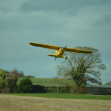
I've been around back country and off airport pilots for a lot of years, and I'm talking about pilots making many landings a day, often in some pretty tough places. Frankly, I've never known anyone who goes through these machinations prior to landing, except MAYBE their first few landings off airport.
One of the things that most folks don't think about before they go to a true off airport landing site is all the information that is available to us when we operate at an "airport". High on that list of information is dimensions of the operating surfaces. And, then there are wind indicators of various flavors, an assurance of smoothness of the landing surfaces, stripes to delineate the surfaces and what constitutes "straight", the mean sea level elevation of the surface, etc, etc.
When we opt to take our aircraft to a landing site which is not officially an "airport", most of those things are not available to us. And, this is when we realize just how important all that information that we've been taking for granted is.
So, the FIRST task one needs to undertake at an off airport site is to develop as much of that information as possible before we operate there. This is relatively easy if you can get there by some conveyance besides an airplane, but......usually the reason we're taking an airplane to those places is because they're not accessible by other reasonable means.
So, how do I develop that information? By a series of passes over and around the proposed landing site. Depending on the site and the experience of the pilot, that may require one or two passes, or many passes. I've spent half an hour or more evaluating a site I really wanted to land....one that was technical and difficult. I've also taken a quick look at a gravel bar and landed, with no further ado. Of course, that was in an area where I'd landed on numerous gravel bars, so I had a good basic knowledge of what those bars in that area were like.
But, in general, here's what I derive from the first, relatively high (300 feet +/-) pass:
1) Wind direction and velocity--If there's water around, learn to read the water, otherwise, plants, trees, etc may give you some hints.
2) What are the approaches like? On both ends, of course. This may be a one way strip, due to obstacles at one end....that's information that's essential to the rest of your planning, and may indeed, when coupled with the wind direction determined in 1. above, may suggest that you go somewhere else today.
3) Where is the touchdown point, and where will the plane run out to a stop? Remember, no center lines here.
4) I usually make a WAG as to length. Width should be relatively apparent from height.
5) Finally, I'm looking for obstacles on the surface that I need to avoid.....that ties in with 3. above. From height, this is a rough survey. There may well be stuff we don't see till we get closer. Look for shadows, etc that might indicate irregularities in the surface. And, look at the surface from several angles. It's always interesting to see stuff you missed because of sun angle, etc.
Once that information is at least generally determined, it's time for a lower pass, with no touch. We're "trying on" the approaches and the strip itself, as well as the departure path. This/these passes will be at 10 to 20 feet, and offset, so the pilot can visualize the landing surface. Things you also should be working on in these passes:
1) Obstacles, surface irregularities, etc. Now, you're closer, so you should be able to get a better idea of surface condition. An Alaskan saying is "If it rough, it is. If it looks smooth, it may be."
2) On one or the other of these passes, we're going to "measure" the length of the strip. This implies a pass at ~ 60 knots or about 70 mph. That's about 100 feet per second velocity. Note the term "about" in there....this is not nuclear engineering....we are developing an approximation of usable surface. A ten second pass over the landing surface is ABOUT 1000 feet.
3) On these low passes, we're also getting a feel for wind currents, turbulence, etc. close to the surface. There can be squirrely currents close to the surface, or the opposite: Totally calm air down between the trees.
Now, you should be getting comfortable with this landing site, or not. If not, you may want to leave at this point. If, on the other hand, you're really motivated to land here, take it to the next step:
1) Approach with takeoff/climb flaps and run your tires on the surface. You should have decided PRECISELY where you're going to touch and where the runout line is, based on previous passes. Unless you find something ugly with wheels on the surface, get that line firmly in your mind.....and DO NOT touch or run your wheels ANYwhere else. That's essential....you're pioneering one tiny part of this surface, not the whole thing.
2) Do as many "drag passes" as you need to get comfortable both with the landing AND the takeoff to follow.
Once you've completed this process, if you're still comfortable with this site, it's time to land. Again, DO NOT pioneer and evaluate one part of a landing surface, then land somewhere else on that surface.
So, that's the pioneering process in a very short nutshell. But, the original question was how do we determine if it's "landable" in this aircraft?
That information is best developed at an airport. One with a turf or gravel surface is good, since it offers similar sight perspective as an off airport site.....no center line. But, the point is, the pilot who is new to off airport or even back country operations should absolutely NOT begin learning the capabilities of their aircraft in that environment. You learn the performance of your airplane at different loadings and temperatures at an airport. If your turf strip has cones marking the runway edges, find out what the spacing of those cones is. Now you have a tool to evaluate the landing/takeoff performance of your craft, and its pilot. Read the Operator's Manual if you have one, and get some dual from someone who's both familiar with your airplane AND with off airport/back country operations. You're learning to extract the best possible performance from your airplane, AND from its pilot....You in this process. That means landing precisely on your touchdown point, EVERY approach. If you're not going to touch at touchdown speed and attitude on your chosen point, go around!!
That's the rule until you can touch at minimum forward speed on every pass. Now, you can start measuring your landing roll. Same process goes for the takeoffs. Always use the best soft/short field takeoff technique, for EVERY takeoff, unless there is a compelling reason not to (adverse winds, for example). And, I mean for every takeoff....remember, from now on, every takeoff and every landing is going to be practice in pursuit of that precision you're going to need out in the boonies. Your goal is to takeoff in minimum distance AND at minimum controllable speed for conditions. Followed by acceleration in low ground effect, preferably to Vy. Then climb.
Etc. Continue this process, at an airport, until you are very comfortable with your landing and takeoff precision. Again, touchdown at minimum forward speed, followed by appropriate braking. Takeoffs at maximum performance, followed, as Contact says, by acceleration in low ground effect.
Once you've mastered these evolutions at an airport (get the point yet?), that's the time to consider going out to an off airport or back country landing site. Note that I did not call it an "airport", because it may not be. Again, if you can find an experienced instructor to go with you on this first junket, good deal, that'll help. But, if you've followed this process thoroughly, you should be ready to conservatively tackle unprepared sites, as my former employer called them.
But, for all the reasons noted in earlier posts (varying DA, aged engines/airplanes, variable environmental conditions, etc), you need to determine your own airplane's and your performance characteristics and abilities, rather than rely on the data offered in your POH. I started this process in aircraft that didn't have a POH, so all performance data had to be developed. And, don't forget, different pilots will exhibit different performance in the same aircraft. Just because your buddy can land a given site in an aircraft identical to yours does not imply that you should.
Most of all, as you develop this information, you'll be honing your skills and experience, getting a much better feel for your airplane, and hopefully having fun in the process. Of course, these sessions often result in sweat soaked shirts.....

but that's okay too.
Have fun!
MTV