Backcountry Pilot • Riley - n/a - Estancia, NM

Riley - n/a - Estancia, NM

Discuss your knowledge of airports and off-airport strips. Help inform other pilots of status, warnings, noise abatement, and closure endangerment. See also: http://www.shortfield.com
9 postsPage 1 of 1

Riley - n/a - Estancia, NM

Airport is located at North 34.683276, West 106.199894. The property is at the intersection of Riley Rd. and Ten Pines Rd.

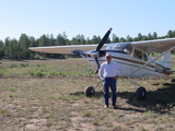
Main runway is about 1500 ft, cross-wind runway about 900 ft. Old runway about 800 ft (used as taxiway currently). Surface is dirt, although could be gravel.

Image
Last edited by zaitcev on Wed May 28, 2014 6:29 am, edited 1 time in total.
zaitcev offline
User avatar
Posts: 54
Joined: Sat Oct 30, 2010 6:31 am
Location: Albuquerque, NM

Re: Uncharted - UNKNOWN - Estancia/Punta/Torreon, NM

I flew over on Sunday after some rains, which are a rarity in our parts, and there was a man in a tractor on the runway, grading it. So the field is active, however the effective length of the runway is reduced to about 1100 ft.

I'm thinking about driving there and introducing myself. Maybe he'll let me land. I'm not sure what's appropriate in such cases.

Image
zaitcev offline
User avatar
Posts: 54
Joined: Sat Oct 30, 2010 6:31 am
Location: Albuquerque, NM

Re: Riley - n/a - Estancia, NM

ZA:

That may be Biplane Ranch? Met a guy a few years back that I think had a Starduster that said he lived in that area.

Let us know what you find out.


Thanks!
88H offline
User avatar
Posts: 312
Joined: Sun Jan 11, 2009 7:28 am
Location: Los Lunas, NM

Re: Riley - n/a - Estancia, NM

I like the idea of a friendly spot with a swimming pool :D
I think there are 3 types of coordinates used?? From my experience, the ones generally used for aviation(on the charts and my garmin GPS break the degrees into 60 minutes. Others commonly used break the degrees into100 minutes.The Google Earth Coordinates (which is what the Garmin GPS's use)for that place are 34*41'01.00" x 106*11'57.57"
If I see where the minutes run over 60, then I know to convert to the type with 60 minutes per degree.
The 3rd type I am not sure of, but I know these 2 get confused, then misleading.
I also found another while trying to find this one. Larry probly knows about it, it is pretty close to his place. 34*33'41.26" x 106*12'36.62"
gary
shortfielder offline
User avatar
Posts: 2350
Joined: Sun Mar 05, 2006 7:14 pm
Location: Durango, Colorado
FindMeSpot URL: http://share.findmespot.com/shared/face ... D263l9HKFb
If you want to go up, pull back on the controls. If you want to go down, pull back farther.

My SPOT page

Re: Riley - n/a - Estancia, NM

"Riley Tenpines" is about 12 nm south of Biplane Ranch. I say about because I was unable to find it 2 weeks ago (anymore). Riley is in a good shape, but the ground looks darkish where the tractor went. The owner probably never bothered to put any gravel on it. I'm sure it costs money.

Thanks for the notice about the "Gravel Spur" -106.20610 34.55687. I didn't know about it.

I put places I know into a map at Bing:
http://www.bing.com/maps/?v=2&cp=34.569 ... orm=LMLTCC

My attempts to add any of them to Shortfield.com were unsuccessful. Although I have to admit I haven't landed on any of them. I need more than 800 ft on pavement at our altitudes, even if I got permission from owners.
zaitcev offline
User avatar
Posts: 54
Joined: Sat Oct 30, 2010 6:31 am
Location: Albuquerque, NM

Re: Riley - n/a - Estancia, NM

ZA:

With your permission, I am going to forward this link to the NMPA members who are working on a mapping project. We are working with the Glidder Association to map out all active and abandoned strips around the state. You have several strips, especially that one south of Socorro, that is not on our list. After we get them collected, we are going to start populating the map we have on the NMPA website.

Thanks for this!

Larry

Gary:

If it is ok with you, I am going to have the guy from NMPA email you. You probably have a lot of strips in the NW that we need to consider. Thanks in advance for the help!!!

Larry
88H offline
User avatar
Posts: 312
Joined: Sun Jan 11, 2009 7:28 am
Location: Los Lunas, NM

Re: Riley - n/a - Estancia, NM

Larry, by all means feel free to contact me at [email protected].

I know that landout strips are critical for glider folks because I read Frank Paynter's 2013 crash report, where he counted on a strip but was unable to find it. They need up-to-date conditions and photos.
http://soaringcafe.com/2013/06/the-end- ... sh-report/

-- Pete
zaitcev offline
User avatar
Posts: 54
Joined: Sat Oct 30, 2010 6:31 am
Location: Albuquerque, NM

Re: Riley - n/a - Estancia, NM

shortfielder wrote:I also found another while trying to find this one. Larry probly knows about it, it is pretty close to his place. 34*33'41.26" x 106*12'36.62"


I flew over that place today. It's the saddest sight ever. Next to the disused runway, two aircraft are rusting away: a hershie bar Cherokee without a cowling and a Sportcopter Vortex or 912, laying on its side, one blade broken off at the mast.

Image

P.S. Someone at rotorcraft forums found this story from 2009:
http://alibi.com/blog/29976/Gyrocopter.html

Apparently the owner's name is Mike Demarco and he's the neighbour of the owner of the "Gravel Spur" airport. The copter is actually a Vanscraft with a 2-stroke engine.
zaitcev offline
User avatar
Posts: 54
Joined: Sat Oct 30, 2010 6:31 am
Location: Albuquerque, NM

Re: Riley - n/a - Estancia, NM

ZA / Gary:

Thanks for the info. Passing along info to mapping group.

Regards, Larry
88H offline
User avatar
Posts: 312
Joined: Sun Jan 11, 2009 7:28 am
Location: Los Lunas, NM

DISPLAY OPTIONS

9 postsPage 1 of 1

Who is online

Users browsing this forum: No registered users and 1 guest

Latest Features

Latest Knowledge Base