Backcountry Pilot • S. Utah to Auburn, Wa

S. Utah to Auburn, Wa

Not necessarily information about airstrips or airports, but more general info about a greater area or a route of flight.
12 postsPage 1 of 1

S. Utah to Auburn, Wa

My dads health has been rapidly failing this last year and he is now off all his meds and ready to go. So, looks like I am looking at a trip up in the next 2-3 weeks (depending on what I can work out with my job).

My preferred destination is Auburn (S50) closest to where he is living. Haven't been to S50 since about 1979 so any more recent information would be helpful 8) . At this point, Looks like Wells, NV (KLWL) and John Day (KGCD) are the perfect fueling points in route, problem is, there is a nasty fire related TFR surrounding the airport, so updates would be appreciated from anyone in the area. Depending on weather (and fires) my have to make some alterations or fly commercial.

Thanks, Chris
slowhawk offline
User avatar
Posts: 501
Joined: Thu Aug 07, 2008 8:33 am
Location: Nowhere

Re: S. Utah to Auburn, Wa

Most of the west is IFR for smoke right now, and it doesn't look like it's going to improve anytime soon. Even though the airports report VFR or MVFR, cross country is definitely IFR. Often you can look down and see the ground through the smoke, but there is no horizon...it's impossible to fly without being on the gauges. I just flew from Idaho to CA and 90% of it was IFR flying. Flying low enough to use ground reference would have put me around 1000 feet agl, and no guarantee of not going IFR. Smoke can go all the way to the ground, too. Trying to scud run smoke is every as dangerous as scud running weather. If you're not happy flying on the gauges for hours at a time, I'd find another way to get there.

good luck
Hammer offline
KB and Supporter
User avatar
Posts: 2094
Joined: Mon Jan 08, 2007 9:15 am
Location: 742 Evergreen Terrace

Re: S. Utah to Auburn, Wa

Hey Chris,
Sorry to hear about your dad. I haven't flow that far south recently but can give you a VFR trip report on my flight LAST week from Grangeville, ID into the Puget Sound. Left Grangeville around Noon and flew across the northern part of the Blue Mountains to Walla Walla. At 9000' visibility was averaging 25 miles looking S and 15 miles looking N (due to fire smoke) w/light turbulence. From Walla Walla to the Dalles at 8500' visibility was 25-15 miles w/light turbulence. Landed at the Dalles and fueled up. Flying thru the gorge at 6500' I had a 25-30 KT headwind, the visibility still 25 miles w/moderate turbulence. From the Portland area North into the Puget Sound at 6500' 20 mile visibility w/light turbulence. The whole trip was blanketed with fire smoke and you have no horizon.
Hammers report might be a lot more current than mine.
That's all I got for you. Let us know how it works out.
Sam
SkylaneSam offline
User avatar
Posts: 143
Joined: Thu Oct 06, 2011 7:38 pm
Location: Puget Sound & Idaho

Re: S. Utah to Auburn, Wa

Thanks guys,

I suspected the visability would be marginal due to all the fire TFRs, but the 28th is the soonest it looks like i will be able to get away from work, maybe it will clear (or get worse #-o 
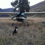
). Reminds me of the Alaska interior during the summer
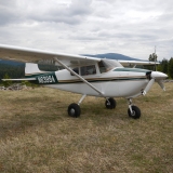
 :shock:
slowhawk offline
User avatar
Posts: 501
Joined: Thu Aug 07, 2008 8:33 am
Location: Nowhere

Re: S. Utah to Auburn, Wa

The smoke really varies from day to day depending on the winds. Just head west and deal with the real world conditions as you meet them.
jugheadF15 offline
Contributing author
User avatar
Posts: 309
Joined: Sun Sep 20, 2009 6:12 am
Location: Snohomish

Re: S. Utah to Auburn, Wa

Sorry about your dad slowhawk. Tough times.

If you give it a go fly safe and be careful. Smoke sucks to fly in and is worse than it looks. A couple years ago I flew into some smoke that didn't looks too bad. Spent two hours in it while trying to keep my head from spinning. Almost lost it a couple times. Not fun.
Image
whee offline
User avatar
Posts: 3386
Joined: Fri Jan 20, 2006 1:59 pm
Location: SE Idaho

Re: S. Utah to Auburn, Wa

You can download the latest smoke product from NOAA here http://www.ospo.noaa.gov/Products/land/hms.html Under the Map of the US at the top right click on Smoke, it is a KLM file that will open in Google Earth

Image
tcj offline
User avatar
Posts: 1278
Joined: Thu May 29, 2008 12:52 pm
Location: Ellensburg, WA
tcj

Re: S. Utah to Auburn, Wa

Thanks,
Things are going downhill faster than expected, so looks like i will give it a go tomorrow, head northwest and see if i can weave through the worst of it. We'll see how it goes :shock:
slowhawk offline
User avatar
Posts: 501
Joined: Thu Aug 07, 2008 8:33 am
Location: Nowhere

Re: S. Utah to Auburn, Wa

Chris, sorry to hear about your pops. I suppose we will all go thru this at some point.

Fly safe and enjoy your journey. We may be on scooters down there around 9/12.. I'll stop by and see if you are around.
SixTwoLeemer offline
User avatar
Posts: 1285
Joined: Thu Feb 07, 2008 10:53 am
Location: Wasatch Front
Altitude is Time…. Airspeed is Life!

Re: S. Utah to Auburn, Wa

First of all, sorry about your dad.

My flying partner flew from Central Oregon to Idaho today. He said it was a safe flight but very smokey and that he got into Stanely OK but weren't able to get into the Johnson Creek area.

John Day airport is inside a TFR and more importantly surrounded by a bunch of big fire and smoke. The fire's and multiple TFR's continue as you head east. As of now it looks like Baker (to the East of John Day) is open but several fires and TFR's surround it which may make it difficult to get into. To the west, Prineville is a good stop and only has drift smoke in the area as of now. Northeast of Prineville (by Madras) is another fire/TFR for the Warm Springs fire but you should be able to get around or over it without too much hasle as you head north. Washington has its own set of problems right now too but I have no intel on that.

Of course the wind can change the pirep at any moment but all in all it sounds like doable trip. Flight Following was helpful this morning too but it has some height limitations in eastern Oregon (the higher the better). Go for it and have a safe flight! I hope you have a peaceful flight.

CW
clippwagon offline
User avatar
Posts: 737
Joined: Sun Nov 13, 2011 9:49 pm
Location: Oregon

Re: S. Utah to Auburn, Wa

Did I spot your plane tied down @ U42?? Maybe you decided to take a smoker to WA??

I live nearby U42 if you need anything. Good luck with your Dad.
SixTwoLeemer offline
User avatar
Posts: 1285
Joined: Thu Feb 07, 2008 10:53 am
Location: Wasatch Front
Altitude is Time…. Airspeed is Life!

Re: S. Utah to Auburn, Wa

Yes that's mine at u42. After ducking and weaving through several thunderstorms after leaving Escalante, it was evident that I was going to push the envalope, so I went for plan b and went commercial out of SLC. Turned out well, was here in time to be here when he was transported home from the hospital and bridge the gap till hospice could start.
slowhawk offline
User avatar
Posts: 501
Joined: Thu Aug 07, 2008 8:33 am
Location: Nowhere

DISPLAY OPTIONS

12 postsPage 1 of 1

Who is online

Users browsing this forum: No registered users and 0 guests

Latest Features

Latest Knowledge Base