Backcountry Pilot • Southwest Alaska Flying

Southwest Alaska Flying

Did you fly somewhere cool, take photos, and feel like telling the tale to make us drool from the confines of our offices? Post them up!
132 postsPage 1 of 71, 2, 3, 4, 5 ... 7

Southwest Alaska Flying

Took a trip yesterday to give some stick time to a guy that is interested in learning to fly. We took the scenic route to visit Tikchik Narrows Lodge by flying over to Ekwok, New Stuyahok, and Koliganek on our way up. Was a bit windy at those three, so he got to see some crosswind landings, plus we were bucking a major headwind so the flight there took quite a while. The strip at the lodge is just a narrow track, maybe 1700 feet long (maybe shorter, not sure). Here we are, parked at the far end of the strip after landing, with my copilot walking up the strip to the lodge.
Image

One of our local flyers was here to visit a mutual friend who is the winter caretaker, and his recently acquired spam can was parked at the other end of the strip as we got to the lodge.
Image

The lodge setting is pretty nice...as was the weather...not sure I've ever seen better flying weather, even with the headwind on the way up it was smooth and beautiful, and dead calm around the lodge.
Image

When we got ready to go again, my copilot lost his head...
Image

We pulled the airplane forward in the gravelly grass at the end of the strip, then set it ready to roll forward. After we got in and ready, we got everything ready, fired it up, and blasted out of there. It was lovely. Quite an amazing little spot for a lodge, which has been there a long time.
Image

On the way home we went looking for caribou, and we turned up a group of around 10 at one point but none other than that. We will have to work a little harder to find some when we get ready to go hunt this winter. On the way back home we crossed the Mulchatna River near its confluence with the Nushagak.
Image

Copilot in training.
Image

And some dude that needs a shave.
Image

Moonrise over the Alagnak River was pretty awesome.
Image

Sunset over Bristol Bay.
Image

And finally, the moon just a few minutes after the Alagnak moonrise photo, as the sky color was deepening, was getting really impressive...pretty cool.
Image

Good flights all.
Troy Hamon offline
User avatar
Posts: 913
Joined: Tue Apr 06, 2010 8:27 am
Location: King Salmon
FindMeSpot URL: http://share.findmespot.com/shared/face ... 04iX0FXjV2
Aircraft: Piper PA-22

Re: Southwest Alaska Flying

troy, you give the tripe a good name, we fly our old tripe to all kinds of places, some people think they cant make it. best bang for the buck flying. hope the feds make the third class medical thing a reality and we can keep flying her. keep up your [posts ,we enjoy the scenery, living in fl the highest mt in fl is the trash mtns. RLM
messenger offline
Posts: 47
Joined: Mon Jun 06, 2011 5:07 am
Location: florida

Re: Southwest Alaska Flying

Was going to set my ol E model BO there about 20 some years ago and some guy runs out with a 3 Wheeler and parks it in the middle of the strip, left it there and walked back tothe lodge!! Never did think much of the place or people since then!!
GT
M6RV6 offline
User avatar
Posts: 2313
Joined: Mon Feb 25, 2008 5:52 pm
Location: Rice Wa. 82WN Magee Creek AERODROME
FindMeSpot URL: http://share.findmespot.com/shared/face ... sWKXuhKlg2
Have as much Fun as is Safe, and Keep SMILIN! GT,

Re: Southwest Alaska Flying

I wouldn't expect a welcome from any private lodge in the summer...unless you are a customer. They really like to fully control the entire experience of their clients. So if it was summer, I'm not surprised. In this case, I went there because I know the caretaker. I don't know anything about the operation proper, but it looked like a pretty nifty setting. But for $7,700 per person per week, I guess it better be nice.
Troy Hamon offline
User avatar
Posts: 913
Joined: Tue Apr 06, 2010 8:27 am
Location: King Salmon
FindMeSpot URL: http://share.findmespot.com/shared/face ... 04iX0FXjV2
Aircraft: Piper PA-22

Re: Southwest Alaska Flying

Great pic, I enjoy seeing other parts of Alaska I have not been to yet.

Ken
akflyer2001 offline
User avatar
Posts: 479
Joined: Sun May 24, 2009 3:25 pm
Location: North Pole , Alaska

Re: Southwest Alaska Flying

Troy Hamon wrote:Image


What an awesome spot! Nice TR, I'd love to do some flying up in that area.
robw56 offline
User avatar
Posts: 3263
Joined: Thu Jan 18, 2007 9:30 pm
Location: Ward
Aircraft: 1957 C-180A

Southwest Alaska Flying

By the way Troy, I'm just finishing your book. I have really enjoyed it.

Eduardo
PatínLoco offline
User avatar
Posts: 305
Joined: Sun Sep 09, 2012 12:10 pm
Location: El Salvador

Re: Southwest Alaska Flying

Thanks Eduardo...I'm looking forward to hearing about flying in your neck of the Americas...
Troy Hamon offline
User avatar
Posts: 913
Joined: Tue Apr 06, 2010 8:27 am
Location: King Salmon
FindMeSpot URL: http://share.findmespot.com/shared/face ... 04iX0FXjV2
Aircraft: Piper PA-22

Southwest Alaska Flying

Well, there's a lot to tell. Flying in Central America is a trip. Kinda like flying in your neck of the woods, except for the cold. We don't use carb heat down here. I got several old fun planes to fly down here (L4 Cub, 450 Stearman, and a C-47). If you're ever inclined to have a completely different aviation experience, let me know. You're ore than welcome. Just for you to know, when you're freezing your butt in King Salmon, our weather is 75-85 F and clear blue skies!!!

Eduardo
PatínLoco offline
User avatar
Posts: 305
Joined: Sun Sep 09, 2012 12:10 pm
Location: El Salvador

Re: Southwest Alaska Flying

I would love to come visit. I'll have to start working on the family...might be a year or three. We like adventures, my wife will be easy to convince, just going to have to save up.
Troy Hamon offline
User avatar
Posts: 913
Joined: Tue Apr 06, 2010 8:27 am
Location: King Salmon
FindMeSpot URL: http://share.findmespot.com/shared/face ... 04iX0FXjV2
Aircraft: Piper PA-22

Re: Southwest Alaska Flying

Awesome photos! It makes me want to pack up and head that way...
phorine offline
User avatar
Posts: 36
Joined: Sat Jul 21, 2012 12:21 pm
Location: Gatlinburg, TN

Re: Southwest Alaska Flying

Come on up!
Troy Hamon offline
User avatar
Posts: 913
Joined: Tue Apr 06, 2010 8:27 am
Location: King Salmon
FindMeSpot URL: http://share.findmespot.com/shared/face ... 04iX0FXjV2
Aircraft: Piper PA-22

Re: Southwest Alaska Flying

I am hoping to, but I gotta make a purchase first. Rental 150 to Alaska is way to expensive...

I made as far as the south east on a cruise ship (bleh) earlier this year. I love how desolate it is. I'm about 1 mile as the crow flies from the Great Smoky Mountains National park, which is the biggest piece of undeveloped land in the east, and south east Alaska made it seem like a city park. It's hard to find a back country camp site in the smokies where you can't hear a frigging Harley exhaust when it's a really calm night and you're trying to sleep.
phorine offline
User avatar
Posts: 36
Joined: Sat Jul 21, 2012 12:21 pm
Location: Gatlinburg, TN

Re: Southwest Alaska Flying

Had a brief window of completely mild winds and sunny weather, one day only, so I blasted off to take a look at Mount Martin and points nearby. It's been pretty cold, it was -2F this morning and had only warmed to positive single digits by the time we launched in early afternoon. But there was an inversion, and as we climbed up we found some comfortably warm air. Which is good since my plane leaks air into the cabin like a sieve.

After all the cold weather, the small lakes are all well frozen, but the big lakes are a different dynamic. Naknek Lake was well frozen on the western 10 miles or so, then some open water. By Brooks Camp, actually by Mortuary Cove, there was a strange scattering of pieces of ice sheets, will be interesting to see what it looks like after the warmup that is arriving tomorrow comes with snow, rain, wind, and temps rising to the 40s by Friday.
Image

After a couple passes around Brooks Camp, we flew on to the Valley of Ten Thousand Smokes. A few days back, the valley had no snow on the surface, and some high winds were picking up ash and carrying it to Kodiak. Usually our high winds seem to go the other direction, and nobody notices except us. But when the ash starts dropping in Kodiak, the volcano observatory usually gets some calls asking when the eruption happened.

"Oh, about 100 years ago..."

Now there is a nice thin blanket of snow, but the ash is visible where the watercourses have carved down through it.
Image

The eruption actually came out of Novarupta, which is the little lava plug in the middle of the photo. The largest eruption since Tambora, and it didn't even come out of a proper mountain...which wasn't known for a while afterward.
Image

We climbed up, then swung down to Mount Martin to get a photo of the steaming summit caldera. On a nice clear day with the right atmospheric conditions, we can see it from King Salmon and Naknek by the steam plume above the horizon. It was visible even yesterday. Today, it was steaming away in there. As we flew past, the smell of rotten eggs was overpowering. I assured my passenger that I didn't do it.
Image

As we flew on across the upper end of the Valley, Mount Griggs was standing tall above the valley.
Image

From there, we continued over Mount Katmai. I've been meaning to get up to get a look at it, but there is always somewhere else to fly that I'd like to see, but today everything worked out. An amazing day. Mount Katmai was originally thought to be the source of the 1912 eruption before they discovered that the ash sheet was thickest around the Novarupta vent. They thought it came from Katmai because it was the highest mountain in the area, and then it was gone, the summit had collapsed. In fact, it appears that the eruption at Novarupta drained the magma chamber beneath Katmai, and it then collapsed in on itself.
Image

Grabbed a shot of a pretty fabulous little canyon on the back side of Snowy Mountain with the sun lighting it up just right...
Image

We flew on for quite a trip, but the light got a little more subdued as a cloud layer moved in and the light got pretty flat. But we flew past Hallo Bay, then turned west and went down Kulik and Nonvianuk Lakes, then down the Alagnak River. As we descended, we were back in the inversion and the mountains began taking on odd shapes. I've tried to explain how it looks to people, but I never seem to get a good photo. I need to remember to take a telephoto lens along. In the meantime, here's a shot...those mountains in the distance aren't really shaped like that...and they aren't really that tall...
Image

As we got back home, I was descending when all of a sudden it felt like we were flying through a bowl of mush. Looked around, and the instruments all claimed everything was fine, but it just felt totally WRONG. Looked outside again, then scanned the instruments...and realized we were flying down through the inversion. I looked out and picked a mountain and pulled power to descend through the layer. As we went through, I saw the mountain mirage effect transition from one in which we were above the reflecting layer to where we were below it...and all of a sudden we were flying smooth again. Funny.

Good flights everyone.
Troy Hamon offline
User avatar
Posts: 913
Joined: Tue Apr 06, 2010 8:27 am
Location: King Salmon
FindMeSpot URL: http://share.findmespot.com/shared/face ... 04iX0FXjV2
Aircraft: Piper PA-22

Re: Southwest Alaska Flying

Beautiful photos you lucky dawg.
bcdpilot offline
Posts: 79
Joined: Sun Mar 07, 2010 7:59 pm
Location: scottsdale

Re: Southwest Alaska Flying

Great photos, especially the one of Mount Martin.
robw56 offline
User avatar
Posts: 3263
Joined: Thu Jan 18, 2007 9:30 pm
Location: Ward
Aircraft: 1957 C-180A

Re: Southwest Alaska Flying

A friend of mine wanted some hood time today. We are in the middle of a warm-up phase, but the ceilings were forecast to be high, the visibility was forecast to be good, and the wind was forecast to be almost calm. Usually when it gets warm in the winter, one of these factors is more in the realm of unpleasant...but not today.

We got ourselves over to the airplane and launched as they were reporting clouds at 1100 feet...which is quite a bit lower than forecast. But I was already paying special attention to the weather, as the low hills to the north of the field had a low band of clouds moving across in front of them that was visible as I was driving down the road.

When I go flying in the winter I have a bunch of survival gear in the plane. In this case, it was pretty warm out, above freezing anyway, but I threw in my super-warm parka and bibs just in case...

On climb out, we found ourselves bumping against a thin layer at 400 feet...then as we ducked back under we could see up through it right to blue sky. So we went up through a hole and off we went. From above, it was super-thin, and localized to King Salmon, with more low clouds down toward Naknek. Since Josh was under the hood, it was up to me to keep an eye on conditions, and since both King Salmon and Naknek were flyable, I figured we'd just stay close and take whichever was still open if one of them closed down. And if all else failed, I have a friend with a private strip up on slightly higher ground that was completely out of the fog layer to the east.

Josh flew a bunch of turns, descents, climbs, and combinations. I had him go to climbing and descending turns, he flew a couple stalls, and we did some unusual attitudes. Finally, he had had enough and pulled off the hood. At that point, the lake was totally open, clear, and beautiful.
Image

But the layer over King Salmon had solidified and was no longer something you could look down through. Hmm. The last 20 minutes of Josh's hood time I had asked him to dial in the ATIS and while it was low, it was still fine for getting in to the field via a SVFR clearance, with good visibility reported at 10 miles and a ceiling of 400 feet.
Image

Now that he was done hood flying, it might be time to head in?

No, in our brilliance, we decided to take a quick swing up to where we had gone moose hunting...

After a run up to the Alagnak River and back, the weather was still the same on the ATIS, but the low layer as we dropped down and approached was looking pretty unfavorable... We could still see out to the east fairly well, but it was getting pretty low. After making contact with the tower, they asked us to report 5 north, but at 6 north we couldn't see 5 north...so we swung east and told tower we were headed around. They cleared us into the surface area anyway, and asked us to report 1 mile out. We flew until we reached King Salmon Creek, then started heading down the creek. As we turned toward the field again, the visibility got poorer and poorer. But there was a little sliver of better visibility right down along Pike Ridge, which looked like we could perhaps all the way to the Naknek River. So we headed down along the ridge.

The tower called up to ask our location, and to tell us that their best visibility from the tower was toward Pike Ridge...right where we were...and sure enough the visibility to the west went from crummy to awesome right then, and we had a clear view of the field. They asked us our choice of runway and cleared us to land, and in we went. After shutting down and getting ourselves halfway through the process of putting the plane to bed we looked around and the clouds had completely descended on the field...we couldn't see the tower 1/4 mile away. I've gone into the field in low ceiling and visibility conditions before. But that's the first time I have flown in with about 10 minutes to spare separating me from a night somewhere else...

And I very much doubt that the field in Naknek would have been any better. And my friend's field looked like it was likely completely fogged in as well on Pike Ridge. So we would have been spending the night in Levelock, or Igiugig, or maybe Kokhanok. Which might have been its own adventure, but I'm happy enough to save that for another time.

Meantime...next time it is sounding marginal below I think we might do less dawdling...
Troy Hamon offline
User avatar
Posts: 913
Joined: Tue Apr 06, 2010 8:27 am
Location: King Salmon
FindMeSpot URL: http://share.findmespot.com/shared/face ... 04iX0FXjV2
Aircraft: Piper PA-22

Southwest Alaska Flying

Good stuff! I'll have to come out that way some time in the 185, looks like a lot of fun flying out there! Great photos! I'm based a birchwood. So maybe 2 hrs to your neck of the woods?
tblooma offline
Posts: 5
Joined: Thu Nov 24, 2011 5:17 pm
Location: chugiak

Re: Southwest Alaska Flying

I flight plan for 90 kts, takes me around 3 hrs to get to MRI, not sure what real speeds are on a 185 but 140 kts should get you around 2 hrs. When are you thinking of?
Troy Hamon offline
User avatar
Posts: 913
Joined: Tue Apr 06, 2010 8:27 am
Location: King Salmon
FindMeSpot URL: http://share.findmespot.com/shared/face ... 04iX0FXjV2
Aircraft: Piper PA-22

Re: Southwest Alaska Flying

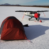
Yesterday a friend and I went to Bethel and back. Neither of us had ever been there and we had been talking about making the flight sometime so off we went. We had a pretty solid headwind on the way, and since we wanted to know our fueling options, we stopped in Dillingham to make sure the self-serve fuel was open and functional. The landing was a bit sporty, as the winds were at 260 at 11 gusting 17, so the landing was as close to a direct crosswind as you can get. The Tri-Pacer actually handles that pretty well. But at 20 gusting 30 I might have been landing straight across the runway onto the taxiway...

Had to taxi behind an Everts jet to get fuel, so I took a taxi route that had me taxiing toward the rear of the jet in order to see how much wind was coming off the idle generator turbine you can always hear from those things on the ground. Ended up being none...but I didn't want to be the subject of a youtube special.

From DLG, we climbed up and went over the mountains between Lake Nunavaugaluk (maybe my favorite place name in all of Alaska...I'm always suggesting it to parents looking to name their newborns...everybody thinks I'm joking...) and Lake Aleknagik.
Image

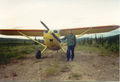
Josh is actually taller than I am...he's 6'5" and I'm 6'4"...luckily the Island Girl is a little bigger inside than our other PA-22 was. We are still crammed in there, but the last one was even tighter.
Image

The mountains between Dillingham and Bethel are for the most part not very high, but they are a beautiful mix of rounded tops and jagged ridges.
Image

With the headwind all the way to Bethel, we were looking at our fuel burn and calculating our options. We had been flying entirely on the right tank. I told Josh I would be switching when we were five miles out, and we should have about 2 gallons left in the right tank by then. With the wind at our back, we should be arriving back at Dillingham with 45 minutes of fuel...if the wind dropped maybe closer to 30 minutes...both of us have 1 hour minimums...so we decided we really may as well stop and ask for fuel.

The wind was 290 at 12, so we got cleared straight in on 30. I was looking at the airport diagram, and it looked like it might be hard surface for the first little section, with the overall runway length at 1875 ft. I couldn't remember a landing with substantial wind that was angled right down the runway, so I was interested to see if I could get it down and stopped on the pavement...

As we approached, Josh was looking ahead...

"I thought it was a gravel runway, but they have the runway end numbers painted on...I think it is paved!"

"Yeah, I was noticing that the runway had sections that looked hard surfaced in the diagram, if I read it correctly, the first little section is paved, then gravel."

"Okay, that makes sense."

As we came in, the wind was steady and smooth, so I stuck it right on the numbers, pulled power, pulled on the brake, and was stopped in time to taxi off before the gravel. Google satellite imagery suggests the entire paved portion is 475 feet or so. Aiming at the numbers, stopped where I did, I was probably down and stopped in about 400 feet. I don't think I'll bother to enter the short field competition at Valdez. But I think I could have done that landing every time...felt pretty good. In fact, it feels like I have fully transferred my skills to this airplane, similar as it is.

The tower directed us to Crowley when we asked for fuel, but it was after 6 pm and we didn't find anybody there. At the Yute Air terminal another pilot walked over and asked us if we needed fuel, then he called a number and a few minutes later a truck pulled up to fuel us.
Image

We headed back in short order, our very abbreviated visit to Bethel complete. It is really only around 40 or 50 miles of complete flat country between Bethel and the first hills, and in some ways it isn't that different from the Bristol Bay lowlands. But it does seem a lot flatter.
Image

Image

Image

The mountains were beautiful on the way home.
Image

Image

We flew a couple laps around the Muklung Hills looking for wreckage from the Ace B1900 crash this winter, but didn't turn up anything. We kept thinking we were looking at it, but then when we got a better look it was always rocks.

Winds had died down to numbers more like we had in Bethel by the time we landed at King Salmon, a lovely end to a lovely flight.
Troy Hamon offline
User avatar
Posts: 913
Joined: Tue Apr 06, 2010 8:27 am
Location: King Salmon
FindMeSpot URL: http://share.findmespot.com/shared/face ... 04iX0FXjV2
Aircraft: Piper PA-22

DISPLAY OPTIONS

Next
132 postsPage 1 of 71, 2, 3, 4, 5 ... 7

Who is online

Users browsing this forum: No registered users and 0 guests

Latest Features

Latest Knowledge Base