Here’s a test of ability to hopefully compose an interesting trip report. I learned a lot from this trip as a new pilot and how diverse and challenging the state of New Mexico is in regards to its geology.
As opportunity would have it, we ended up with a small ranch operation on the west side of NM in addition to the small ranch we already had in south central Texas. Driving between the two is 16 hours, do it in one day or two, it’s still a beating. Commercial flights and rent cars provide a 14 hour delivery. Enter the Maule M5. 7 mostly pleasant hours later and you're there. The weather changes a lot in this kind of distance so it takes a lot of long range forecast info and planning. I have determined (as it has been said by others) that a PPL is a learners permit. Studying and preparing for the type of flying we need to do in order to complete our mission is well beyond the the scope of simply acquiring a PPL and has some aspects beyond others personal minimums (which has a tendency to invite their admonishment). Pioneers such as Wolfgang Langewiesche (Stick and Rudder), Sparky Imeson (Mountain Flying Bible), Robert Buck (Weather Flying) and BCP’s own Jim Dulin (aka contact flying), have all been helpful in developing knowledge of the risks and techniques to overcome these challenges. And thanks to many others here at BCP for numerous insights into the type of flying that is required of us.
New Mexico is a beautiful state. It has wide open desert basins, large open prairies, and significant strips of alpine forested mountain terrain. Our neighbors tell us that the winters can get down to -40º F (cattle only graze this country from May to September). That would be a surprise to anyone that a state this far south would see those types of climate extremes. With the exception of the alpine areas, it is an arid state. The high altitude mountains create an environment that allows precious water to be extracted from the sky and drains down to feed the Rio Grande, Pecos, Gila, and other important water sources that serve numerous states. The sandstone formations provide the earth tone paintbrush that New Mexico and the southwest is known for.
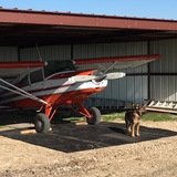
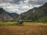
We chose the Maule because with our distance a reasonable cruise speed is required. Flying ranch to ranch requires STOL capability. Our Maule M5 will safely carry 927 lbs of useful load. To us, it is the perfect plane. Even at KSSR’s almost 7000’ altitude, we were getting 700 fpm climb out. Not bad for 180 horses.
The weather in Texas for this trip had just changed from warm humid overcast to blustery blue norther at our departure time. Winds at the nearby KHYI were reporting 25 gusting to 39 mph. These winds were 45º starboard at the ranch airstrip. The brush line that the 1200’ ranch airstrip etches through provides a nice cross wind protection until airborne. Our next stop (KHYI) was only 5 miles away to get fuel for our first leg as I tend to keep the plane light on fuel when returning to the ranch. I accepted the admonishment of extreme care in these winds while on the ground and it paid off. Once fueled up and airborne again, the bumps disappeared at about 2000’ agl. We chose to fly approximately 2 hour legs which put our next fuel stop at E41. The same wind conditions existed there that we had at HYI. Fortunately the airport terminal building provided some shield from the wind while at the pump. Nice little airport with good fuel prices. Airborne again and within 40 minutes we scooted around Midland’s Class C airspace after contacting their approach frequency and advising our course. Shortly thereafter we crossed the state line into New Mexico.
ForeFlight is such an excellent tool as we found that what few VOR’s we could get reception on could not provide a suitable radial for the course we were flying. It also helps that having driven through all this country for years provides a good knowledge of recognizable landmarks to navigate by.
It is in this phase of the trip that the world changes around us as we enter the Trans Pecos and Rocky Mountains.

After leaving the ranch in Texas it is a steady climb of terrain that requires a matching shift in flight altitude. I like flying reasonably low as it looks like things are going by faster and there is more to see and amuse yourself with. But we also had to be high enough to stay out of the bumps. The ceilings by now were at 12,000’ msl. By the time we got to KSSR, we were at 9,500’ msl. SSR is an interesting airport location that is up on a high mesa near Ft Stanton, NM. There are numerous high mountains in its proximity that need to be negotiated (or avoided in the presence of mountain wave), most notably Sierra Blanca.

This mountain range was deflecting strong southwesterly currents that were bringing up Pacific moisture across old Mexico into the region. For us, the mountains provided protection from this along our course. After refueling and departing (upper winds were out of the southwest, at the ground it was from 030), we had to modify our course to avoid White Sands Missile Range restricted airspace.

In here is the Trinity Test Site, open to the public twice a year. While we had VOR’s for this area to work with, once you got out of range of the Corona VOR you were still too far away to tune in Gallup. ForeFlight and dead reckoning to the rescue.
Within an hours flight of SSR, Mt Taylor (dormant volcano) becomes recognizable.

Its snow covered peak is very prominent on the horizon. In places along our route we could identify lenticular clouds. Fortunately for us they weren't in our path. The air we were in was quite smooth.
The winds aloft reports we looked at were reporting southwesterly air currents at 30+ mph. The Maule’s airspeed indicator was reporting 120 to 125 mph while flying approximately 300º magnetic. ForeFlight groundspeed was indicating 145 mph. No, it didn’t make sense to me either, but was happy to get that groundspeed anyway.
By now we are flying over the Rio Grande.

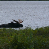
The bulk of New Mexico’s population centers would be upstream from here in the cities that line the river and I-25 to the north. We are over the Sevillita National Wildlife Refuge that hosts the sandhill and whooping crane migrations each year.
The next mountainous region we approach will be the Zuni Mountains that start south of Grants, NM, and proceed west to the Zuni Navajo Indian Reservation, near Gallup.

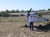
It is in these mountains that our destination lies. But until we can get suitable landing space cleaned up with the help of a neighbors motor grader, we’ll be happy to keep the Maule at Gallup Muni. We were at 11,000’ MSL by now; the Zuni’s are almost 9000’ in places. We could see the snow left behind from a nice White Christmas.

This meant that we need to rent a four wheel drive to get to the ranch. Once tied down at Gallup, the rent car agency picked us up and we learned that they had no 4wd available. So we picked a vehicle that had “Jeep” written across the grille, it was only 2wd. Yes we got stuck, but were within 1 and 1/2 mile hike to complete the journey.


Got our chores done and headed back to the car, unstuck it, and returned it to the agency. Overnight temperatures dropped to 18ºF and left a nice coating of frost on the Maule. This delayed our departure as we faced the wings into the morning sun for assistance in cleaning the wings. The return trip weather was largely a carbon copy of the trip up with southwesterly altitude currents and 12,000’ ceilings. This did change as we headed southeast. By the time we got to SSR, the ceilings were about 1000’ AGL in spite of the METAR otherwise.

There was a pilot at SSR trying to get to El Paso in a 182 that could not get through via the Rio Grande basin to the west because of the low ceilings nor via the eastern slope to the south towards the Hueco Mountains. For us, our route was taking us away from this development and as we proceeded on course we could distance ourselves from the ceiling as the terrain was falling away from SSR.
The winds aloft on this return trip was very similar to the outgoing leg. Winds were 245º at 30+ (at FL 39, it was 80 to 90 mph) as we were flying about 125º magnetic. ASI indicating 120 to 125 mph and ForeFlight indicating 155 to 160 mph groundspeed. I think the ASI is due for calibration…
Our late departure from GUP would mean that we were to land at night at HYI. As the evening wore on, the ceilings developed numerous layers we had to be mindful of and negotiate. There is a campus adjacent the airport that is lit up like a ballpark at night that makes the airport easy to find in excess of 100 miles away. Once we identified the “ballpark”, the rest was splitting the difference between the dropping ceiling and the obstructions on the ground. HYI has spent considerable resources upgrading the runways and lighting in the last couple of years. The new lights were a sight on final; Its a virtual hero’s welcome! Better than most of the Christmas decorations we saw this season. We chased a student flying a 172 on an ILS approach for our final into HYI. The Maule got to spend the night in the Redbird hangar with some pretty upscale company, a far cry from the humble stable she has at the ranch.

Once the weather and other obligations subsided, we squared up with Redbird and brought the Maule back to the ranch.
I have my eyes on a portable welder I need to use in New Mexico, and yes, the Maule can carry it.