As a former wildland firefighter, I know it is mother nature's way of cleansing herself, but man I wish the Forest Service would have/ could have protected the immediate area of the strip. It'll take decades for it to get back to the way it was with that strong pine sent that it always greeted you with.
Upper Loon Creek burned
Wed Sep 06, 2006 9:18 am
Upper Loon Creek burned
As a former wildland firefighter, I know it is mother nature's way of cleansing herself, but man I wish the Forest Service would have/ could have protected the immediate area of the strip. It'll take decades for it to get back to the way it was with that strong pine sent that it always greeted you with.
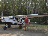
- Grassstrippilot offline


- Posts: 3536
- Joined: Wed May 31, 2006 6:17 am
- Location: Syracuse, UT
- FindMeSpot URL: https://share.garmin.com/WolfAdventures
- Aircraft: Cessna 205
Wed Sep 06, 2006 4:20 pm
cabin creek?
What a tragedy. It didn't seem like the area was overloaded with fuels, but the Potato fire was really bad the week we were camped at Smiley Creek (8/13-19). We could see the giant smoke column the whole time. Finally, a big thunderstorm came through and soaked the Stanley area and to the north. I guess that knocked that fire down, but others started around the same time.
Any idea how close the fires have come to Cabin Creek? I saw on the NIFC web site http://www.nifc.gov/fireinfo/nfn.html that structure protection is in place at Taylor Ranch and Cabin Creek, but haven't been able to tell how close the fire has come. From the map, it looks like they've named it the Dunce fire.
I'm glad you made it into Big Creek. At least that hasn't burned . . . .
CAVU
Wed Sep 06, 2006 6:28 pm
Cabin Cr and Taylor Ranch are fine, the Dunce fire was one of the first fires this season, and now it's not doing a whole lot. There is another fire south of Taylor Ranch called the Lewis fire, but I don't think it'll make it's way down to Big Cr. I think Big Cr strip will be in fine shape this year, there were 2 fires that were down river that could have threatened it, but I think the FS acted quick enough and took care of them.
The area I'm most concerned about is the South Fork. Around Krassel. There are probably 15 fires in that area, I haven't seen the South Fork of the Salmon in over a month. It'll be really interesting to see what happens when it's all done. I don't think anything is threatened, except perhaps some of the USFS lookouts. We really need a snow storm about now.
I've about had it with all the fires right now. We've had a high pressure system sitting over us the last couple days trapping the smoke. Tough flying. Sun Valley reported 6 miles of vis this AM when I went in. Boise reported 4 this afternoon, and on my way home to McCall this evening, AWOS was reporting 3 miles. Yeah 3 is legal, but yikes... exhausting flying, I only flew 4 hours today and I feel totally spent.
I heard there was a 182 that's gone missing up by Root Ranch. No calls, no ELT, but we keep listening for it. I heard he headed that way because the Flying B was too smokey. Fly safe everyone.
John
- LowAndSlow offline
- Posts: 161
- Joined: Wed Feb 15, 2006 9:27 am
- Location: Medford, OR
Thu Sep 07, 2006 7:44 pm
I heard there was a 182 that's gone missing up by Root Ranch. No calls, no ELT, but we keep listening for it. I heard he headed that way because the Flying B was too smokey. Fly safe everyone.
I believe the missing 182 was found. He was on the ground safe and sound at Root ranch. He had told flight service he was going to go down and see if he could land. If he couldn't land, he would climb back up into radio range and tell them his next plan. Since he didn't say the magic words, "close my flight plan" Flight Service kept his flight plan open. Since he was able to land safely flight service never heard from him again. His flight plan became overdue, and a search was initiated. It's hard to handle flight plans in the back country, but its nice to know that if we file one, and if we are overdue somebody will start looking.
Fri Sep 08, 2006 7:00 am
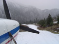
I came out of Smiley Creek yesterday morning and it was as bad as it was when we went in on Wednesday afternoon. We had to land in Fairfield while we waited for some thunder bumpers to move off of Hailey, then figured we'd go over to Magic to wait some more. Ended up Hailey was reporting 10 miles vis so we decided to take a look. That thunderstorm must have cleared it out for us. We ended up having about that, +/- a few miles all the way into Smiley Creek. We heard a lot of guys asking each other where they were and a few admitting that they didn't know for a while, but had since found themselves and were headed home.
The next morning it was just as smokey, minus the overcast. No problem getting back out, but vis was down to about 3-5 miles. It looked worse to the north so we decided to pack it in.
Hey Lowandslow, do you have any idea what the vis is like north of the middle fork? I know it depends on the days winds, but a last week when I was up at Big Creek, it cleared out just north of the Indian Creek area. I asked another guy Wednesday and he said that it was clearer up that direction again. I was planning on heading that way tomorrow and am wondering if the same is still holding true.
Fly safe.
- Grassstrippilot offline
- Posts: 3536
- Joined: Wed May 31, 2006 6:17 am
- Location: Syracuse, UT
- FindMeSpot URL: https://share.garmin.com/WolfAdventures
- Aircraft: Cessna 205
Fri Sep 08, 2006 3:11 pm
Potato fire?
Was that one on Potato mountain out of Stanley? I have chased elk all around the top of that knob as well as most of the area North of there.
Sat Sep 09, 2006 8:52 am
Glad to hear the 182 is safe and sound.
The Potato fire was just north east of Stanley, burned a lot of acres, but I haven't been able to see the total damage yet, still too smokey.
Grassstrip - It seems to be clearer north or the Middle Fork, but not always. We're doing a lot of work on Big Cr right now, and I haven't aborted any trips like I did to the M.F. These days, good vis is relative; up until a month ago, I never would have thought 7 miles was good vis! Sure beats poking around at 3 or less...
Take care
John
- LowAndSlow offline
- Posts: 161
- Joined: Wed Feb 15, 2006 9:27 am
- Location: Medford, OR
Sun Sep 10, 2006 9:21 pm


- Strata Rocketeer offline
- Posts: 504
- Joined: Sat Mar 26, 2005 11:19 am
"I've been ionized, but I'm okay now." - Buckaroo Bonzai
DISPLAY OPTIONS
Who is online
Users browsing this forum: No registered users and 1 guest
Latest Features
-
Live to Tell
A Minnesota pilot is surprised to learn that the sudden asymmetric drag of an out-of-rig ski can…Read More -
Creators
Working in some of the Yukon's most beautiful and remote environments, photographer Simon Blakesley captures aircraft in…Read More -
Aircraft Ownership and Maintenance
Upgrading to big tires can make a huge difference in backcountry performance, but with those gains come…Read More -
Tales from Yesteryear
In this tale from bush flying yesteryear, Don Cogger signs up to help Atlee Dodge Jr recovery…Read More


Latest Knowledge Base
-
Destinations
A regional guide with ideas for winter camping destinations in California, Nevada, New Mexico, and Arizona.Read More -
Aircraft
Finding an affordable aircraft that can handle the backcountry for $80K or less? A challenge for sure, but with the…Read More -
Aircraft
01.29.2018 - Zane - Updated tire diameter graphic to add 8.50x10 Guide to tires for use in the backcountry and off-airport landing…Read More -
Pilots
12.22.2013 - Initial article format Operating aircraft on skis and negotiating a snow-covered landscape is an entirely unique skillset and environment.…Read More


