Backcountry Pilot • Where'd the mountains go?

Where'd the mountains go?

Did you fly somewhere cool, take photos, and feel like telling the tale to make us drool from the confines of our offices? Post them up!
26 postsPage 1 of 21, 2

Where'd the mountains go?

I flew down to Durango to visit my Sis last week and returned yesterday. As I climbed on up to 13,000' on course eastward, I entered the clouds somewhere around 9000' or so--really didn't keep track. At just about 12,500', I was on top, and this was all I could see in any direction:

Image

Pretty soon, I could begin to see the San Luis Valley:

Image

It was pretty clear over the Valley, as I climbed up to 14,000' to cross the Alamosa VOR:

Image

Image

Image


But the east side of the Valley was semi-obscured:

Image

Image

Image


Once over the top heading north, there was little sign of snow, including on the lee side of Pikes Peak:

Image


Pretty cool, right? :)

Cary
Cary offline
User avatar
Posts: 3801
Joined: Sun Jan 10, 2010 6:49 pm
Location: Fort Collins, CO
"I have slipped the surly bonds of earth..., put out my hand and touched the face of God." J.G. Magee

Re: Where'd the mountains go?

Very cool!
CamTom12 offline
User avatar
Posts: 3705
Joined: Sun Jul 08, 2012 1:08 pm
Location: Huntsville
FindMeSpot URL: https://share.delorme.com/camtom12
Aircraft: Ruppe Racer
Experimental Pacer
home hand jam "wizard"

Re: Where'd the mountains go?

So what was the plan if the engine quit over the mountains VFR on top?
G44 offline
Supporter
User avatar
Posts: 2093
Joined: Thu Oct 27, 2011 10:46 am
Location: Michigan

Re: Where'd the mountains go?

Cary wrote:Image

G44 wrote:So what was the plan if the engine quit over the mountains VFR on top?

That's the first thought i had...
ExperimentalAviator offline
User avatar
Posts: 677
Joined: Tue Apr 15, 2014 8:02 am
Location: Plains

Re: Where'd the mountains go?

I'd guess an instrument descent.

I see the need to avoid unacceptable risk, but when do you trust your engine and go? He's an instrument rated and proficient pilot in an instrument certified airplane. VFR on top eliminates the danger of icing...

I'd have done it.
CamTom12 offline
User avatar
Posts: 3705
Joined: Sun Jul 08, 2012 1:08 pm
Location: Huntsville
FindMeSpot URL: https://share.delorme.com/camtom12
Aircraft: Ruppe Racer
Experimental Pacer
home hand jam "wizard"

Re: Where'd the mountains go?

Image
GumpAir offline
User avatar
Posts: 4557
Joined: Wed Feb 14, 2007 9:14 am
Location: Lost somewhere in Nevada
Aircraft: Old Clunker

Re: Where'd the mountains go?

CamTom12 wrote:I'd guess an instrument descent.

I see the need to avoid unacceptable risk, but when do you trust your engine and go? He's an instrument rated and proficient pilot in an instrument certified airplane. VFR on top eliminates the danger of icing...

I'd have done it.


Over that terrain? I wouldn't have.
G44 offline
Supporter
User avatar
Posts: 2093
Joined: Thu Oct 27, 2011 10:46 am
Location: Michigan

Re: Where'd the mountains go?

Big cities/metro areas scare me way more in the engine out department.

Gump
GumpAir offline
User avatar
Posts: 4557
Joined: Wed Feb 14, 2007 9:14 am
Location: Lost somewhere in Nevada
Aircraft: Old Clunker

Re: Where'd the mountains go?

GumpAir wrote:Big cities/metro areas scare me way more in the engine out department.

Gump


X2
blackrock offline
User avatar
Posts: 1576
Joined: Tue Jan 29, 2008 6:54 pm
Location: Elko, NV
FindMeSpot URL: http://share.findmespot.com/shared/face ... BFmtASxjeV
Aircraft: Bearhawk

Re: Where'd the mountains go?

X3
jomac offline
User avatar
Posts: 720
Joined: Sun Aug 17, 2008 10:25 pm
Location: idaho falls, id
jomac

Re: Where'd the mountains go?

Nice pic's. Just east of Twin Falls I went on top with a peak sticking out here and there around Malad City. I wouldn't have done it except I could see there wasn't a cloud in the sky over towards Rock Springs. Wouldn't have been good if the engine crapped out on me around Malad.
180Marty offline
Supporter
User avatar
Posts: 2313
Joined: Mon Jan 02, 2006 11:59 am
Location: Paullina IA

Re: Where'd the mountains go?

The ceiling was 9,000 feet. Was he to stay below that? Yeah, he could see the terrain from there, but at a price. He would have given up 3-5 miles of gliding distance. By being at 12,500 he gained that gliding distance, which might have been very important in terms of getting to an airport or clearing before running out of energy. And, as he's gliding, he would still pass through 9,000 on his way down he would just be doing so 3-5 miles closer to a potential landing area than he would have had he been flying at that altitude the whole time.

I totally understand and agree that flying VFR on top over a low overcast has perils, but that wasn't this flight. IMO any VFR so low that you wouldn't consider flying on top is an indication that maybe you shouldn't be flying it underneath either.
rw2 offline
User avatar
Posts: 1799
Joined: Sat Dec 22, 2012 1:10 pm
Location: San Miguel de Allende
FindMeSpot URL: https://share.delorme.com/LaNaranjaDanzante
Aircraft: Experimental Maule
Follow my Flying, Cooking and Camping adventures at RichWellner.com

Re: Where'd the mountains go?

One of the best flying cartoons (Gary Larson I think) I've even seen showed a pilot commenting to his passenger "say, what's a mountain goat doing way up in the clouds", and in the foreground is showed a bearded goat seemingly suspended in vapor. :P

SLC has a VFR corridor I've used twice, allowing a non transponder pilot like me to squeak through, with proper radio work or course To my surprise, I had several LZ's available almost the entire way. Really big parking lots, athletic fields, etc. A lot more landing options then flying over the lake anyway, also lot's of flags so good wind indicators, it still felt pretty strange to be flying so close to a major metro center! The last time I went that way I snuck around the backside of the Wasatch Range, more familiar hazards anyway.
courierguy offline
User avatar
Posts: 4197
Joined: Thu Mar 31, 2005 6:52 pm
Location: Idaho
"Its easier to apologize then ask permission"
Tex McClatchy

Re: Where'd the mountains go?

Come on now....

If you fly single-engine IFR anywhere, you risk the fan quitting over terrain that will not allow a safe landing. Day, night, mountains, over Nebraska cornfields, if vis and ceiling are down at that specific spot, you're going to have a problem.

Personally I hate IFR, and VFR, over metro areas. If something does break I don't want to hurt anyone on the ground, and, I don't want to get run over if I'm forced to use a road.

Mountain IFR I'm way more concerned with high MEAs and ice. I'd much rather pop out the bottom of a low ceiling full flap, low airspeed/groundspeed and deal with whatever I had to run into under control, than iced up high speed and gonna whack the ground real hard.

Gump
GumpAir offline
User avatar
Posts: 4557
Joined: Wed Feb 14, 2007 9:14 am
Location: Lost somewhere in Nevada
Aircraft: Old Clunker

Re: Where'd the mountains go?

Nice pics Cary, you got that thing up to 14,000 ft? Impressive! You could have dropped into La Garita for old times sake.
Rezrider offline
Posts: 288
Joined: Mon Sep 02, 2013 9:06 pm
Location: Four Corners

Re: Where'd the mountains go?

Interesting comments. Yeah, there's a risk--just getting in the airplane is a risk. SE IFR is a risk anywhere, but with 4000' to glide in the clouds to roughly 9000' bases, then roughly 2000' from the bases to the ground until over the higher terrain, there's lots of time and visual room to make a plan. My airplane has a bit better glide ratio than the average 172, which I suppose has something to do with the droopy tips and flap gap seals, plus I can pull the prop out all the way to reduce drag, so there are a lot of possibilities if something goes wrong. Believe me, I don't go into any of that lightly, without thinking of the risk and how to mitigate it to the extent I can. It's the same thought process whenever I go into the rocks in good VFR weather, i.e., if something happens, can I put it down somewhere and survive?

FWIW, the route east of Durango to Alamosa is V211 BRAZO V368 ALS with an MEA of 13,000'. If there'd been a hiccup, the first alternative would have been to turn around back to Durango depending on where the hiccup occurred. Otherwise, there are Jicarilla/Apache Nation and several private strips west of the bigger rocks, all pretty usable. Once over the top, it's gliding distance to Alamosa. On east of Alamosa, the MEA is 14,000', and there are Fort Garland on the west side of the rocks and Cuchara Valley (La Veta) and Spanish Peaks (Walsenburg) on the east side. The only real issue is invariably a mountain wave effect that creates a real sinker after La Veta Pass. But the terrain allows a steady emergency glide into the low lands if necessary.

Incidentally, I watched the leading edges on the way through the clouds to on top, and there was never a trace. I think it was too cold, but whatever, there wasn't any. I had the pitot heat and AOA heat on, of course, but the only frost was on the inside of the side windows, and not much of that.

Honestly, I'm concerned a whole lot more about flying over the Denver area, especially on the usual VFR routes from Greeley either east or west of the Bravo to Centennial or farther south. There aren't a lot of safe places to put it down while over that urban area.

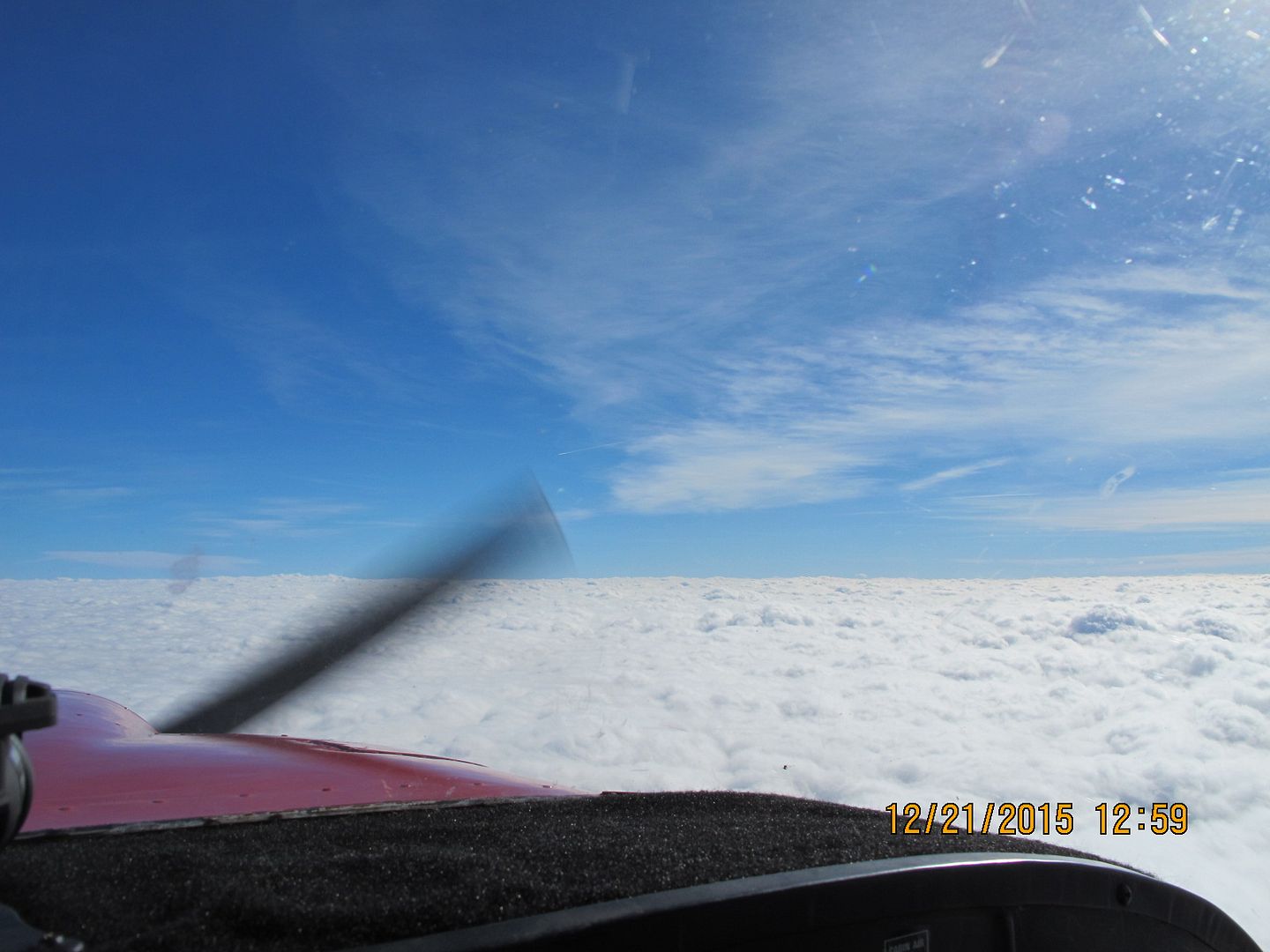
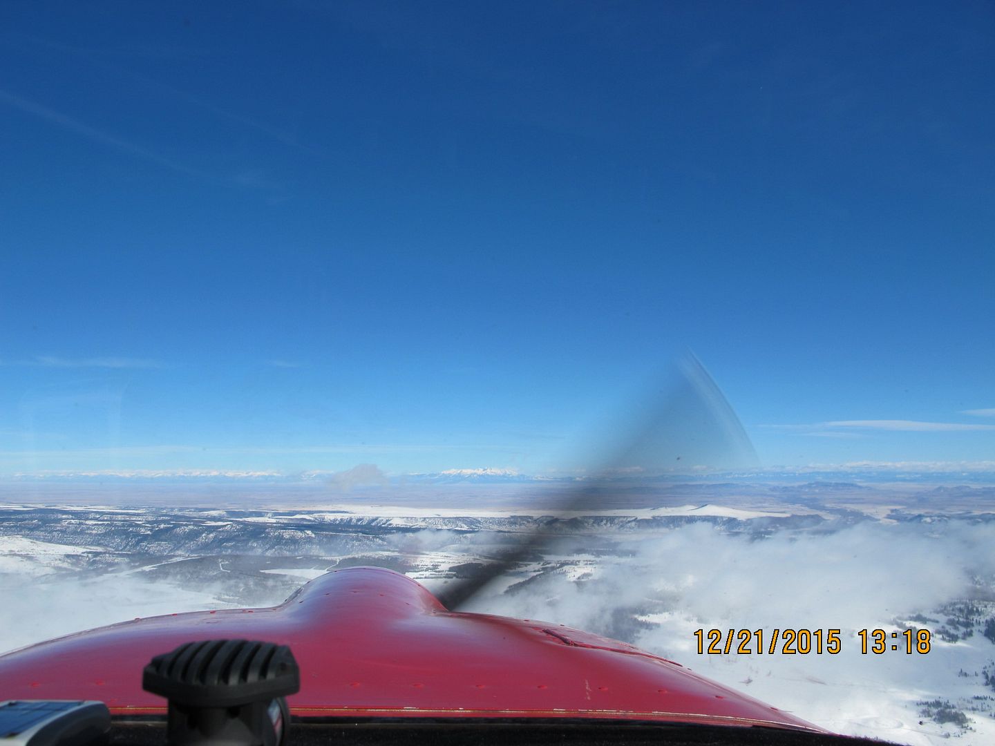
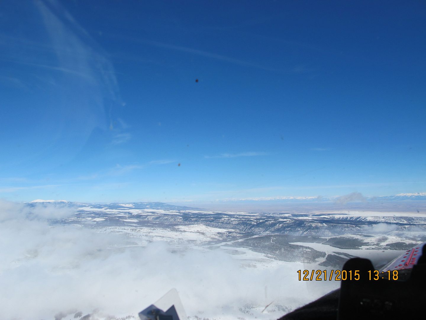
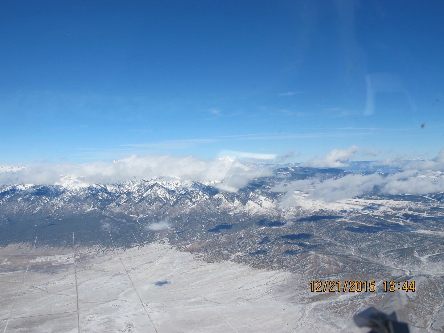
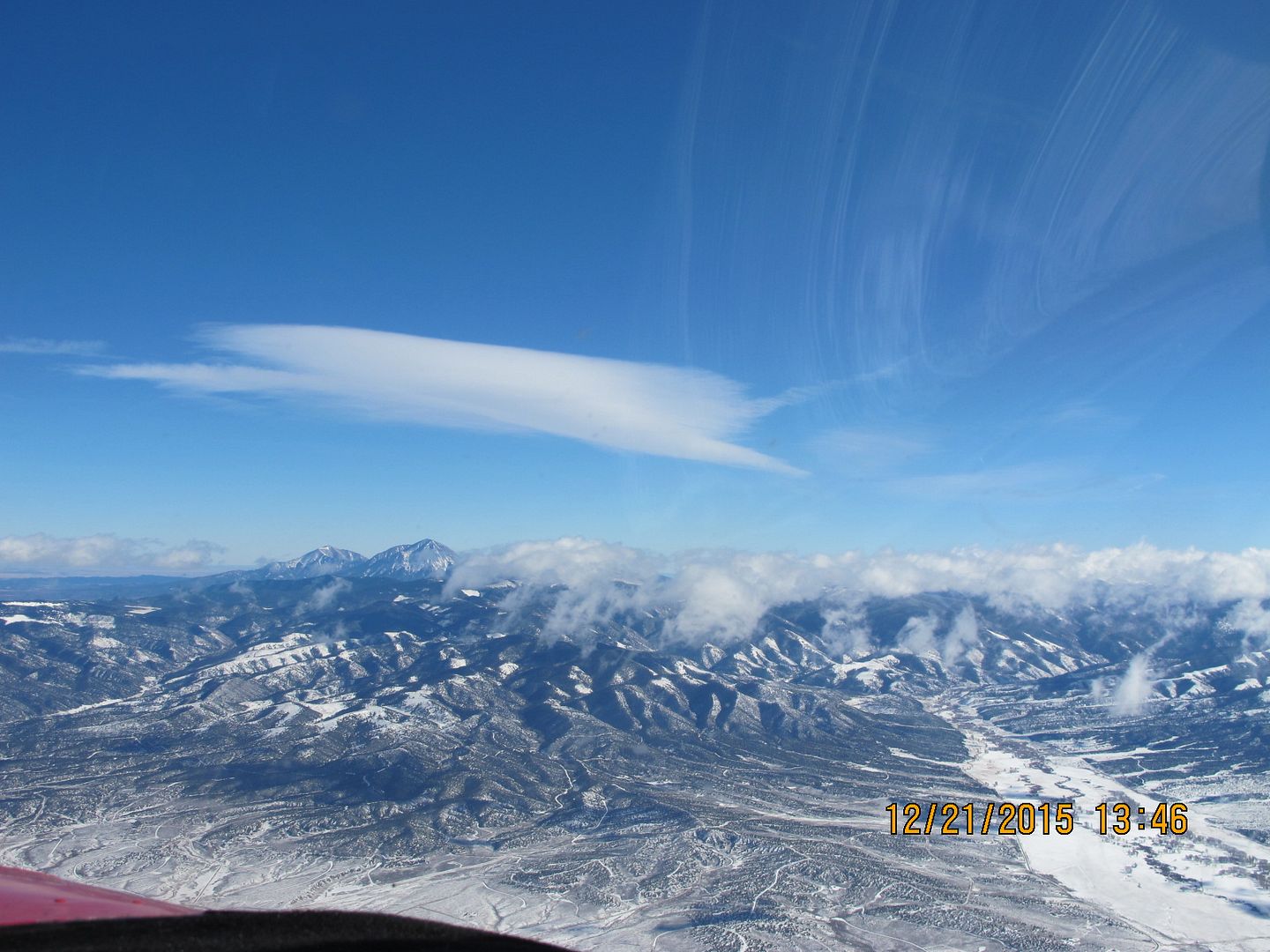
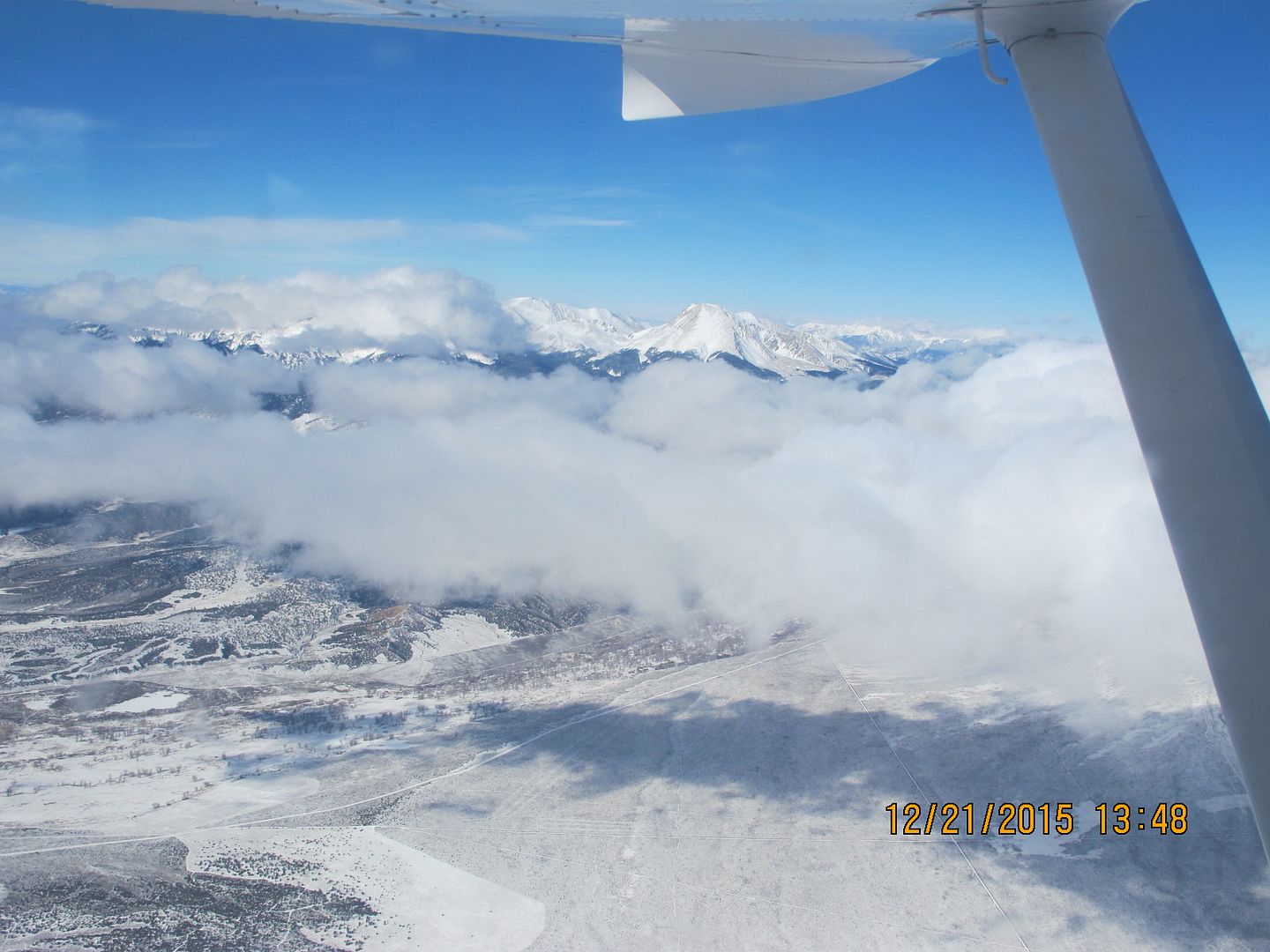
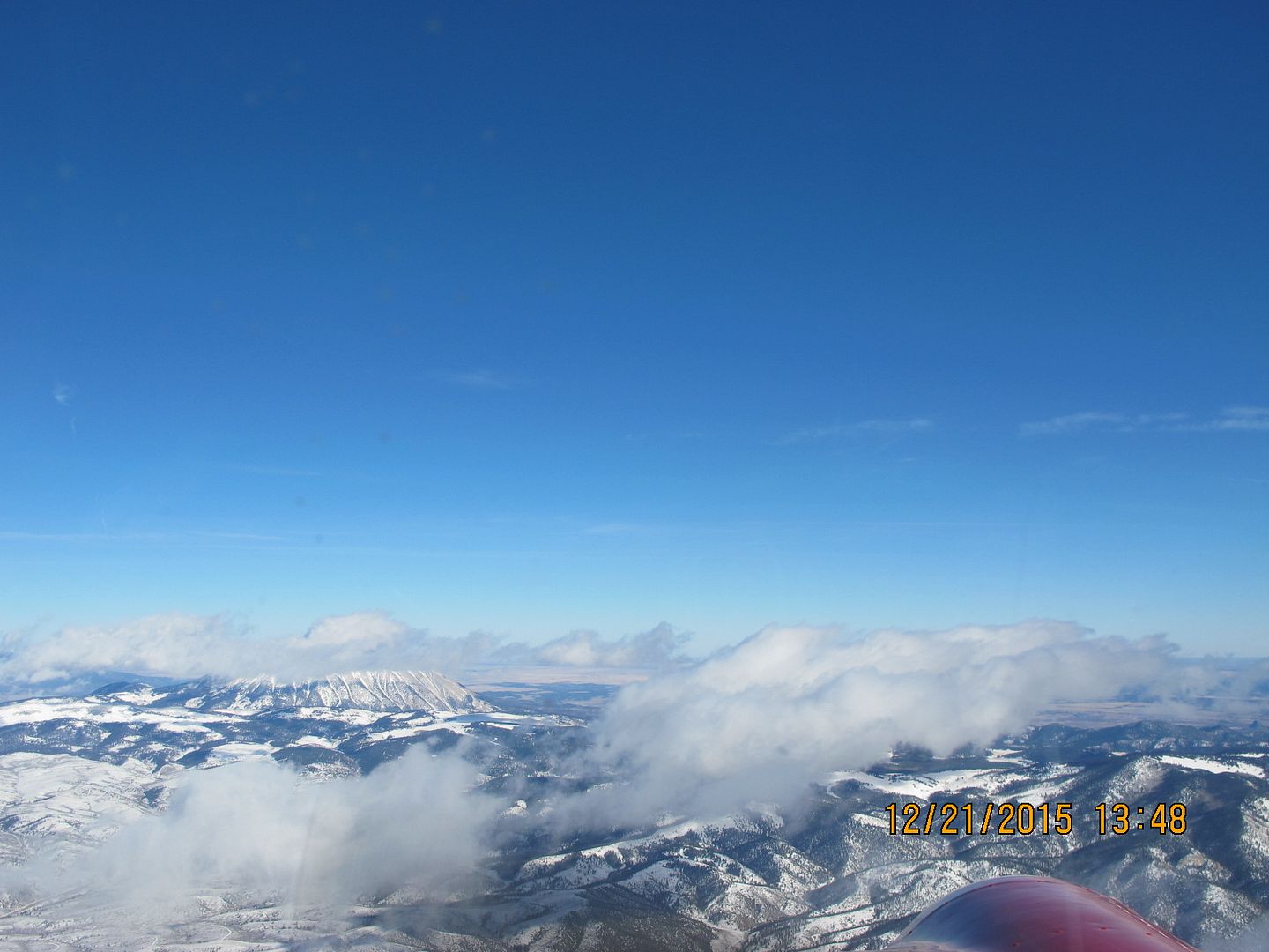
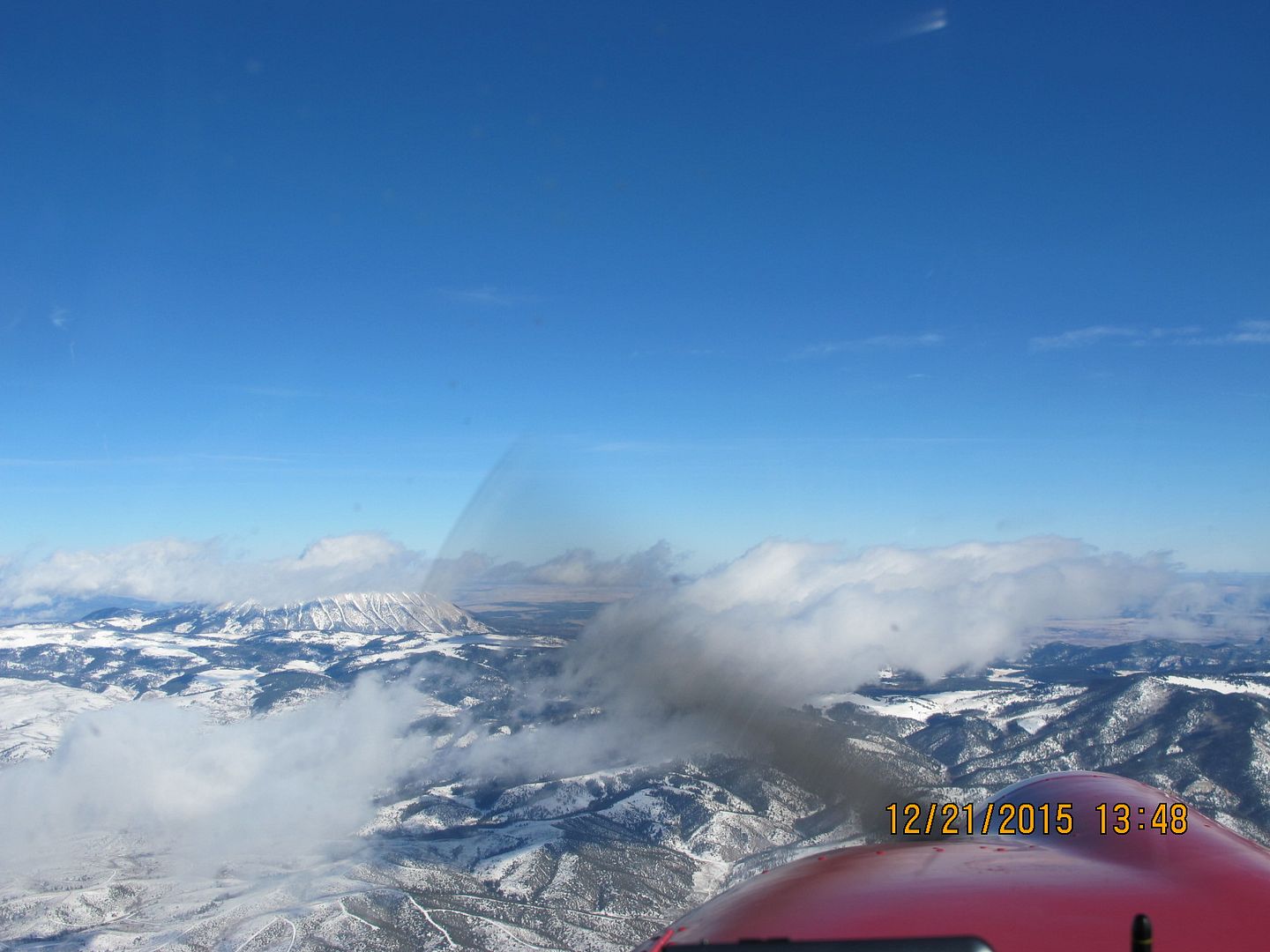
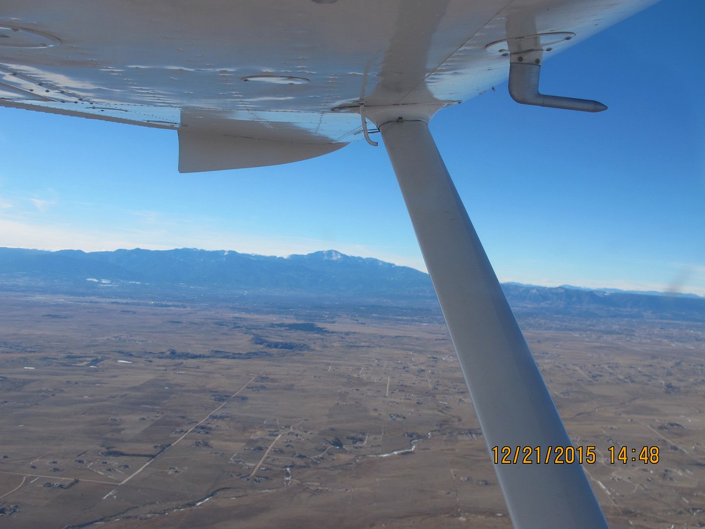
Anyhow, I wanted to share some of the views--it's truly beautiful from up there, although it was pretty cold outside, -6 to -8 F until after we descended north of Pueblo. Fortunately the heater works well and kept the interior in the low 60s, and both puppy dog and I were dressed for the cold. All in all, it was a really good trip.

Cary
Cary offline
User avatar
Posts: 3801
Joined: Sun Jan 10, 2010 6:49 pm
Location: Fort Collins, CO
"I have slipped the surly bonds of earth..., put out my hand and touched the face of God." J.G. Magee

Re: Where'd the mountains go?

Enjoyed the photos. Thanks for posting; they look cool.
blackrock offline
User avatar
Posts: 1576
Joined: Tue Jan 29, 2008 6:54 pm
Location: Elko, NV
FindMeSpot URL: http://share.findmespot.com/shared/face ... BFmtASxjeV
Aircraft: Bearhawk

Re: Where'd the mountains go?

This time last year, I was VFR Reno to Tucson. At 100 out I hit unforecast low clouds. Under looked marginally doable so went VFR on top for the next hour or so. Kept the lower terrain of the valleys pictured on the GPS and an evolving contingency plan in mind while on top. It was a nice smooth flight with beautiful views. I'd do the same again without hesitating provided there is enough fuel on board for alternate destinations.
blackrock offline
User avatar
Posts: 1576
Joined: Tue Jan 29, 2008 6:54 pm
Location: Elko, NV
FindMeSpot URL: http://share.findmespot.com/shared/face ... BFmtASxjeV
Aircraft: Bearhawk

Re: Where'd the mountains go?

"but with 4000' to glide in the clouds to roughly 9000' bases, then roughly 2000' from the bases to the ground until over the higher terrain, there's lots of time and visual room to make a plan".


Excellent. Having room after you break out makes VFR on top MUCH safer. Looked to me like the peaks were in the clouds, that is why I asked what the plan was. Sounds like you had an excellent plan.
G44 offline
Supporter
User avatar
Posts: 2093
Joined: Thu Oct 27, 2011 10:46 am
Location: Michigan

Re: Where'd the mountains go?

Guess im definitely more like gump for sure....scooting across the frank like i do, and i must add, after a person has balled up a certified plane or two, ill take a full flap 60kt speed into whatever also, long as i have control...i must admit, its kind of amazing what a pounding a 182 will take to save its people on board....sometimes here in good old idaho we r vfr on top....but with a plan....
jomac offline
User avatar
Posts: 720
Joined: Sun Aug 17, 2008 10:25 pm
Location: idaho falls, id
jomac

DISPLAY OPTIONS

Next
26 postsPage 1 of 21, 2

Who is online

Users browsing this forum: No registered users and 0 guests

Latest Features

Latest Knowledge Base