What are some good tools/techniques for predicting visibility due to smoke?
I've got a list of grass and gravel I want to fly to and camp on this summer in the North East. One aspect of Weather planning that I learned nothing about during flight training was smoke. I'm a VFR pilot flying a VFR equipped aircraft. We don't often get wildfire smoke here in New England but it sounds like it might be something we get used to this summer. Even farting around locally though smoky 4 mile visibility is.... uncomfortable.
I've read through Zane's excellent knowledge base article https://backcountrypilot.org/knowledge-base/pilots/187-hazards-of-wildfire-smoke#h8-resources but wondered if there were any improved forecasting tools available now (5 years later).
I've been watching https://firesmoke.ca/forecasts/current/ but the forecast is limited to 48 hours.
Thanks!
Hayden
Wildfire Season Flight Planning
Thu Jun 08, 2023 6:15 am
- SmokeyTheBear offline

- Posts: 136
- Joined: Fri Jul 10, 2020 6:55 am
- Location: Charlestown
- Aircraft: Cessna 170B
Thu Jun 08, 2023 10:12 am
Re: Wildfire Season Flight Planning
Getting more than 48 hours on reliable smoke conditions is nigh onto impossible. Slight changes in the wind can make a big difference in smoke density in a given area. That means you can have good conditions for getting where you're going, but make get stuck later by poor visibility due to smoke. Even worse would be getting stuck with a fire coming your way if the wind shifts. If fires are burning in an area I'd like to go, I just don't go there. As far as smoke from distant fires, I look at longer range wind projections. You can a good idea on probable wind strength and direction from a variety of sources 7 days in advance. Be aware that the wind direction often changes with altitude, so don't just check the surface wind predictions, be sure to look at wind strength and direction at various altitudes. If the fires are far away and the wind from the surface to over 9,000' is blowing toward the fires from where I want to be for the next week, I'll consider going. If the predictions are mixed, I make other plans. It looks like this is going to be a bad year for fires and smoke as we shift back into an el Nino weather pattern.
Thu Jun 08, 2023 1:24 pm
Re: Wildfire Season Flight Planning
Hayden, check products on the NOAA site.
This https://rapidrefresh.noaa.gov/hrrr/HRRRsmoke/ for example.
The HRRR is the High Resolution Rapid Refresh weather forecast model. It runs every hour (i.e., Rapid Refresh) and they have a version that forecasts smoke.
Select the "Vertically Integrated Smoke" row and click on the check mark for Loop.
I haven't really played with it so I can't comment on its use for flight planning.
IIRC NOAA also runs a site which analyses and predicts transport of volcanic ash, where one can choose different altitudes.
Might be useful for smoke, as well.
Wolf

Fri Jun 09, 2023 9:09 am
Re: Wildfire Season Flight Planning
140eagles wrote:This https://rapidrefresh.noaa.gov/hrrr/HRRRsmoke/
Wolf: Thanks for this. This website is really interesting and will take some time to figure out all it has to offer.
Tue Jun 13, 2023 10:05 am
Re: Wildfire Season Flight Planning
I find smoke is like snow, unpredictable. VFR limits are 3 miles in controlled airspace, 1 mile in uncontrolled. That's not much if you don't have your ducks lined up, don't have a panel, don't have IFR flying experience.
Was flying through Oregon enroute California in my Pitts, no compass, before gps, in smoke, at 10k, following I5. Near Medford I was losing ground reference and dropped down to regain it. Ended up between the freeway lanes at 200' with about 1/2 mile viz. Called Medford tower to let them know I was going to be low-level through their zone. They said "were you going?", I said "I'm following I5, I'm out of gas, going to Ashland", to which they replied "Ashland is 1/8 obscured in smoke, tell us a landmark you see along I5". "I see a large apartment building on a low hill on the left side". "Dang, boy, you're already a couple miles south of the airport, do a 180 and come north, report a large intersection with a Denny's on the right". I called the intersection and he said "standby a few seconds, on my call turn right 90 degrees to the freeway, you'll cross two runways, you're cleared to land on any of them". Relief gave way to impatience and a couple hours later, with a full tank of gas, I called them for a special to get out. "Cleared takeoff, turn south along the freeway, good luck" - those controllers had hearts of gold.
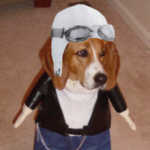
Here's a pic of "Smokey the Bear" twerking on our fire base (no offence to the OP)

Was flying through Oregon enroute California in my Pitts, no compass, before gps, in smoke, at 10k, following I5. Near Medford I was losing ground reference and dropped down to regain it. Ended up between the freeway lanes at 200' with about 1/2 mile viz. Called Medford tower to let them know I was going to be low-level through their zone. They said "were you going?", I said "I'm following I5, I'm out of gas, going to Ashland", to which they replied "Ashland is 1/8 obscured in smoke, tell us a landmark you see along I5". "I see a large apartment building on a low hill on the left side". "Dang, boy, you're already a couple miles south of the airport, do a 180 and come north, report a large intersection with a Denny's on the right". I called the intersection and he said "standby a few seconds, on my call turn right 90 degrees to the freeway, you'll cross two runways, you're cleared to land on any of them". Relief gave way to impatience and a couple hours later, with a full tank of gas, I called them for a special to get out. "Cleared takeoff, turn south along the freeway, good luck" - those controllers had hearts of gold.
Here's a pic of "Smokey the Bear" twerking on our fire base (no offence to the OP)
Last edited by Karmutzen on Tue Jun 13, 2023 5:08 pm, edited 1 time in total.
'74 7GCBC, 26" ABW, Aera 660 feeding G5 and FC-10 FF.
Tue Jun 13, 2023 12:56 pm
Re: Wildfire Season Flight Planning
Karmutzen wrote:"I see a large apartment building on a low hill on the left side"
Rogue Valley Manor I'm betting! Haha. The old folks' home next to the freeway.
- Zzz offline


- Posts: 2854
- Joined: Fri Oct 08, 2004 11:09 pm
- Location: northern
- Aircraft: Swiveling desk chair
Half a century spent proving “it is better to be thought a fool than to open your mouth and remove all doubt.”
DISPLAY OPTIONS
Who is online
Users browsing this forum: No registered users and 0 guests
Latest Features
-
Live to Tell
A Minnesota pilot is surprised to learn that the sudden asymmetric drag of an out-of-rig ski can…Read More -
Creators
Working in some of the Yukon's most beautiful and remote environments, photographer Simon Blakesley captures aircraft in…Read More -
Aircraft Ownership and Maintenance
Upgrading to big tires can make a huge difference in backcountry performance, but with those gains come…Read More -
Tales from Yesteryear
In this tale from bush flying yesteryear, Don Cogger signs up to help Atlee Dodge Jr recovery…Read More


Latest Knowledge Base
-
Destinations
A regional guide with ideas for winter camping destinations in California, Nevada, New Mexico, and Arizona.Read More -
Aircraft
Finding an affordable aircraft that can handle the backcountry for $80K or less? A challenge for sure, but with the…Read More -
Aircraft
01.29.2018 - Zane - Updated tire diameter graphic to add 8.50x10 Guide to tires for use in the backcountry and off-airport landing…Read More -
Pilots
12.22.2013 - Initial article format Operating aircraft on skis and negotiating a snow-covered landscape is an entirely unique skillset and environment.…Read More


