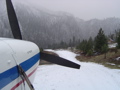
Not that it matters, it was not the CAP or the helicopter that located the wreck. It was one of the two aircraft that the division of Aeronautics had launched out of McCall. Each had a search assignment location provided by Ray Glidden - Flight Operations Director. Ray was right on on one of the locations. John Seaver was flying his 180 and his son the observer, spotted the survivor first and the wreckage near by. The CAP arrived shortly afterwards. The helicopter departed Johnson Creek and followed Johns instructions. He was however unable to land due to the terrain. Life Flight was called and made it in with their helicopter. I was flying the other aircraft searching the Indian Creek area. I arrived the same time the first helicopter arrived. John was at bingo fuel so I took over until Life Flight showed up with the CAP flying high cap.
IdahoSupercub
Aircraft Missing Johnson Creek
Tue Jun 19, 2007 4:27 pm
- Idaho SuperCub offline
- Posts: 141
- Joined: Sun Nov 19, 2006 3:46 pm
- Location: McCall, Idaho
Tue Jun 19, 2007 5:13 pm
- Idaho SuperCub offline
- Posts: 141
- Joined: Sun Nov 19, 2006 3:46 pm
- Location: McCall, Idaho
Wed Jun 20, 2007 8:48 am
I was very saddened to hear about Berks crash. I've been thinking a lot about it, I guess because it's right in the heart of where I work and play. My condolences to his friends and family. He will be missed.
I also wanted to thank everyone who helped look, at their own personal expense and risk. Aviators are a unique group, in that they always seem to go out of their way to help one another.
I think Berk left us two very important lessons that we should all abide by when flying the backcountry.
1. Always tell someone where you're going and when you'll be back. We do this at work, and I know that if I haven't checked in within 30 minutes of my stated arrival time, the searching begins. That's a comforting feeling, really. This is big country, and obviously, there's many places to hide a small plane. So give someone a route and a time. I bet I flew over the head of Quartz Creek 3 or 4 times between Thursday and Sunday, but never thought to be looking for an airplane.
2. If you're flying below ridge top, you must MUST know where you are, absolutely. If there is any doubt, you should find a wide point in the canyon and circle up. Yellow Pine is a perfect place to do that. Climb up higher, get a better perspective and a better safety cushion. You just can't "think" you're in the right spot, it's just too unforgiving.
So, let's all make the rest of the summer a safe one.
John
- LowAndSlow offline
- Posts: 161
- Joined: Wed Feb 15, 2006 9:27 am
- Location: Medford, OR
Wed Jun 20, 2007 11:46 am
John,
In consideration of your sign in log, I wanted to remind everyone that there is a phone at JC, so it is a unique base in the "backcountry" in that you can file an FAA flight plan. Haven't been out there camping recently - is the phone still there, working?
I know that I used to rethink filing a flight plan after forgetting to close it a couple times and getting "the call" from the FSS and hearing the scolding. Now, as soon as I file, I put my watch on my right wrist. Can't help but notice something is different as I put the plane away and remember to close the flight plan. If camping in the backcountry, I will at least give a flight plan with a RON time frame so at least I'll be expected within a day. When I cannot get out on time because of weather, the airlines have been extremely helpful in relaying a message to flight service to extend my time. The wife, however, has approved a sat phone after being buried in overnight on skis this winter so shouldn't have to trouble them any more. (depending on where you are and a canyon's alignment, you may be shielded from any jet airways, so doesn't always work). If simply running behind and out of range of an FSS radio, you can often reach someone else in the air who IS in the vicinity of a FSS remote and have them relay for you. However much trouble this may seem, it is miniscule compared to the difficulty of organizing a search when you don't know where to start. I have been on searches where the area was "somewhere between Reno and anywhere in the backcountry". Having a flight plan at least gives searchers a potential chance. I suspect the only reason Suzanne was located is because they were close to their known starting point.
Another annoyance for me in filing a flight plan is when I am simply going up to fly around and don't have a solid plan. Obviously the FSS briefers don't like this because they need something concrete to put in those empty spaces on the form. So I will give my best guess and then let them know that "Just for the tape record" I am also considering going here and there and there. Or if I'm going to Lewiston from Boise I'll say that my route will likely be over Council and up Hell's Canyon, but if weathered in that directtion, backup route will be New Meadows, Little Salmon Drainage and then North. The point here is that your conversation is recorded and if there is later a search, you have given a lot more information than can be put on a simple flight plan form.
Sorry to preach, but I know that I was previously an intermittent user of the FAA flight plan, but would USUALLY tell someone. The fact is that you ALWAYS need to give information on your planned whereabouts and the FAA is more user friendly than you might think.
Now I need to listen to good advice and get a PLB and that sat phone to put in a comfy vest.
Matt
Zane, know this was a bit off topic, feel free to move it.
Last edited by Matt 7GCBC on Wed Jun 20, 2007 11:50 am, edited 1 time in total.
- Matt 7GCBC offline
- Posts: 330
- Joined: Fri Feb 11, 2005 11:12 pm
- Location: Northwest
- FindMeSpot URL: http://share.findmespot.com/shared/face ... vXLMMuZOv7
DISPLAY OPTIONS
Who is online
Users browsing this forum: No registered users and 1 guest
Latest Features
-
Live to Tell
A Minnesota pilot is surprised to learn that the sudden asymmetric drag of an out-of-rig ski can…Read More -
Creators
Working in some of the Yukon's most beautiful and remote environments, photographer Simon Blakesley captures aircraft in…Read More -
Aircraft Ownership and Maintenance
Upgrading to big tires can make a huge difference in backcountry performance, but with those gains come…Read More -
Tales from Yesteryear
In this tale from bush flying yesteryear, Don Cogger signs up to help Atlee Dodge Jr recovery…Read More


Latest Knowledge Base
-
Destinations
A regional guide with ideas for winter camping destinations in California, Nevada, New Mexico, and Arizona.Read More -
Aircraft
Finding an affordable aircraft that can handle the backcountry for $80K or less? A challenge for sure, but with the…Read More -
Aircraft
01.29.2018 - Zane - Updated tire diameter graphic to add 8.50x10 Guide to tires for use in the backcountry and off-airport landing…Read More -
Pilots
12.22.2013 - Initial article format Operating aircraft on skis and negotiating a snow-covered landscape is an entirely unique skillset and environment.…Read More


