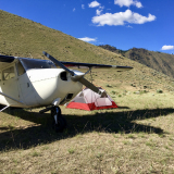
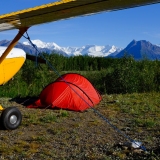
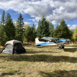
Favorite Idaho Backcountry Hikes?
Not necessarily information about airstrips or airports, but more general info about a greater area or a route of flight.
twflyer wrote:IncipientSpin wrote:Finally going to hike into Falconberry Lake next weekend! I'll post some pics when I get back, with a trout report as well.
Where will you start for the Falconberry Lake hike?
Joe
Had some stuff come up unfortunately and wasn't able to get out that way. My plan was to drive to the end of the road near Sleeping Deer Mountain trail head, and follow the ridge line in to the lake heading west. looks to be roughly 5-6 miles or so barring any detours each way.
-
IncipientSpin offline
-
Posts:
120
- Joined: Mon Feb 23, 2015 5:47 pm
- Location: Boise, ID
-
Tue Jan 30, 2024 12:17 pm
Thread revival!
Has anyone found a one-stop shop for hiking trails from backcountry strips?
Trails.idaho.gov is a good site, but it's really hard to orient hikes to strips. Glad to find this thread and hopefully some new info has come to light since this was last discussed.
-
EvilEagle offline


-
Posts:
5
- Joined: Tue Jan 30, 2024 12:13 pm
- Location: Meridian
- Aircraft: PA-18, BE-36
-
Glad somebody revived this thread! Now we're talkin'! I was just about to mention Margaret Fuller's book "Trails of the Frank Church-River of No Return Wilderness" but then I looked back through the thread and sure enough: I linked to it back in 2014!

Anyway, it's been updated since.
Here it is on Amazon.
-
Oregon180 offline

-
Posts:
1259
- Joined: Tue Jun 19, 2007 10:37 am
- Location: Ashland
- Aircraft: C180B
-
Here is another great resource:
https://idahotrailsassociation.orgMW
Zane if I did it wrong can you fix? LOL
Last edited by
Zzz on Tue Jan 30, 2024 9:27 pm, edited 1 time in total.
Reason: Corrected bbcode
-
185Midwest offline
-
Posts:
437
- Joined: Sun Sep 30, 2018 11:58 am
- Location: Fort Wayne
- Aircraft: C-185
-
EvilEagle wrote:Thread revival!
Has anyone found a one-stop shop for hiking trails from backcountry strips?
Trails.idaho.gov is a good site, but it's really hard to orient hikes to strips. Glad to find this thread and hopefully some new info has come to light since this was last discussed.
I’ve had good success with the AllTrails app.
-
StuBob offline
-
Posts:
293
- Joined: Wed Jul 29, 2015 7:52 am
- Location: Indianapolis
- Aircraft: Cessna 185 Skywagon
-
Soldier Bar to Dave Lewis Peak affords the best views in the Big Creek drainage. An old CCC trail is present and in decent condition for not being maintained for perhaps 70 or 80 years. Geology buffs might appreciate the transition of orogenies in the mineral belt on the way up in the same way a person might appreciate the day trip in the Grand Canyon from rim to rim. It is exceptionally snake-y up to about 5k',however.
Waterfall Creek also accesses Dave Lewis, but also Rush Creek Lookout. That one would be a nice trip with kiddos, I think. Plus all the whitefish you have time to harvest.
Cold Meadows offers several multi day trips. The hike down to cabin Creek is a good one if you can get dropped off.
The traverse from soldier bar to Mt McGuire in the Yellow Jackets takes in some of the more amazing areas the region has to offer. I've done it without having to tap into much carried food more or less with the help of a fly rod.
The high lakes are mostly full of food.
The hike to Stanley hot springs from Fish Lake has been a fave for more than a few decades for me to spend the night near, with a good trail after June even for a night hike.
The Big Creek trail still has a lot to offer for archaeological buffs, although many important sites have been lost in the floods following the fire. There are a ton of teepee rings and shelters all over the place. People liked it there for quite a while.
Monumental still has gold in a few areas if you like poking around for that. You won't get rich. But you will easily find gold dust.
-
lesuther offline
-
Posts:
1429
- Joined: Fri Sep 24, 2010 1:26 pm
- Location: CO
-
DISPLAY OPTIONS
Who is online
Users browsing this forum: No registered users and 0 guests


