Does anyone have any information on an old strip called Fish Creek Airstrip in Oregon? It's located SE of Estacada, perched above the Clackamas river.
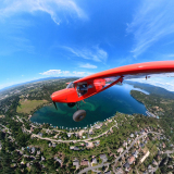
Sat Image
I'm assuming it's a closed Forest Service strip.
Forgotten Airstrips: Fish Creek, Oregon
Mon Jul 21, 2008 3:59 pm
- chrisg offline
- Airstrip Database Manager
- Posts: 220
- Joined: Tue Jan 01, 2008 9:04 pm
- Location: Coeur d'Alene, Idaho
Chris
http://www.shortfield.com - Backcountry Airstrip Database
https://discord.gg/HNHKeDE - Groundfall - Bush Flying Video Game
http://www.shortfield.com - Backcountry Airstrip Database
https://discord.gg/HNHKeDE - Groundfall - Bush Flying Video Game
Mon Jul 21, 2008 4:18 pm
Here's a centered link: http://maps.google.com/maps?f=q&hl=en&geocode=&q=N+45.1667+W+122.1667&ie=UTF8&ll=45.149767,-122.147455&spn=0.018916,0.029955&t=h&z=15
No idea on the status, but it shows on the Oregeon Gazetter.
No idea on the status, but it shows on the Oregeon Gazetter.
- Zzz offline


- Posts: 2854
- Joined: Fri Oct 08, 2004 11:09 pm
- Location: northern
- Aircraft: Swiveling desk chair
Half a century spent proving “it is better to be thought a fool than to open your mouth and remove all doubt.”
Mon Jul 21, 2008 5:00 pm
Yeah, I saw it in the Gazateer on the drive home from camping last weekend and started to drive up there to check it out. I got within a quarter mile and then heard a long series of rapid fire gunshots just around the next corner. I decided I probably shouldn't drag my wife and infant into target practice.
- chrisg offline
- Airstrip Database Manager
- Posts: 220
- Joined: Tue Jan 01, 2008 9:04 pm
- Location: Coeur d'Alene, Idaho
Chris
http://www.shortfield.com - Backcountry Airstrip Database
https://discord.gg/HNHKeDE - Groundfall - Bush Flying Video Game
http://www.shortfield.com - Backcountry Airstrip Database
https://discord.gg/HNHKeDE - Groundfall - Bush Flying Video Game
Mon Jul 21, 2008 6:23 pm
Re: Forgotten Airstips: Oregon
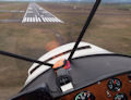
chrisg wrote:Does anyone have any information on an old strip called Fish Creek Airstrip in Oregon? It's located SE of Estacada, perched above the Clackamas river.
Sat Image
I'm assuming it's a closed Forest Service strip.
I just emailed my neighbor Bryan who has been backcountry flying many years in Super Cub and C180. He lived here in the Portland area most of that time, although he is in Idaho right now. I remembered that he told me about it several years ago. He says:
It hasn't been used in about 15 yrs. In the few years I had my plane down, no one used it and it got over grown. We need to organize a work party and drive up there and cut down the trees and brush. Last time I flew over it there was an abandoned car or two in the middle of the runway. The trees are getting pretty tall. It will be quite job to clear it. Rumor has it that the forest service owns the property and didn't mind if it was cleared. Although I would want to check that out before going up there. We used to just keep the new growth trees cut as they grew in and nobody cared. It's a shame, it was a fun practice strip.
- airprakken offline
- Posts: 28
- Joined: Sat Apr 05, 2008 12:00 pm
- Location: Oregon @ OR41
Randy
TU206 with semi-big tires and VG's
TU206 with semi-big tires and VG's
Tue Jul 22, 2008 10:20 am
Do not tell anyone but I grew up in Estacada. There was also an air strip just above Promontory boat launch (Or North Fork Reservoir). We called it D Flats when I was in High School. We used to go up there with our 4x4’s and play in the mud. At that time the strip had big dirt mounds every couple hundred feet. I have no idea when the last time the strip was used.
Now that I am a pilot I have flown over it several times and wished it was still in use. If you go to Google Earth the lat and long are 45 13` 52.54N 122 14` 12.02W. I am not sure how to input the link so you can find it. You can see where the strip was and how much it has grown over. I think I have some great pictures of the strip from the late 80’s. I will have to look.
Now that I am a pilot I have flown over it several times and wished it was still in use. If you go to Google Earth the lat and long are 45 13` 52.54N 122 14` 12.02W. I am not sure how to input the link so you can find it. You can see where the strip was and how much it has grown over. I think I have some great pictures of the strip from the late 80’s. I will have to look.
God forbid we should ever be twenty years without a rebellion. ***Thomas Jefferson***
"The tree of liberty must be refreshed from time to time with the blood of patriots and tyrants." **Thomas Jefferson**
"The tree of liberty must be refreshed from time to time with the blood of patriots and tyrants." **Thomas Jefferson**
Tue Jul 22, 2008 10:32 am
Wayne, did you Estacada folks ever refer to "going upriver?" I was there a few weeks ago to go camping at Hideaway Lake, and the lady at the grocery store asked if I was going upriver. I said yes, but thought "why? what's upriver?" which of course brings to mind scenes from Deliverance and Apocalypse Now.
You can link to satellite images of a particular coordinate pair by plugging them in Google Maps. This is not Google Earth, it is the web-based program found at http://maps.google.com.
Just paste in your coordinates and remove any punctuation that normally denotes degress, minutes, and seconds, so it looks like:
Remember that West is a negative value, unless you prefix each coordinate with "N" or "W".
To copy the map link into the forum, copy the URL from the "Link to this page" link on the right hand side of the page.
http://maps.google.com/maps?f=q&hl=en&g ... iwloc=addr
You can link to satellite images of a particular coordinate pair by plugging them in Google Maps. This is not Google Earth, it is the web-based program found at http://maps.google.com.
Just paste in your coordinates and remove any punctuation that normally denotes degress, minutes, and seconds, so it looks like:
- Code: Select all
45 13 52.68, -122 14 12.12
Remember that West is a negative value, unless you prefix each coordinate with "N" or "W".
To copy the map link into the forum, copy the URL from the "Link to this page" link on the right hand side of the page.
http://maps.google.com/maps?f=q&hl=en&g ... iwloc=addr
- Zzz offline
- Posts: 2854
- Joined: Fri Oct 08, 2004 11:09 pm
- Location: northern
- Aircraft: Swiveling desk chair
Half a century spent proving “it is better to be thought a fool than to open your mouth and remove all doubt.”
Tue Jul 22, 2008 11:18 am
I have a similar story about Fish Creek Airstrip. I was up there camping last summer, and like you, saw it posted on a map. So I made it my Sunday morning quest to find it and check it out. I found it without too much trouble, but there was evidence of people driving to it when it was winter/spring cause the ruts in the dirt were very bad. It is over grown so much that if you just happened upon it, you might not now it was an airstrip other than being strait, long and flat. It opened up when you got toward the end and what I saw made me furious.  It looked like it had been used as a logging landing, and when they were done it turned into a garbage dump. There were 5 or 6 tents set up, but no one was up at 10 am, so they must have still been sleeping off the party they had the night before. I say that because there is no other reason to camp in such a filthy place unless you want to create a mess and not clean it up. Beer cans, vodka bottles, fast food bags and wrappers, old tires and 55 gal drums. Shot up milk containers and broken glass, bags of garbage with diapers and cigarette butts. All of this and I never even got out of my truck. It made my stomach turn as the anger built up inside, and I decided I had better leave before I had a confrontation with the campers and got really mad. On the drive back I thought, "no wonder they want to lock up the forest and not let anyone in".
  I know, what a terrible thought to have in my own head. No I do NOT think that is the answer, but I don't have any solutions either.
Zane we need a ruling, is this an official Hijacking? Anyway, to help satisfy your curiosity Chris, yes it could be fixed up and used. There is a lot of clean up, and the trees need to be cut. I am not a Airport builder, but I would guess you would have to use cat to flatten out the ruts and take out the tree trunks. I don't think anything like a grader could make it up the road. But maybe once you got it cleaned off, it would not look that bad. We could always hope.
Erick
- Dokmow offline

- Posts: 246
- Joined: Wed Oct 18, 2006 1:17 pm
- Location: Eugene, Oregon
- FindMeSpot URL: http://share.findmespot.com/shared/face ... 738geaMOD6
Rans S7S
Tue Jul 22, 2008 12:30 pm
It would be nice to reclaim this strip, if possible. Sounds like a big job, part of which would be keeping the yahoos from undoing a lot of hard work. I'd put some labor into the project.
Permission from the forest service might be difficult. Having their blessing would be great but, probably would be more successful to just do it.
Anyone have access to heavy equipment? If not, renting a bobcat or something like that might be worthwhile.
Permission from the forest service might be difficult. Having their blessing would be great but, probably would be more successful to just do it.
Anyone have access to heavy equipment? If not, renting a bobcat or something like that might be worthwhile.
- GroundLooper offline

- Posts: 1168
- Joined: Wed Jun 13, 2007 6:52 pm
- Location: Vancouver, WA
BCP Poser.
Life is good. Life is better with wings.
Life is good. Life is better with wings.
Tue Jul 22, 2008 12:53 pm
I guess a guy would have to weigh the risk vs reward for reclaiming the strip. If you put in hours of work to clear the strip only to have X number of rednecks return the following weekend to dump more garbage and spin more donuts in the mud, why bother? It sounds like zero enforcement of the land use is in effect.
On the other hand, you could make a big effort to clear it, then drag whatever timber you cut off the strip into a giant pile blocking the access road. Make it something that would take literally hours to clear. You know the Forest Service would love that, but at the same time they may look the other way.
On the other hand, you could make a big effort to clear it, then drag whatever timber you cut off the strip into a giant pile blocking the access road. Make it something that would take literally hours to clear. You know the Forest Service would love that, but at the same time they may look the other way.
- Zzz offline
- Posts: 2854
- Joined: Fri Oct 08, 2004 11:09 pm
- Location: northern
- Aircraft: Swiveling desk chair
Half a century spent proving “it is better to be thought a fool than to open your mouth and remove all doubt.”
Tue Jul 22, 2008 1:33 pm
I love the idea of reclaiming it, but I agree with Zane on the risk versus reward. Another question is: would this strip have value beyond a practice strip (i.e. would a person want to visit or camp there)?
I put a call in with the FS yesterday to get more information on the strip, but haven't heard back. Beyond the strip, I think the first question for the FS is: what the hell is going on up there with all yahoos abandoning cars, shooting guns, and trashing the land?
I put a call in with the FS yesterday to get more information on the strip, but haven't heard back. Beyond the strip, I think the first question for the FS is: what the hell is going on up there with all yahoos abandoning cars, shooting guns, and trashing the land?
- chrisg offline
- Airstrip Database Manager
- Posts: 220
- Joined: Tue Jan 01, 2008 9:04 pm
- Location: Coeur d'Alene, Idaho
Chris
http://www.shortfield.com - Backcountry Airstrip Database
https://discord.gg/HNHKeDE - Groundfall - Bush Flying Video Game
http://www.shortfield.com - Backcountry Airstrip Database
https://discord.gg/HNHKeDE - Groundfall - Bush Flying Video Game
Tue Jul 22, 2008 1:59 pm
Unfortunately that area of the Clackamas River drainage has one of the highest crime rates in the entire state. It is notorious for meth users and crimes against hikers and recreationalists at the nearby hot springs, particularly car break-ins and the occasional assault. It's pretty ridiculous... bring your guns.
Pete
Pete
- Neighbor Pete offline
- Posts: 54
- Joined: Tue Jul 22, 2008 1:41 pm
- Location: Columbia River Gorge
Tue Jul 22, 2008 2:04 pm
Neighbor Pete wrote:Unfortunately that area of the Clackamas River drainage has one of the highest crime rates in the entire state. It is notorious for meth users and crimes against hikers and recreationalists at the nearby hot springs, particularly car break-ins and the occasional assault.
Yikes! Sounds like we either need to carpet bomb the entire drainage or find another airstrip reclamation project.
- chrisg offline
- Airstrip Database Manager
- Posts: 220
- Joined: Tue Jan 01, 2008 9:04 pm
- Location: Coeur d'Alene, Idaho
Chris
http://www.shortfield.com - Backcountry Airstrip Database
https://discord.gg/HNHKeDE - Groundfall - Bush Flying Video Game
http://www.shortfield.com - Backcountry Airstrip Database
https://discord.gg/HNHKeDE - Groundfall - Bush Flying Video Game
Tue Jul 22, 2008 2:23 pm
I say carpet bomb and reclaim!
Seriously though, I just wanted to let ya'll know that it is a fairly questionable area and some additional research into that might be best before spending too much effort on clearing the strip. The Forest Service and Clackamas Sheriffs office could certainly shed more light on the matter, but I've been paying attention to it for years and there is a long history of frequent problems in that neck of the woods. Wish it weren't so....
Pete
- Neighbor Pete offline
- Posts: 54
- Joined: Tue Jul 22, 2008 1:41 pm
- Location: Columbia River Gorge
Tue Jul 22, 2008 3:49 pm
The Fish Creek drainage has been closed to cars and pickups for approximately 10 years. I know the FS RD 54 is closed right where the FS RD 5420 Y’s off. I assume the FS RD 5420 is open. It appears there is a nice spur road off of the FS RD 5410 road that goes right to the strip. There was a slide that took out a large portion of the 54 road, I think it was 1996 or 1997, and the FS did not want to spend the money to fix it.
My dad and I ride our four wheelers up the 54 RD and do some fishing in some high lakes. We ALWAYS take our guns with us.
I would be willing to take a trip up there if anybody is interested. Or I can have my dad drive up there and get us some nice photographs to post on the site.
If anybody is interested in a work party to re-claim the strip count me in. It’s kind of cool for me. My Grandfather helped build most of the roads in the Fish Creek drainage. Who knows he may helped build the air strip. That area is a little sentimental to me.
God forbid we should ever be twenty years without a rebellion. ***Thomas Jefferson***
"The tree of liberty must be refreshed from time to time with the blood of patriots and tyrants." **Thomas Jefferson**
"The tree of liberty must be refreshed from time to time with the blood of patriots and tyrants." **Thomas Jefferson**
Fri Aug 08, 2008 10:56 am
I just spoke to Lenny at the Estacada Ranger District. He didn't know anything about the the Fish Creek airstrip and had to go look at map to see where it was at. He has been there 30 years...never heard of anyone landing up there. He gave me the name/number of another ranger who suggested I talk to the FAA (yeah, I'm sure that will be a fruitful exchange).
I can keep on them in hopes that they'd let us clean it up, but the question still remains: is it worth being cleaned up or is there a better candidate?
We should probably check-in with some of the other state/national organizations that may already be trying to re-open and old strip (e.g. Oregon Aviation Association, Recreational Aviation Foundation, etc.).
Thoughts?
- chrisg offline
- Airstrip Database Manager
- Posts: 220
- Joined: Tue Jan 01, 2008 9:04 pm
- Location: Coeur d'Alene, Idaho
Chris
http://www.shortfield.com - Backcountry Airstrip Database
https://discord.gg/HNHKeDE - Groundfall - Bush Flying Video Game
http://www.shortfield.com - Backcountry Airstrip Database
https://discord.gg/HNHKeDE - Groundfall - Bush Flying Video Game
Fri Aug 08, 2008 1:09 pm
I think the strip is in a nice location, topographically speaking. Demographically, it may be problem. I'm always concerned about easily accessible airstrips that are not tended. How do you keep ORVs from tearing it up... or people dumping there like they have been for so many years? Not only would it take an effort to fix it up, but it would have to be regularly maintained as well.
Although it's overgrown and trashed, I think it would be worth the effort. As I remember it, a piece of equipment would be required. A small dozer would be perfect, but a tractor with a loader and blade would do the job too.
I'd be willing to help in any way I can. Unfortunately, that isn't saying much since all the equipment I have access to at the moment is a small selection of shovels. I AM a bang-up Bobcat driver though!
If Fish Creek turns out to be a lost cause, maybe Chukar Flats might be worth some effort? I've never been there, but I had heard that it was in poor shape. I think this is it... Chukar Flats. If it's not it sure looks like a nice location.

I am the text I create.
Fri Aug 08, 2008 2:34 pm
JRStripe wrote:If Fish Creek turns out to be a lost cause, maybe Chukar Flats might be worth some effort? I've never been there, but I had heard that it was in poor shape. I think this is it... Chukar Flats. If it's not it sure looks like a nice location.
A guy that flys out of Corvallis, and has a plane a few doors down from me, flies to Chukar Flats with his buddies now and then. They all fly tail draggers, but his doesn't have monster tires. I've been intending to check it out, but haven't gotten around to it yet. I'd be interested in hearing from anyone else that has flown into there. The Deschutes river is certainly beautiful, and down that far, it would even be swimable in the late summer.
tom
- Savannah-Tom offline
- Posts: 891
- Joined: Mon Mar 06, 2006 3:26 pm
- Location: Corvallis, OR
Fri Aug 08, 2008 2:56 pm
I'm showing Chukar Flats on the John Day River. What's that strip on the Deschutes? It looks interesting!
[airport]No%20ID%20017[/airport]
[airport]No%20ID%20017[/airport]
- chrisg offline
- Airstrip Database Manager
- Posts: 220
- Joined: Tue Jan 01, 2008 9:04 pm
- Location: Coeur d'Alene, Idaho
Chris
http://www.shortfield.com - Backcountry Airstrip Database
https://discord.gg/HNHKeDE - Groundfall - Bush Flying Video Game
http://www.shortfield.com - Backcountry Airstrip Database
https://discord.gg/HNHKeDE - Groundfall - Bush Flying Video Game
Fri Aug 08, 2008 4:35 pm
Looks like I was wrong. The guy who described it's location to me said it was near where the heavy jogged blue line (the one showing the change in Class E Floors) makes a 90º over the river. I thought we were talking about the Deschutes not the John Day. How convenient there is a strip in both locations!
Tom: head on over to the Madras FBO some Sunday morning. There is a group of guys that meet to have coffee who know the area well. They might be some help.
Tom: head on over to the Madras FBO some Sunday morning. There is a group of guys that meet to have coffee who know the area well. They might be some help.
I am the text I create.
Fri Aug 08, 2008 4:44 pm
Thanks for the tip on the Madras FBO. I really like that place. I'll have to check it out.
Here's a shot of the quadrangle map of the airstrip. The lat-lon is noted on the map. I couldn't find it on google maps.
Kind of funny about the one on the John Day. I just glanced at the map and assumed that it was the one on the Deschutes.
tom

Here's a shot of the quadrangle map of the airstrip. The lat-lon is noted on the map. I couldn't find it on google maps.
Kind of funny about the one on the John Day. I just glanced at the map and assumed that it was the one on the Deschutes.
tom
- Savannah-Tom offline
- Posts: 891
- Joined: Mon Mar 06, 2006 3:26 pm
- Location: Corvallis, OR
DISPLAY OPTIONS
Who is online
Users browsing this forum: No registered users and 0 guests
Latest Features
-
Live to Tell
A Minnesota pilot is surprised to learn that the sudden asymmetric drag of an out-of-rig ski can…Read More -
Creators
Working in some of the Yukon's most beautiful and remote environments, photographer Simon Blakesley captures aircraft in…Read More -
Aircraft Ownership and Maintenance
Upgrading to big tires can make a huge difference in backcountry performance, but with those gains come…Read More -
Tales from Yesteryear
In this tale from bush flying yesteryear, Don Cogger signs up to help Atlee Dodge Jr recovery…Read More


Latest Knowledge Base
-
Destinations
A regional guide with ideas for winter camping destinations in California, Nevada, New Mexico, and Arizona.Read More -
Aircraft
Finding an affordable aircraft that can handle the backcountry for $80K or less? A challenge for sure, but with the…Read More -
Aircraft
01.29.2018 - Zane - Updated tire diameter graphic to add 8.50x10 Guide to tires for use in the backcountry and off-airport landing…Read More -
Pilots
12.22.2013 - Initial article format Operating aircraft on skis and negotiating a snow-covered landscape is an entirely unique skillset and environment.…Read More


