Good mapping ownership app
Avionics, airplane covers, tires, handheld radios, GPS receivers, wireless Wx uplink...any product related to backcountry aircraft and flying.
Hey guys, thought I’d share, one of the apps I found recently
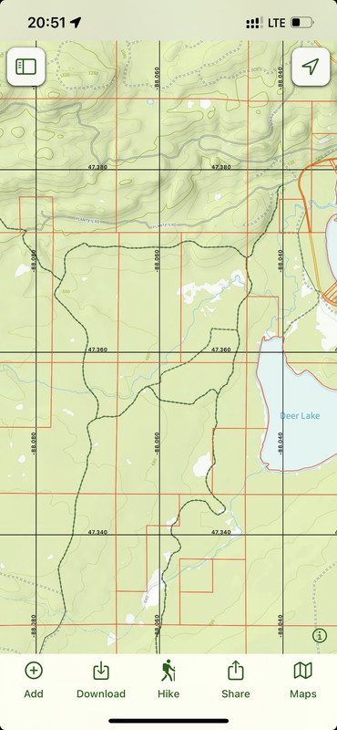
Shows property owners, can load up sectional onto it too, line of sight, etc
Works independently on the Apple Watch too, good for hiking, biking and backcountry ops in general
https://apps.apple.com/app/id672246353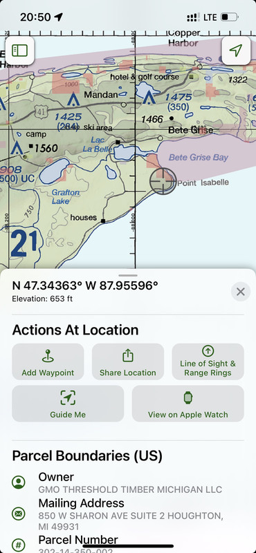
-
NineThreeKilo offline
- Retired
-
Posts:
1679
- Joined: Thu Dec 31, 2009 8:16 pm
- Location: _
-
FWIW a lot of county websites around here have parcel maps on their website,
nowadays they generally use an aerial photo format instead of a "map"
-
hotrod180 offline


-
Posts:
10534
- Joined: Wed Jan 26, 2005 11:47 pm
- Location: Port Townsend, WA
Cessna Skywagon -- accept no substitute!
Wed Jun 14, 2023 12:34 pm
hotrod180 wrote:FWIW a lot of county websites around here have parcel maps on their website,
nowadays they generally use an aerial photo format instead of a "map"
I agree, I just like being able to overlay a sectional (or a zillion other maps) over the parcels and have all of them for the US right in my hand
It also has a interesting feature where it can alert you if you go into or out of a boundary of a parcel, handy for some camping and hunting stuff
-
NineThreeKilo offline
- Retired
-
Posts:
1679
- Joined: Thu Dec 31, 2009 8:16 pm
- Location: _
-
DISPLAY OPTIONS
Who is online
Users browsing this forum: No registered users and 0 guests


