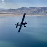
Brian and I along with Corey and Zane and others have put this map together with very basic info. Lat / Long, beta, etc. It is very generic. You have to know that all of these places I have pioneered and landed with great diligence. The info that you will read is for what I took in while going there. As a pilot, there is so much more info to obtain prior to landing.
Covering my tail feathers here for liability reasons...

I have to say THAT NONE OF US ARE RESPONSIBLE FOR YOU LANDING IN THESE PLACES that we have mapped. Some of these places I have not been back to in months or years. Things may have changed so as a good backcountry flier you must do fly-overs and assess for yourself each time. Prior to me landing in any of these places I always followed the basic rules of doing a low fly over, assessing the landing, knowing the touch down spot, size of rocks, are there logs?, how are the weeds, can I get out?, where am I going to turn around and how. What is my departure like, what about with winds...I could go on and on. Long story short, do your homework on each diligently and don't trust that just because its on MY map for where I like to land that its factual and its all good to land without prior diligence of your own.
These locations listed here have so many variations and you may see and better way to land it. Thats great! The map also only shows 60 or so spots that are close to the fly-in location. There are hundreds more. Seriously. As you are flying around during the fly in please look for new places to land on your own. Thats part of the thrill here that we have to offer. Then write down your coords, take a picture and we will add it to the map when we are done.
Anyhow, I think you are getting my point.
Here are the maps for your entertainment purpose only. Enjoy and fly safe. I DID NOT TELL YOU TO GO LAND THERE...

https://www.google.com/maps/d/viewer?mid=z79fgagsL8wA.kMiycQ1MN-oo
And a KML file for Google earth thats color coded like a ski run map.
https://www.backcountrypilot.org/resources/nevada-airstrips.kml
Taken from the other thread..Well thanks for one uping us Zane! If you go off Zanes site make sure you read the file provided to give you the color code.
Green= Easy
Blue = Med
Black = Hard!
Any questions?
Also make certain you read the pilot details for radio and traffic patterns prior to attending.
Last note, the weather is looking to be really nice along the entire west coast for us. Please go in and register in the event section here. Just trying to come up with last minute numbers for our BBQ Saturday night and breakfast Sunday morning.
Remember you pumpkins. Bring your fireworks. Bring your water.
AKT


](/phpbb3/images/smilies/eusa_wall.gif "Brick wall")


