So, I've been all over southcentral, but haven't really ventured into the Alaska range yet. Now is the time since I have a good airplane and want to visit MMoyle and another friend in Platinum.
The two things I've been thinking about is fuel and weather.
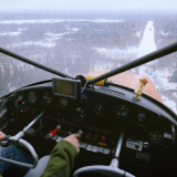
For fuel, I have 36Gals, burn right around 7, so I have around 5 hours of fuel, and only flight plan for 4. Airplane goes right at 105mph (climb prop) so I have a 400 mile range. I'm thinking the smartest thing to do would be to go this path:
PAWS (Wasilla) to
Mouth of Lake Clark Pass to
PAIL (Iliamna)
About 200 miles, check the weather, fill up.
PAIL to PADL (Dillingham)
About 118 miles, check the weather, fill up.
PADL to PAPM
About 103 miles.
The idea is to stop to check weather every hour and have enough fuel to turn around and fly all of the way back if something goes wrong.
My alternate airports will be the ones I came from, or Bethel when I get west.
Weather,
What is the best way to look at weather? I don't think I'll get a TAF for platinum, but I know that Mark can give me updates if I text him from my inreach. While in Iliamna or Dillingham I can use my cell phone (hopefully) and look at the weather cams or find some wifi, or find a computer, or text Mark.
Also, I'm concerned about getting to Platinum and dealing with a 25kt crosswind. It might make sense to leave in the afternoon at 5pm and try to roll into Platinum in the evening when there is less wind, but that would require that I can get self serve fuel in Illiamna and Dillingham, which I can check into.
I'll certainly file a flight plan and have my tracker on me.
I thought about flying the route on my flight sim just to get an idea of what I'm looking at, but then again, flying Lake Clark pass looks pretty straighforward... Not sure if it would help.
Anyway, looking for any feedback from those that have done this 100 times.
Thanks!
schu
Planning a trip to Western Alaska
Mon Jul 31, 2017 12:15 pm

Mon Jul 31, 2017 2:33 pm
Re: Planning a trip to Western Alaska
Should be a great trip. Can't help you with local tips since where you are headed is a good bit south of where i spent a little over 10 years flying, but a couple things in general about flying out to the west coast.
Flight information in the way of reporting stations and cameras have come a long way, but there is still a lot of uncovered real estate. there are still localized areas inroute that can and do frequently have very different weather than what you are seeing reported. I found that you often have to have the i'm going to have to go look and have a plan in your head on what conditions you will turn back for.
Fuel is scarce. Even places that normally have fuel, like McGrath, may not, it's always best to call and check before you head out, and what hours it's available (McGrath had a 200.00 charge for after hours at one time). carry extra with you if you can.
Flight service is still a big help for weather, when you are inrange.
Only been through lake clark pass one time, it can be a busy place. i believe there is a section on it in the Alaska supplement you will want to be familiar with.
Hopefully some guys with local knowledge will chime in with the local tips. Enjoy the trip, it is a great adventure.
Chris
Mon Jul 31, 2017 3:10 pm
Re: Planning a trip to Western Alaska
Thanks for the reply, that's helpful.
I was just in Skagway a few weeks ago, pretty place!
I was just in Skagway a few weeks ago, pretty place!
Mon Jul 31, 2017 3:34 pm
Re: Planning a trip to Western Alaska
Was in Illiamna a week ago (my first time flying myself west of the AK Range), went out through Lake Clark Pass and back through Merrill Pass. I cruise about where you do in my Pacer with a climb prop. Some points of interest perhaps: ATT only provided 3G at the airport so couldn't update weather apps so just talked to the FSS fella there. There may have been wifi at the FSS but it wasn't alive when we landed. The self-serve fuel was alive and well but I called ahead. Lake Clark Pass CTAF is 122.9, for some reason I overlooked that little item and was using the Cook Inlet CTAF until corrected. Both of those passes are awesome to wander through.
Lake Clark Pass is straight-forward. Merrill Pass is quite a bit more narrow and higher (a lot more aircraft aluminum on the valley walls also). Porcupine Pass further north (if you get pushed that way) is lower but narrower.
Since you are flying right over Togiak, if you can land on Hagemeister Island there is a Banya on the island right across from Tongue Pt. Used it quite often when Herring fishing out there.
Mon Jul 31, 2017 7:24 pm
Re: Planning a trip to Western Alaska
Sounds like a great trip!! If Lake Clark pass is closed you can follow the coast down turn into Iliamna bay. Follow the haul road to Pedro bay and follow lake shore to Iliamna. Port Alsworth is a great place to stop lodge on runway if you get stuck. North side of Naknek had fuel last three years ago not credit card so call ahead for hours. McGrath now has credit card fuel and the McGrath hotel steak supper with room, another great place to get stuck. Fuel at Sleetmute but 12 bucks a gallon in June because barge has not made it up and it is flown in (might be better by now). If you have room 10 gal in cans or bushwheel bags is always nice to have in the back in case you find a area you want to play around. The FSS guys/gals are aways happy to see a face and they have lots of local knowledge. Very nice country to fly over.
DENNY
DENNY
DENNY
Mon Jul 31, 2017 9:18 pm
Re: Planning a trip to Western Alaska
You should have 3G GCI coverage at Dillingham, Togiak and Goodnews (probably Platinum too). Illiamna and Port Alsworth have 2G coverage. You should be able to pull up weather cams. If you stop at Iliamna, walk into the FSS. Enroute use the RCOs.
Last time I was out there Lake and Pen had cheaper fuel in PA than Illiamna. Naknek was cheaper than King Salmon, but that's pretty far south for you.
If x-winds are an issue land across the runway on the taxiway or use the old crosswind runway. Winds out there don't typically obey diurnal patterns, I wouldn't count on any time of day being better.
Sent from my iPhone using Tapatalk
DISPLAY OPTIONS
Who is online
Users browsing this forum: No registered users and 1 guest
Latest Features
-
Live to Tell
A Minnesota pilot is surprised to learn that the sudden asymmetric drag of an out-of-rig ski can…Read More -
Creators
Working in some of the Yukon's most beautiful and remote environments, photographer Simon Blakesley captures aircraft in…Read More -
Aircraft Ownership and Maintenance
Upgrading to big tires can make a huge difference in backcountry performance, but with those gains come…Read More -
Tales from Yesteryear
In this tale from bush flying yesteryear, Don Cogger signs up to help Atlee Dodge Jr recovery…Read More


Latest Knowledge Base
-
Destinations
A regional guide with ideas for winter camping destinations in California, Nevada, New Mexico, and Arizona.Read More -
Aircraft
Finding an affordable aircraft that can handle the backcountry for $80K or less? A challenge for sure, but with the…Read More -
Aircraft
01.29.2018 - Zane - Updated tire diameter graphic to add 8.50x10 Guide to tires for use in the backcountry and off-airport landing…Read More -
Pilots
12.22.2013 - Initial article format Operating aircraft on skis and negotiating a snow-covered landscape is an entirely unique skillset and environment.…Read More


