8GCBC wrote:Zane wrote:
It's kind of hard to tell from the sat photo, but the terrain in there is fairly significant. And those trees along the river are pretty tall.
“daedaluscan” wrote:
Been a while since I have been there but I remember that valley as narrow and steep to.
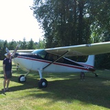
Powers is a great spot, a really nice place to camp.
Looking closer, it appears pretty dangerous. Steep canyon surrounding proposed LZ...

Perfectly understandable to be nervous on the map recon at your experience level. Especially just after the transition from fixed wing to RW.
See how your power margin is on takeoff, note the temp and altimeter. Check temp and altimeter (at the same altimeter setting) when you go over fly that strip, it’ll give you a ballpark of what your power margin should be (better/worse/same as takeoff).
Ridges and tall trees are a lot less scary when you can comfortably cruise around at an airspeed slower than Cubs stall. Give it a couple of medium/low passes, decreasing airspeed each time as long as you’re comfortable with the conditions. If you chose to make an approach or two, keep it right on the ETL shudder so your go around is just applying collective and increasing airspeed slightly.
At work we analyze a helicopter LZ using a few different considerations, of which “technical” are most applicable to civilian flight.
Technical characteristics of LZ/PZ (LONGLASSV)
-Landing formations
-Obstacles
-Number and type of A/C
-Ground slope of landing area
-Load suitability
-Approach and departure directions
-Size of landing area
-Surface condition
-Vulnerability
You probably only need OGASS. Add the second L if you’re planning to sling load your cot

.
At the very least, fly over and enjoy the trip and the view! Mountains, ridges, and tall trees all get further apart the slower you go.
EDIT:
I just remembered another landing acronym:
Landing Considerations
Suitability
Long Axis
Obstacles
Wind