Looking at the turbulance on the low level chart and am not sure on the turbulance info. I understand the symbols for the severity but not sure the range or altitude for the forcasted turbulance. For example an area may show the symbol moderate turbulance then "180/". Does this mean that the turbulance is from surface to 18,000 or from 18,000 up. My guess would be surface up but not 100% sure.
Thanks
Prog Chart Question
Fri Jan 21, 2011 1:20 pm
Fri Jan 21, 2011 1:37 pm
Re: Prog Chart Question
Cough... Choke...
Prog what???????????
Gump
Prog what???????????
Gump

Fri Jan 21, 2011 1:41 pm
Re: Prog Chart Question
This is where I go if I want to know abot turbulence
http://weather.aero/tools/weatherproducts/turbulence
Levels come in 2K increments. You can pick the levels you are interested in.
Gary
http://weather.aero/tools/weatherproducts/turbulence
Levels come in 2K increments. You can pick the levels you are interested in.
Gary
- shortfielder offline
- Posts: 2350
- Joined: Sun Mar 05, 2006 7:14 pm
- Location: Durango, Colorado
- FindMeSpot URL: http://share.findmespot.com/shared/face ... D263l9HKFb
If you want to go up, pull back on the controls. If you want to go down, pull back farther.
My SPOT page
My SPOT page
Fri Jan 21, 2011 3:04 pm
Re: Prog Chart Question
Here is a link to what I'm refering to
http://aviationweather.gov/data/product ... cl_new.gif
http://aviationweather.gov/data/product ... cl_new.gif
Fri Jan 21, 2011 3:27 pm
Re: Prog Chart Question
Figures indicate the top and base of the turbulence. Basically from the surface to what ever it says in the chart your referring to.
That is a good site Gary...
AKT
That is a good site Gary...
AKT
- aktahoe1 offline
- Posts: 2052
- Joined: Sun Jul 13, 2008 8:22 am
- Location: Alaska and Lake Tahoe = aktahoe
If it looks smooth, it might be. If it looks rough, it is...www.bigtirepilot.com ...www.alaskaheliski.com
Fri Jan 21, 2011 3:37 pm
Re: Prog Chart Question
Page 11-5 of the Aviation Weather Surfaces Handbook by FAA. Also see 11-8 for subtleties of the High Level chart.
All the FAA publications are great in my opinion. Good color and diagrams. Nice to have in the bookshelf.
All the FAA publications are great in my opinion. Good color and diagrams. Nice to have in the bookshelf.
- Zzz offline


- Posts: 2855
- Joined: Fri Oct 08, 2004 11:09 pm
- Location: northern
- Aircraft: Swiveling desk chair
Half a century spent proving “it is better to be thought a fool than to open your mouth and remove all doubt.”
Sat Jan 22, 2011 1:31 am
Re: Prog Chart Question
Your example is surface to 180.
I'm with gump, why check the weather? we're going anyway.
I'm with gump, why check the weather? we're going anyway.

John
KSBP
KSBP
Sat Jan 22, 2011 4:10 am
Re: Prog Chart Question
shortfielder wrote:This is where I go if I want to know abot turbulence
http://weather.aero/tools/weatherproducts/turbulence
Levels come in 2K increments. You can pick the levels you are interested in.
Gary
Thanks Gary..plan on flying today, we'll see how the map is in relation to what I find when I head up north. Kinda thought with the approaching snow storm there might be some turb.
HC
'05 7GCBC High Country Explorer
The faster I go , the farther behind I get.
The faster I go , the farther behind I get.
Sat Jan 22, 2011 6:59 am
Re: Prog Chart Question
Hey Ernie
From the sounds of your dreams, your turbulence may start be for you even get up(pun intended)
Have a great day
Gary
From the sounds of your dreams, your turbulence may start be for you even get up(pun intended)
Have a great day
Gary
- shortfielder offline
- Posts: 2350
- Joined: Sun Mar 05, 2006 7:14 pm
- Location: Durango, Colorado
- FindMeSpot URL: http://share.findmespot.com/shared/face ... D263l9HKFb
If you want to go up, pull back on the controls. If you want to go down, pull back farther.
My SPOT page
My SPOT page
DISPLAY OPTIONS
Who is online
Users browsing this forum: No registered users and 2 guests
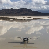
Latest Features
-
Live to Tell
A Minnesota pilot is surprised to learn that the sudden asymmetric drag of an out-of-rig ski can…Read More -
Creators
Working in some of the Yukon's most beautiful and remote environments, photographer Simon Blakesley captures aircraft in…Read More -
Aircraft Ownership and Maintenance
Upgrading to big tires can make a huge difference in backcountry performance, but with those gains come…Read More -
Tales from Yesteryear
In this tale from bush flying yesteryear, Don Cogger signs up to help Atlee Dodge Jr recovery…Read More


Latest Knowledge Base
-
Destinations
A regional guide with ideas for winter camping destinations in California, Nevada, New Mexico, and Arizona.Read More -
Aircraft
Finding an affordable aircraft that can handle the backcountry for $80K or less? A challenge for sure, but with the…Read More -
Aircraft
01.29.2018 - Zane - Updated tire diameter graphic to add 8.50x10 Guide to tires for use in the backcountry and off-airport landing…Read More -
Pilots
12.22.2013 - Initial article format Operating aircraft on skis and negotiating a snow-covered landscape is an entirely unique skillset and environment.…Read More


