Hi all,
I know my Musketeer is not a STOL plane but I want to quantify it's performance.
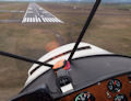
Today the conditions were good for a test, so with only me in the plane and a hour of fuel (1750lb, 600lb under gross) I did some max performance takeoffs. Here are the facts...
-1000'msl
-2200' Density altitude
-32.20"hg
-79deg f
-wind calm to 050deg @ 5knt
-2700' 090-270 hard, dry, cut grass strip that is level (used 090)
I did three takeoffs to get an average and measured the distance with a tape measure. Landmarks were easy to use.
-600' ground run
-1100' over 30' (telephone pole height)
-1800' over 50'
How does this relate to other four seaters in the 150-180hp range flying light?
TIA,
Todd Giencke
quantifying my plane's peformance
Thu Jun 28, 2007 5:50 pm
Thu Jun 28, 2007 8:12 pm
Re: quantifying my plane's peformance
tgiencke wrote:Hi all,
I know my Musketeer is not a STOL plane but I want to quantify it's performance.
Today the conditions were good for a test, so with only me in the plane and a hour of fuel (1750lb, 600lb under gross) I did some max performance takeoffs. Here are the facts...
-1000'msl
-2200' Density altitude
-32.20"hg
-79deg f
-wind calm to 050deg @ 5knt
-2700' 090-270 hard, dry, cut grass strip that is level (used 090)
I did three takeoffs to get an average and measured the distance with a tape measure. Landmarks were easy to use.
-600' ground run
-1100' over 30' (telephone pole height)
-1800' over 50'
How does this relate to other four seaters in the 150-180hp range flying light?
TIA,
Todd Giencke
If you ever want to know how your plane really does over a 50 foot obstacle Montana Aeronautics has a device called a theodolite. They can tell you precisely when you get to 50 feet. You can then load your plane to various weights and see what the performance is. It's a good way also to check and see if your POH is accurate. I did this with my Bo and with myself and about 40 gallons, a density altitude of 5500 and no wind I got thru 50 feet at 1246 feet, almost exactly what the book calls for. For you I would suggest doing this at more realistic weights. Start adding weight in 100 pound increments and see what happens.
- Bonanza Man offline
- Posts: 909
- Joined: Fri Jul 07, 2006 3:42 pm
- Location: Seeley Lake
Thu Jun 28, 2007 9:12 pm
If you have a friend who is a surveyor, rope them into shooting it for you.
Or go to a WAAS enabled field and then analyze the GPS track of your flight when you get home.
Or go to a WAAS enabled field and then analyze the GPS track of your flight when you get home.
- Zzz offline


- Posts: 2855
- Joined: Fri Oct 08, 2004 11:09 pm
- Location: northern
- Aircraft: Swiveling desk chair
Half a century spent proving “it is better to be thought a fool than to open your mouth and remove all doubt.”
Fri Jun 29, 2007 3:37 pm
Disclaimer: In no way am I basing decisions on this little toy, but got it out of shear curiosity. I'm tinkering with it to see if it gets me in the right ballpark (kind of like reverse engineering) and calibrating it to the specific aircraft that I fly. With that being said....
Last Christmas I got a slide rule calculator from Sporty's that I thought looked like it would be fun to play with and see what kind of numbers it would provide me for varying conditions. This slide rule type calculator basically takes the info from the POH that you would normally have to add 10% for, subtract X amount for, and puts it into a slide rule format. It asks you to put in DA, type of runway, slope, temp, % of gross weight, etc, and then computes the needed distance for takeoff. It has a few common type of aircraft listed at the bottom, but can be calibrated for your specific make and model.
So far, it seems to be in the ballpark. The only draw back is I have to guesstimate my takeoff distance (unless I'm at a towered field and I ask the tower to guesstimate for me). It's been fun to play with and has given a little more insight to the performance of the aircraft I fly. I figure that I'll keep tweaking it until I routinely get a consistent, valid result. But even then, it's for informational purposes only....like using a "non-sanctioned" weather site for a better overall picture of the weather forecast.
- Grassstrippilot offline


- Posts: 3536
- Joined: Wed May 31, 2006 6:17 am
- Location: Syracuse, UT
- FindMeSpot URL: https://share.garmin.com/WolfAdventures
- Aircraft: Cessna 205
Fri Jun 29, 2007 7:12 pm
A good way to measure takeoff and landing roll is to look for your tracks. In the desert playas, the wheels leave nice marks. A grass strip on a dewy morning also is good for seeing where ya been.
tom
tom
- Savannah-Tom offline
- Posts: 891
- Joined: Mon Mar 06, 2006 3:26 pm
- Location: Corvallis, OR
DISPLAY OPTIONS
Who is online
Users browsing this forum: No registered users and 0 guests
Latest Features
-
Live to Tell
A Minnesota pilot is surprised to learn that the sudden asymmetric drag of an out-of-rig ski can…Read More -
Creators
Working in some of the Yukon's most beautiful and remote environments, photographer Simon Blakesley captures aircraft in…Read More -
Aircraft Ownership and Maintenance
Upgrading to big tires can make a huge difference in backcountry performance, but with those gains come…Read More -
Tales from Yesteryear
In this tale from bush flying yesteryear, Don Cogger signs up to help Atlee Dodge Jr recovery…Read More


Latest Knowledge Base
-
Destinations
A regional guide with ideas for winter camping destinations in California, Nevada, New Mexico, and Arizona.Read More -
Aircraft
Finding an affordable aircraft that can handle the backcountry for $80K or less? A challenge for sure, but with the…Read More -
Aircraft
01.29.2018 - Zane - Updated tire diameter graphic to add 8.50x10 Guide to tires for use in the backcountry and off-airport landing…Read More -
Pilots
12.22.2013 - Initial article format Operating aircraft on skis and negotiating a snow-covered landscape is an entirely unique skillset and environment.…Read More


