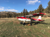
Has anyone made the trip from the airstrip (3S6) to the falls? Looking at google maps, I'm guessing it's 4-5 miles each way
Are there any tools/apps out there that can give approximate hiking distances between two points on a map such as this?
Toketee State to Toketee Falls?
Tue Jul 05, 2016 10:15 am
Re: Toketee State to Toketee Falls?
I use this site a lot for trip planning. http://new.nowcoast.noaa.gov/ I like it because it has some great weather features, and you can bring up different base maps including satellite imagery and detailed topo maps. Turn off the visible satellite layer (cloud cover), and click on base map to switch to topo and zoom in. Has a scale in the lower left corner so you can judge distance pretty accurately.

Tue Jul 05, 2016 10:29 am
Re: Toketee State to Toketee Falls?
I haven't hiked it but have driven the long route shown here. https://www.google.com/maps/dir/Toketee ... 633971!3e2
I have hiked a lot in that area just using dead reckoning with a map and compass. it is pretty easy terrain but no guarantee about the ease of a direct route from the airfield to the falls.
I have hiked a lot in that area just using dead reckoning with a map and compass. it is pretty easy terrain but no guarantee about the ease of a direct route from the airfield to the falls.

tcj
Tue Jul 05, 2016 12:04 pm
Re: Toketee State to Toketee Falls?
CFOT wrote:I use this site a lot for trip planning. http://new.nowcoast.noaa.gov/ I like it because it has some great weather features, and you can bring up different base maps including satellite imagery and detailed topo maps. Turn off the visible satellite layer (cloud cover), and click on base map to switch to topo and zoom in. Has a scale in the lower left corner so you can judge distance pretty accurately.
I like it! I foresee many wasted work hours in my future spent learning my way around that site
I figured out how to get the approximate distances on google maps, but didn't have any luck on my tablet last night. Much easier on a computer with a mouse.
- 1:1 Scale offline

- Posts: 235
- Joined: Fri Jul 20, 2012 11:38 pm
- Location: Redmond
- Aircraft: Maule M4-220C
Kelly
Maule M4-220C
Maule M4-220C
Tue Jul 05, 2016 12:21 pm
Re: Toketee State to Toketee Falls?
Not sure what options there are on a tablet, but I'm sure they are numerous, just not free. You might be able to do this in the iPad version of Google Earth:
1. Go to this website.
2. Click the button to "View in Google Earth".
3. It will download a .kml file, click it to open it in Google Earth. If using mobile, you might have to copy the URL for later use.
4. You'll see the Earth Point Top Map overlay appear in your Temporary Places. Make sure it's selected. It will show "downloading" for a few seconds.
5. Zoom way in on the Tokatee airstrip, until it's like half the screen. The resolution of the topo overlay will increase as it loads a different scale version and show more detail.
6. Use the ruler tool, change to "path" mode, and start clicking points along a winding trail. It will tally up the distance and display it.
- Zzz offline


- Posts: 2854
- Joined: Fri Oct 08, 2004 11:09 pm
- Location: northern
- Aircraft: Swiveling desk chair
Half a century spent proving “it is better to be thought a fool than to open your mouth and remove all doubt.”
Tue Jul 05, 2016 3:40 pm
Re: Toketee State to Toketee Falls?
A cool app that I use is called "measure your land". It is great for calculating multi point distances and different land areas. I think that Takate falls is at least 5 miles from the strip, but the North Umpqua River Trail is one of the sweetest single track trails around for mountain biking.
- Scolopax offline

- Posts: 1696
- Joined: Tue Sep 27, 2005 5:02 pm
- Location: Nottingham
- FindMeSpot URL: http://share.findmespot.com/shared/face ... 4aYqSexnZC
Tue Jul 05, 2016 4:20 pm
Re: Toketee State to Toketee Falls?
Planimeter is also a great measuring app for android.

Tue Jul 05, 2016 6:56 pm
Re: Toketee State to Toketee Falls?
Disclaimer: I have no experience with Toketee Airport, though I have visited Toketee Falls while in the Crater Lake/Roseburg, OR area.
My personal favorite mapping website for planning hiking trips is caltopo.com. They have lots of different layers to choose from, including USGS quads, US Forest service quads (where available in national forests, more detailed and up-to-date than USGS quads), google satellite, terrain, maps etc. You can also "ghost" layers on top of each other and change their transparency, like google satellite with a US Forest service quad map overlay. I find that this is as good of a tool as I have found for planning hiking routes and measuring distances. It also can snap your distance measurement tool to follow a trail.
[url]CalTopo.com[/url]
- LowTimePilot offline
- Posts: 9
- Joined: Mon Feb 03, 2014 11:32 pm
- Location: SW WA
Tue Jul 05, 2016 8:19 pm
Re: Toketee State to Toketee Falls?
Watson Falls is closer to the strip. 4ish miles down the road. I like to hike down to Fish Creek as it is very secluded and beautiful!
Sent from my iPhone using Tapatalk
Sent from my iPhone using Tapatalk

Sat Jul 09, 2016 8:51 pm
Re: Toketee State to Toketee Falls?
Thanks for all the tips!
- 1:1 Scale offline
- Posts: 235
- Joined: Fri Jul 20, 2012 11:38 pm
- Location: Redmond
- Aircraft: Maule M4-220C
Kelly
Maule M4-220C
Maule M4-220C
DISPLAY OPTIONS
Who is online
Users browsing this forum: No registered users and 0 guests
Latest Features
-
Live to Tell
A Minnesota pilot is surprised to learn that the sudden asymmetric drag of an out-of-rig ski can…Read More -
Creators
Working in some of the Yukon's most beautiful and remote environments, photographer Simon Blakesley captures aircraft in…Read More -
Aircraft Ownership and Maintenance
Upgrading to big tires can make a huge difference in backcountry performance, but with those gains come…Read More -
Tales from Yesteryear
In this tale from bush flying yesteryear, Don Cogger signs up to help Atlee Dodge Jr recovery…Read More


Latest Knowledge Base
-
Destinations
A regional guide with ideas for winter camping destinations in California, Nevada, New Mexico, and Arizona.Read More -
Aircraft
Finding an affordable aircraft that can handle the backcountry for $80K or less? A challenge for sure, but with the…Read More -
Aircraft
01.29.2018 - Zane - Updated tire diameter graphic to add 8.50x10 Guide to tires for use in the backcountry and off-airport landing…Read More -
Pilots
12.22.2013 - Initial article format Operating aircraft on skis and negotiating a snow-covered landscape is an entirely unique skillset and environment.…Read More


