Backcountry Pilot • Boiling a frog...

Boiling a frog...

Near misses, close calls, and lessons learned the hard way. Share with others so that they might avoid the same mistakes.
47 postsPage 2 of 31, 2, 3

Re: Boiling a frog...

Mountain Doctor wrote:Well, we scrubbed the flight.

We took off with the plan all loaded ready to go to Klamath Falls and Crater Lake, and then continue down into south central California.

The visibility and ceiling at the airport was reported fine, but in-flight visibility was horrible. At 4000 feet, there was no discernible horizon, and all I could see was the terrain below me.

It occurred to me that if there was traffic or weather ahead of me, I wouldn't of been able to see it.

I notified air traffic control that I was turning back and heading to Richland.

I promised my friend that we would have a safe landing, but I did not promise her wear. That is my policy.

So, we had a major change in plans. Transfer the stuff from the airplane to the Mercedes, and drove down to Crater Lake

The weather there was very iffy. Intermittent thunderstorms, some with hell, and many times that it would not of been good flying for crossing the mountains. I think we made a good decision.

God has blessed our trip regardless, we've been having a wonderful time, and I'm also discovering what a pleasure it is to drive my new car long distance.

Have a great day gentlemen, and thank you for all the wise advice that I got from this thread. It makes me sincerely hope that many people that are on our forum, or look here learn from us and benefit from these experiences.


Good decision. There are very few personal flights that "must" be made, so there's no reason to push the envelope unnecessarily.

Cary
Cary offline
User avatar
Posts: 3801
Joined: Sun Jan 10, 2010 6:49 pm
Location: Fort Collins, CO
"I have slipped the surly bonds of earth..., put out my hand and touched the face of God." J.G. Magee

Re: Boiling a frog...

I just finished a 2 week self-imposed seminar in flying in smoke all around the West, BC and western Alberta. I lost count of how many times we changed routes and plans. What was supposed to be a 2,100 mile pleasure trip turned into a 2,800 mile improvisation. In addition to all of the usual weather products, I founds this website to be useful for planning: http://firesmoke.ca/forecasts/

Smoke is maddening because it's harder to predict where and when things will be bad based on the usual tools for prediction (pressure, winds, temp/dewpoint etc.). We arrived one day last week in central Idaho in pretty heavy smoke. The next couple of days weren't too bad, but the morning of our departure was 3SM with broken clouds 4,000' agl, and it didn't improve much for 6 hours. Of course, there was nothing in the forecasts about this. There are just too many variables and, with the exception of the link I found aboove, the weather models don't seem to be tuned for smoke or haze. The one "gift" was that the smoke eased up just in time to dodge thunderstorms in the desert on the way home. Most of this trip had no ADS-B tower reception, so I had no radar or imagery except in the motel room (wi-fi) or from what Center could tell me. I know that I'll have to equip with ADS-B OUT, but I'm seriously considering XM for weather IN. Oh, and I can't post this without thanking and praising the absolutely amazing and helpful service from Kamloops and Edmonton flight service.

Nearly 30 years at this now, and I learned a TON on this last adventure. It wasn't an easy trip, but I'm grateful to have made it.

CAVU
[temp MVFR]
CAVU offline
User avatar
Posts: 659
Joined: Wed May 10, 2006 4:54 pm

Re: Boiling a frog...

CAVU wrote:I just finished a 2 week self-imposed seminar in flying in smoke all around the West, BC and western Alberta. I lost count of how many times we changed routes and plans. What was supposed to be a 2,100 mile pleasure trip turned into a 2,800 mile improvisation. In addition to all of the usual weather products, I founds this website to be useful for planning: http://firesmoke.ca/forecasts/

Smoke is maddening because it's harder to predict where and when things will be bad based on the usual tools for prediction (pressure, winds, temp/dewpoint etc.). We arrived one day last week in central Idaho in pretty heavy smoke. The next couple of days weren't too bad, but the morning of our departure was 3SM with broken clouds 4,000' agl, and it didn't improve much for 6 hours. Of course, there was nothing in the forecasts about this. There are just too many variables and, with the exception of the link I found aboove, the weather models don't seem to be tuned for smoke or haze. The one "gift" was that the smoke eased up just in time to dodge thunderstorms in the desert on the way home. Most of this trip had no ADS-B tower reception, so I had no radar or imagery except in the motel room (wi-fi) or from what Center could tell me. I know that I'll have to equip with ADS-B OUT, but I'm seriously considering XM for weather IN. Oh, and I can't post this without thanking and praising the absolutely amazing and helpful service from Kamloops and Edmonton flight service.

Nearly 30 years at this now, and I learned a TON on this last adventure. It wasn't an easy trip, but I'm grateful to have made it.

CAVU
[temp MVFR]
Hell of a summer to pick for flying BC. Haha. Where all did you go in western AB?

Sent from my SM-G870W using Tapatalk
A1Skinner offline
Supporter
User avatar
Posts: 5186
Joined: Sat Jan 21, 2012 11:38 am
Location: Eaglesham
FindMeSpot URL: [url:1vzmrq4a]http://share.findmespot.com/shared/faces/viewspots.jsp?glId=0az97SSJm2Ky58iEMJLqgaAQvVxMnGp6G[/url:1vzmrq4a]
Aircraft: Cessna P206A, AT402/502/602

Re: Boiling a frog...

Yeah. It was nuts. We entered BC at Kelowna. The plan was to fly to Lake Louise and follow the Icefields Parkway up to Jasper, but a growing cloud layer up towards Jasper forced us to to continue east of the mountains. I tried to get to Hinton, and then into Jasper from the east, but ran into showers, so headed over to Edson for fuel and to regroup. An hour later, things cleared up enough and we followed the highway to Hinton and then into Jasper. We rented a car and spent a week in the parks. The next stop was supposed to be Tsuniah Lake (Haha, indeed!). I've dreamed about spending some time there for years, and we were looking forward to a nice, quiet stay in a comfortable place after bouncing around in crappy motels and the rental car (Jetta with a shimmy). The plan was to fly to Williams Lake or 108 mile house for fuel, then over to Tsuniah, then back down to Oroville or Friday Harbor to reenter the U.S. When the time came to leave, the winds had shifted and the smoke was piling over to the west and south of the fires in the interior, which shut down our BC plans. I thought about going someplace farther north up around Prince George, which was smoke-free at the time. But there seemed to be a fair amount of precip coming through there and on down towards just north of Edmonton. We had some pretty strong storms one night in Jasper and the low clouds hung around all of the next day. I started getting concerned about things shutting down and getting stuck in Jasper. So after it cleared up a couple days later, we made a run for the border, reentering the U.S. at Cutbank. I saw a lot of great country from the air, flying down the eastern slope of the Rockies, but didn't stop. The rest of the trip was a mix of stooging home through smoke and taking breaks for a night or two. We didn't see much of the ground after we got back to the States. So, I saw just enough to whet my appetite to see more of western Alberta. I really like that airstrip in Jasper.

CAVU
[temp MVFR]
CAVU offline
User avatar
Posts: 659
Joined: Wed May 10, 2006 4:54 pm

Re: Boiling a frog...

CAVU wrote:Yeah. It was nuts. We entered BC at Kelowna. The plan was to fly to Lake Louise and follow the Icefields Parkway up to Jasper, but a growing cloud layer up towards Jasper forced us to to continue east of the mountains. I tried to get to Hinton, and then into Jasper from the east, but ran into showers, so headed over to Edson for fuel and to regroup. An hour later, things cleared up enough and we followed the highway to Hinton and then into Jasper. We rented a car and spent a week in the parks. The next stop was supposed to be Tsuniah Lake (Haha, indeed!). I've dreamed about spending some time there for years, and we were looking forward to a nice, quiet stay in a comfortable place after bouncing around in crappy motels and the rental car (Jetta with a shimmy). The plan was to fly to Williams Lake or 108 mile house for fuel, then over to Tsuniah, then back down to Oroville or Friday Harbor to reenter the U.S. When the time came to leave, the winds had shifted and the smoke was piling over to the west and south of the fires in the interior, which shut down our BC plans. I thought about going someplace farther north up around Prince George, which was smoke-free at the time. But there seemed to be a fair amount of precip coming through there and on down towards just north of Edmonton. We had some pretty strong storms one night in Jasper and the low clouds hung around all of the next day. I started getting concerned about things shutting down and getting stuck in Jasper. So after it cleared up a couple days later, we made a run for the border, reentering the U.S. at Cutbank. I saw a lot of great country from the air, flying down the eastern slope of the Rockies, but didn't stop. The rest of the trip was a mix of stooging home through smoke and taking breaks for a night or two. We didn't see much of the ground after we got back to the States. So, I saw just enough to whet my appetite to see more of western Alberta. I really like that airstrip in Jasper.

CAVU
[temp MVFR]
Awesome. If you come north a bit further next time let me know. I'm just north of Grande prairie.

Thank Zzz for bringing up this thread. Very relevant for us up here this year.


Sent from my SM-G870W using Tapatalk
A1Skinner offline
Supporter
User avatar
Posts: 5186
Joined: Sat Jan 21, 2012 11:38 am
Location: Eaglesham
FindMeSpot URL: [url:1vzmrq4a]http://share.findmespot.com/shared/faces/viewspots.jsp?glId=0az97SSJm2Ky58iEMJLqgaAQvVxMnGp6G[/url:1vzmrq4a]
Aircraft: Cessna P206A, AT402/502/602

Re: Boiling a frog...

I'm turning the topic into a knowledge base article. Anyone have photos they'd like to share?
Zzz offline
Janitorial Staff
User avatar
Posts: 2854
Joined: Fri Oct 08, 2004 11:09 pm
Location: northern
Aircraft: Swiveling desk chair
Half a century spent proving “it is better to be thought a fool than to open your mouth and remove all doubt.”

Re: Boiling a frog...

Image
GumpAir offline
User avatar
Posts: 4557
Joined: Wed Feb 14, 2007 9:14 am
Location: Lost somewhere in Nevada
Aircraft: Old Clunker

Re: Boiling a frog...

Coming back from Nampa ID last Sunday about 30 minutes from Central Oregon:

Image

CW
clippwagon offline
User avatar
Posts: 737
Joined: Sun Nov 13, 2011 9:49 pm
Location: Oregon

Re: Boiling a frog...

Here's a few from flying down the BC coast. 2-4 mile viz. I usually fly gps-direct, but felt better following a shoreline or highway in these conditions. A couple of map gps displays working for you is nice. Helps if you can hold an altitude and heading too (real basic IFR stuff), when you have nothing to reference.

Image
Image
Image
Karmutzen offline
User avatar
Posts: 711
Joined: Tue Apr 24, 2012 7:47 pm
Location: Great Bear Rainforest
'74 7GCBC, 26" ABW, Aera 660 feeding G5 and FC-10 FF.

Re: Boiling a frog...

I suspect that flying into smoke and "get there itis" is what got my dad. He was close to the destination on a route he flew hundreds of times into slightly rising terrain. I could send the pictures of what a 60 year old Cessna looks like after plowing 800 feet through the trees but I don't think you would want it. ugly. You made the better call.
jprax offline
Supporter
Posts: 83
Joined: Mon Jan 25, 2010 10:23 pm
Location: Valdez, AK

Re: Boiling a frog...

While the "boiling a frog" analogy is often appropriate to flying in smoke, there are sometimes sudden changes in visibility, depending on how close the fires are.

With distance, smoke tends to more evenly disperse, making for the subtle kind of changes in vis implied by the frog analogy.

But if you're relatively close to a fire, and downwind, you may be stooping along in 2 or 3 mile vis, and suddenly be enveloped in 1/8th mile and solid IMC. This scenario is nasty on many levels, but the big thing is in a few mile vis, you won't see the thick stuff coming.

In 1988, the area I worked burned 1.2 million acres, with another ~ million or so burned in surrounding areas. After one or two episodes of flying directly into a column of smoke, I started attending the morning fire briefing at Alaska Fire Service, to develop a mental map of where the fires were, and their relative activity. That really helped, though I still stuck my nose in IMC a time or two later.

Fire maps and briefing info is available on line these days.

If you're going to be close (within fifteen or twenty miles, give or take) try to stay upwind of the fires if possible.

MTV
mtv offline
Knowledge Base Author
User avatar
Posts: 10514
Joined: Sat Feb 25, 2006 1:47 am
Location: Bozeman

Re: Boiling a frog...

Zzz wrote:I'm turning the topic into a knowledge base article. Anyone have photos they'd like to share?


On behalf of all of us, STUDENT PILOTS (regardless of how many hours we may have), thank you.
Mountain Doctor offline
User avatar
Posts: 641
Joined: Fri May 01, 2015 3:33 pm
Location: Richland
Aircraft: Maule MXT-7 180A

Re: Boiling a frog...

A1Skinner wrote:Awesome. If you come north a bit further next time let me know. I'm just north of Grande prairie.

Thank Zzz for bringing up this thread. Very relevant for us up here this year.


Sent from my SM-G870W using Tapatalk


Thanks, Hank. I appreciate the invite. I'd love to see more of this beautiful country.

CAVU
[temp MVRF]
CAVU offline
User avatar
Posts: 659
Joined: Wed May 10, 2006 4:54 pm

Re: Boiling a frog...

It's cleared up here in SE Idaho but a couple weeks ago......it was so smoky I aborted several flights as it just didn't seem worth it, flying without the view I am used to. After a few days of this I was getting antsy, and while riding my bike on the trails above my place I noticed it was and had been dead calm for quite a while. So I decided as soon as I got back from my ride I was going to jump in the plane and take a quick very local flight.

About 5 minutes later, still riding, I heard thunder and the wind picked up, a thunderstorm had moved into my area and totally fooled me, as it used the smoke as a cloaking device. I prefer my thunderstorm dealings to be on the up and up, where I can see and avoid them, Something similar happened last year, when I was northbound and just clearing Lost Trail Pass north of Salmon, smoky again but otherwise good air, then I saw lightening just a few miles ahead, again it caught me totally by surprise as the thunder clouds seem to be the exact same coloring as the smoke, that just doesn't seem right #-o
courierguy offline
User avatar
Posts: 4197
Joined: Thu Mar 31, 2005 6:52 pm
Location: Idaho
"Its easier to apologize then ask permission"
Tex McClatchy

Re: Boiling a frog...

courierguy wrote:It's cleared up here in SE Idaho but a couple weeks ago......it was so smoky I aborted several flights as it just didn't seem worth it, flying without the view I am used to. After a few days of this I was getting antsy, and while riding my bike on the trails above my place I noticed it was and had been dead calm for quite a while. So I decided as soon as I got back from my ride I was going to jump in the plane and take a quick very local flight.

About 5 minutes later, still riding, I heard thunder and the wind picked up, a thunderstorm had moved into my area and totally fooled me, as it used the smoke as a cloaking device. I prefer my thunderstorm dealings to be on the up and up, where I can see and avoid them, Something similar happened last year, when I was northbound and just clearing Lost Trail Pass north of Salmon, smoky again but otherwise good air, then I saw lightening just a few miles ahead, again it caught me totally by surprise as the thunder clouds seem to be the exact same coloring as the smoke, that just doesn't seem right #-o


The thunderstorm and smoke column thing is nasty. You never know if there will be a visual tip off. You were lucky to have lightening to alert you. Last week over the Owyhee, I noticed that the view ahead was getting just a shade darker, and the visibility seemed to be decreasing at my altitude. I descended a couple thousand feet, the smoke thinned out a bit and I saw the dark bottom of something nasty out the windscreen. I turned right and flew around it. About half way around, the smoke finally cleared and I was looking at a thunderstorm off to my left. If I hadn't noticed that little darkening ahead and gone down to check it out, I could have flown into IMC/thunderstorm at 10,500'.

My wife doesn't like me to listen to music while I'm flying. She says she wants me to pay attention all of the time. She may be on to something there. #-o

CAVU
[temp MVFR]
CAVU offline
User avatar
Posts: 659
Joined: Wed May 10, 2006 4:54 pm

Re: Boiling a frog...

On another discussion forum, there was a thread about the value of the Stormscope in both IFR and VFR flying. Since thunderstorms always have lightning associated with them, and the Stormscope does a great job of showing where that lightning is located, it is a very "comforting" tool to have in the airplane whenever conditions make it difficult to visually see a thunderstorm.

For one of the guys on the other forum, this was flying IFR in a solid layer of clouds, but with some large cells embedded within them. The Stormscope made it easy to tell where the thunderstorms were, and avoid them. NexRad shows precip, which may or may not indicate thunderstorm activity.

For me, it was when I was flying under a solid cloud layer, maintaining VFR. There was constant rain falling, just varying in intensity (with accompanying reduced visibility). But being summer time in Texas, there were a few isolated thunderstorms around. I could not see them, because the cloud bases were pretty much the same as all the other mess out there. NexRad (ADS-B IN) showed light to moderate precip pretty much everywhere around me. Only the Stormscope showed me where the thunderstorms were, so I was able to alter my flight path to remain at least 30 miles clear of them (leaving a big margin for error). Even at that range, I could occasionally see flashes of light in the direction the Stormscope said the thunderstorms were located. I got home safely, and my airplane was pretty clean from all that rain... LOL
JP256 offline
Supporter
User avatar
Posts: 629
Joined: Mon Aug 31, 2015 1:52 pm
Location: Cedar Park
Aircraft: Rans S-6ES

Re: Boiling a frog...

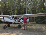
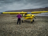
I was heading up North into the smoke on Friday thinking how relevant this thread is right now. I could hear three or four other planes with Center heading into the same general area. I knew I had to drop into terrain during my descent, and it seemed the frog was indeed in the pot as the smoke was getting thicker by the mile. I knew I would soon be at a point where I would have to decide whether to commit, or turn back so I started planning ahead.

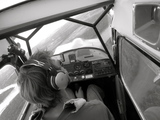
First I double checked my instruments to make sure everything was working, and then set up my Garmin Pilot as a back up, and made sure the terrain data base was loaded and functioning. Then I realigned my course a bit so that I would be in a better position for a turn around if needed in the terrain ahead of me. I took a moment to study the chart and determined a firm go-no go point at which point I would turn around if I could not see the bend in the canyon ahead of me. Beyond this I knew I would have to commit to being right down in the bottom of the canyon where I could follow the river and roads, and a turn around or climb out would not be a safe option.

The frog continued to simmer as I descended along the ridge on the right side of the canyon. Visibility steadily diminished. It was also nearly sunset, and I could hear Coyote's advice chiming in with the little voice in my head, "Watch out when the sun goes over the horizon. It will go from bad to worse. In that case you don't really have 30 minutes more of daylight VFR. It becomes instant IFR".

It turns out that I did not have to wait for my decision point to bail out. As I followed the side of the ridge down not only did my forward visibility disappear, but my downward visibility began to disappear also leaving me only the side of the canyon I was hugging as a visual reference, but I had set myself up so that I was in a good position to turn around. I started my 180 just as Center called to cut me loose.
"Center, I got smoked out and we are turning around.. would like to remain with you," I said as I wondered how the other airplanes I had heard were managing to proceed through this stuff. No sooner had I gotten myself back to some better visibility and given Center a brief report on the conditions, did I hear the other planes in the area follow suit.

I spent the remainder of the evening flying back through a beautiful smoke induced sunset content that I had turned what could have been a difficult situation into a non-event, and in the process may have inadvertently prodded the other pilots in the area into making the better decision.
Image
SIDE NOTE: I had called ahead to someone on the ground near my destination to check on visibility prior to departure. Yes, they could see the ridgeline four miles to the south. Yes they could see the peak three miles to the west. I know the country well, and knew I could get in safely under these conditions. But what happened between the time I got that report and my arrival in the area was something to consider. The widely dispersed smoke that had been prevalent during the day was now settling in thick with the cooling temperatures and calm winds of the evening. The combination of sinking air, and not enough wind to push it through the terrain meant that the smoke was now being consolidated and trapped in this area. So, terrain, temperature, time of day, and wind changes are all factors that can concentrate the smoke in areas along your route, as well as other factors discussed in this thread.
Last edited by CFOT on Wed Aug 23, 2017 11:47 am, edited 3 times in total.
CFOT offline
User avatar
Posts: 581
Joined: Thu Oct 22, 2015 7:32 pm
Location: O46, LHM, O08

Re: Boiling a frog...

Good call CFOT, it's great how these forums disseminate practical knowledge.

One question on your comms with "Center", what does that do for you? Up here we don't talk to anybody, there's a common frequency for airplanes, mostly taken up by fire-fighting air-to-air, and then the occasional call to a FSS. Otherwise we just Helen Keller around on our own. Just wondering what we're missing out.
Karmutzen offline
User avatar
Posts: 711
Joined: Tue Apr 24, 2012 7:47 pm
Location: Great Bear Rainforest
'74 7GCBC, 26" ABW, Aera 660 feeding G5 and FC-10 FF.

Re: Boiling a frog...

One question on your comms with "Center", what does that do for you? Up here we don't talk to anybody, there's a common frequency for airplanes, mostly taken up by fire-fighting air-to-air, and then the occasional call to a FSS. Otherwise we just Helen Keller around on our own. Just wondering what we're missing out.


Provided you are in an area with radar coverage, and not blocked by terrain, you can request VFR flight following by air traffic control. If their work load permits, they will assign you a transponder code and provide you with traffic advisories and other useful bits of information, as well as providing an additional safety net if you get yourself in trouble. Nice to have someone in direct communication who is tracking your location over remote areas, and nice to have the traffic alerts especially in busier airspace or poor visibility situations. Also allows you to fly direct through some types of airspace and TFR's that you would otherwise have to avoid, and you still have all the freedom choose your altitudes and headings as you would on any other VFR flight, unless requested otherwise for traffic separation. The controllers like it too because it makes it easier for them to avoid getting you tangled up with their IFR traffic.
CFOT offline
User avatar
Posts: 581
Joined: Thu Oct 22, 2015 7:32 pm
Location: O46, LHM, O08

Re: Boiling a frog...

Also, being in contact with an ATC radar facility may provide heads up on potential thunderstorm cells in the area. With emphasis on the "may".

Good job, CFOT in using all the tools, and developing a good plan well in advance, then executing the plan, including the escape option. Having a good plan ahead of time makes your decision making a lot easier when things get dicey.

MTV
mtv offline
Knowledge Base Author
User avatar
Posts: 10514
Joined: Sat Feb 25, 2006 1:47 am
Location: Bozeman

DISPLAY OPTIONS

PreviousNext
47 postsPage 2 of 31, 2, 3

Who is online

Users browsing this forum: No registered users and 0 guests

Latest Features

Latest Knowledge Base