Came across this news.
https://www.garmin.com/en-US/newsroom/p ... -aircraft/
I put one on my plane over a year ago
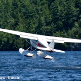
This unit is incredible. On amphibs with glassy water its accurate to the foot! worth it for glassy water alone.
IFR I get callouts for AGL right around when minimums come up. also get nice upgrade to the Altitude animations on a G3X
Since we fly into lakes and grass fields often, ive removed the "terrain" warnings that were annoying when landing somewhere not a runway. Now I get nice Height warnings instead.
I recommend if you have a Garmin suite
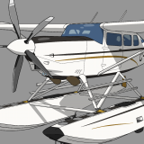
Garmin GHA 15 Approved for Certified Aircraft
Fri Feb 06, 2026 9:25 am
Fri Feb 06, 2026 5:04 pm
Re: Garmin GHA 15 Approved for Certified Aircraft
I was curious if that worked over water or not. Nice!

Fri Feb 06, 2026 6:47 pm
Re: Garmin GHA 15 Approved for Certified Aircraft
The glassy-man’s best friend.
- Zzz offline


- Posts: 2854
- Joined: Fri Oct 08, 2004 11:09 pm
- Location: northern
- Aircraft: Swiveling desk chair
Half a century spent proving “it is better to be thought a fool than to open your mouth and remove all doubt.”
Mon Feb 09, 2026 4:40 pm
Re: Garmin GHA 15 Approved for Certified Aircraft
Does this unit have audio count down or do you have to look at the display?


Mon Feb 09, 2026 4:52 pm
Re: Garmin GHA 15 Approved for Certified Aircraft
I'm not downplaying the quality of this product Garmin may have solved the equation. My lived experience with Rad Alts over water or for that matter even pooled water on a ramp area is dodgy at best. I'm not ready to call this a win for glassy water ops just yet.
Tue Feb 10, 2026 9:43 pm
Re: Garmin GHA 15 Approved for Certified Aircraft
Mapleflt wrote:I'm not downplaying the quality of this product Garmin may have solved the equation. My lived experience with Rad Alts over water or for that matter even pooled water on a ramp area is dodgy at best. I'm not ready to call this a win for glassy water ops just yet.
The win for glassy water ops is a current, experienced pilot, who's not afraid of it.

Wed Feb 11, 2026 8:50 pm
Re: Garmin GHA 15 Approved for Certified Aircraft
mtv wrote:Mapleflt wrote:I'm not downplaying the quality of this product Garmin may have solved the equation. My lived experience with Rad Alts over water or for that matter even pooled water on a ramp area is dodgy at best. I'm not ready to call this a win for glassy water ops just yet.
The win for glassy water ops is a current, experienced pilot, who's not afraid of it.
Agreed! while i've gotten used to hearing the 1 foot audio callout a second ish before touchdown, need to make sure to never change the technique used for flying them.
Thu Feb 12, 2026 6:48 am
Re: Garmin GHA 15 Approved for Certified Aircraft
Cameron96 wrote:mtv wrote:Mapleflt wrote:I'm not downplaying the quality of this product Garmin may have solved the equation. My lived experience with Rad Alts over water or for that matter even pooled water on a ramp area is dodgy at best. I'm not ready to call this a win for glassy water ops just yet.
The win for glassy water ops is a current, experienced pilot, who's not afraid of it.
Agreed! while i've gotten used to hearing the 1 foot audio callout a second ish before touchdown, need to make sure to never change the technique used for flying them.
U got it, good on ya.
Thu Feb 12, 2026 1:06 pm
Re: Garmin GHA 15 Approved for Certified Aircraft
While I agree with MTV that it would not be wise to use as a crutch for somebody learning floats I was wondering If it might be a help in a situation we have been in a few times. If you have ever landed in a lake quite a bit later in the evening than you should have you will realize the minute you drop below the horizon everything goes black. Even if its not glassy you cant see anything but black anyway and just set up a glassy approach and its no problem. In a short lake though the problem is getting set up soon enough for a glassy without running out of room to land.
If you scrape the 40 ft trees on the 40 ft shoreline and your coming in at 80 ft on a short lake is this something that could get you safely down to 15 or 20 ft to get set up for the glassy landing. Garmin says it is a different type of radar and works fine over water. As someone who has actually used it what are your thoughts Cameron about using it it that situation. Appreciate your thoughts as doing radio upgrade now and could easily install.
If you scrape the 40 ft trees on the 40 ft shoreline and your coming in at 80 ft on a short lake is this something that could get you safely down to 15 or 20 ft to get set up for the glassy landing. Garmin says it is a different type of radar and works fine over water. As someone who has actually used it what are your thoughts Cameron about using it it that situation. Appreciate your thoughts as doing radio upgrade now and could easily install.
- peterdillon offline
- Posts: 22
- Joined: Wed Dec 28, 2022 4:18 pm
- Location: Selkirk
- Aircraft: Floats
Thu Feb 12, 2026 2:26 pm
Re: Garmin GHA 15 Approved for Certified Aircraft
peterdillon wrote:While I agree with MTV that it would not be wise to use as a crutch for somebody learning floats I was wondering If it might be a help in a situation we have been in a few times. If you have ever landed in a lake quite a bit later in the evening than you should have you will realize the minute you drop below the horizon everything goes black. Even if its not glassy you cant see anything but black anyway and just set up a glassy approach and its no problem. In a short lake though the problem is getting set up soon enough for a glassy without running out of room to land.
If you scrape the 40 ft trees on the 40 ft shoreline and your coming in at 80 ft on a short lake is this something that could get you safely down to 15 or 20 ft to get set up for the glassy landing. Garmin says it is a different type of radar and works fine over water. As someone who has actually used it what are your thoughts Cameron about using it it that situation. Appreciate your thoughts as doing radio upgrade now and could easily install.
I'm equally interested in the "lived" experience with the newer Garmin unit. I will offer the following observations based on my experience with operational use of radar altimeters down to as low as Cat 2 approaches.
As with any technology the overriding premise must always be "good slave, poor master". As has been pointed out by others, tools of the trade cannot replace skill supported by regular practice and proper application of. I welcome new technology, especially if it enhances safety and elevates awareness.
I'm not going to insult everyone with a long winded pontification on how they function, I actually have no clue its all PFM to me. In it's basic and simplest form radar is an echo. An accurate echo requires a hard surface devoid of clutter hence the reason why the terrain prior to a runway serviced by a precision approach on which radar altimetry is depend is stripped bare, contoured and sanitized. So now lets consider the preverbal 50' treelined shoreline. The echo will return off the granite below but not the tops of the 50' intrusion into the final approach path, radar alt needs a hard surface. So while water isn't compressible; I've very successfully proven that many times, much to my chagrin it's equally not a hard surface that can return a valid result. Radar altimeter unlocks can happen over even the best prepared surfaces. I've regularly witness faulty readings while taxiing over pooled water or ice on airport ramps and taxiways.
I will repeat my earlier mantra, technology is a "good slave, poor master".
Fri Feb 13, 2026 7:22 am
Re: Garmin GHA 15 Approved for Certified Aircraft
Hey Peter, Yes ive done that a few times and it helps. Ive also landed directly into a sunset when you cant see nothing from the sun and it helps, you now have Audio high awareness.
To the next posters note, its height over trees. the lake I live on has 150ft terrain coming in. it follows that.
One thing this made me think about. is the 2 full Night VFR flights I did this year to 3500 runways. These runways seem to always feel like 2000ft at night since they arent amazingly lit up.
when its real dark dark night and you cant see anything except runway lights till your like 30ft up, and with amphibs the Landing lights aren't as good. it really helped on these 2 landings.
Fri Feb 13, 2026 7:38 am
Re: Garmin GHA 15 Approved for Certified Aircraft
Thanks for the response Cameron The fact that it calls out the numbers is the thing of potential value when landing. Obviously not a time to be staring at the dash. I haven't heard anybody say it doesn't work as well over water from people using it so far any comment there Cameron? The big question is if its reliable and if it is it will save lives and equipment. Been flying in the bush for over 50 years and I know my depth perception isn't what it used to be.
- peterdillon offline
- Posts: 22
- Joined: Wed Dec 28, 2022 4:18 pm
- Location: Selkirk
- Aircraft: Floats
Fri Feb 13, 2026 8:09 am
Re: Garmin GHA 15 Approved for Certified Aircraft
if you have the garmin equipment installed that can run it. and are willing to invest in safety. Buy it.
Its been working on 10+ glass landings. as we know. alll types of glass water are slightly different. Hasnt not worked yet!
I also bought with Garmins AOA so I could add a stall warning. But this has provided much more value to me. Every-time I fly i'm happy its there. Money well spent. Sadly I got Exp version when it came out for like $1800+install. Its gone up it appears.
Cam
Fri Feb 13, 2026 12:01 pm
Re: Garmin GHA 15 Approved for Certified Aircraft
Quote:
"To the next posters note, its height over trees. the lake I live on has 150ft terrain coming in. it follows that."
Perfect, keeping a margin over the trees is ideal, well played.
"To the next posters note, its height over trees. the lake I live on has 150ft terrain coming in. it follows that."
Perfect, keeping a margin over the trees is ideal, well played.
Fri Feb 13, 2026 1:03 pm
Re: Garmin GHA 15 Approved for Certified Aircraft
Thanks thats just what I wanted to hear Cam so went ahead and ordered one and wont be available till mid April. Wont even notice the price of it when it comes to paying the bill for that full Garmin up grade an AP.
- peterdillon offline
- Posts: 22
- Joined: Wed Dec 28, 2022 4:18 pm
- Location: Selkirk
- Aircraft: Floats
DISPLAY OPTIONS
Who is online
Users browsing this forum: Google [Bot] and 0 guests
Latest Features
-
Live to Tell
A Minnesota pilot is surprised to learn that the sudden asymmetric drag of an out-of-rig ski can…Read More -
Creators
Working in some of the Yukon's most beautiful and remote environments, photographer Simon Blakesley captures aircraft in…Read More -
Aircraft Ownership and Maintenance
Upgrading to big tires can make a huge difference in backcountry performance, but with those gains come…Read More -
Tales from Yesteryear
In this tale from bush flying yesteryear, Don Cogger signs up to help Atlee Dodge Jr recovery…Read More


Latest Knowledge Base
-
Destinations
A regional guide with ideas for winter camping destinations in California, Nevada, New Mexico, and Arizona.Read More -
Aircraft
Finding an affordable aircraft that can handle the backcountry for $80K or less? A challenge for sure, but with the…Read More -
Aircraft
01.29.2018 - Zane - Updated tire diameter graphic to add 8.50x10 Guide to tires for use in the backcountry and off-airport landing…Read More -
Pilots
12.22.2013 - Initial article format Operating aircraft on skis and negotiating a snow-covered landscape is an entirely unique skillset and environment.…Read More


