Backcountry Pilot • Graphic TFR's- Don't Trust Them

Graphic TFR's- Don't Trust Them

Avionics, airplane covers, tires, handheld radios, GPS receivers, wireless Wx uplink...any product related to backcountry aircraft and flying.
12 postsPage 1 of 1

Graphic TFR's- Don't Trust Them

Yesterday when I checked the fire TFR near my place on Garmin Pilot I was thrilled that it had been dramatically reduced in size and nowhere near my place. Then I checked it in Foreflight and it was still the same size. I figured Foreflight hadn't updated. I checked again this morning and saw the same thing. Confused I checked them on both my iPad mini and my iPhone X. They both were the same. So I decided to graph the TFR out myself on Google Earth. I took the description of the TFR that I got from Garmin Pilot and lo and behold I got the same boundary's in Google Earth that I got in Foreflight. Garmin Pilot's display is wrong.

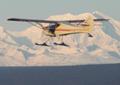
Last evening I was outside and a float plane flew overhead twice. Once outbound and again inbound. Based on the direction it flew I'm guessing it was the one referred to in this article.
https://www.ktuu.com/content/news/Drone-float-plane-interrupt-Swan-Lake-Fire-aerial-operations-512667821.html

Perhaps he was using Garmin Pilot or some other device that didn't display the TFR correctly. Hard to imagine the month that TFR has been in affect that any pilot around here wouldn't know about it.

I usually fly with Garmin Pilot. I would have violated the TFR.

Believe I'll forward these on the both the FAA and the Fire Incident Commander.

Image

Image
Barnstormer offline
Posts: 2700
Joined: Sun Oct 14, 2012 7:42 am
Location: Alaska
Aircraft: C185

Re: Graphic TFR's- Don't Trust Them

Phil,

Good for you for following up with Garmin on this, and it'd be worth talking to the FAA. Regardless, there's no excuse for violating a TFR, but, it sure couldn't hurt if the float pilot was indeed using Garmin Pilot.

Very good catch. I always look at TFRs and give them a wide berth if at all possible.

I know of one case, a few years back, where a plane flew through a TFR, based on using Foreflight. He was reported by the fire folks, and cited by the FAA. His assertion was that the TFR wasn't depicted on his moving map.

It turned out that the TFR had actually expired ten or fifteen minutes prior to his entering the area. That was the end of FAA participation.

But, if you see smoke, stay a long ways away.

MTV
mtv offline
Knowledge Base Author
User avatar
Posts: 10514
Joined: Sat Feb 25, 2006 1:47 am
Location: Bozeman

Re: Graphic TFR's- Don't Trust Them

I've notified the FAA, the Fire Management Coordinator, and Garmin. Some friends and the local EAA Chapter.
Barnstormer offline
Posts: 2700
Joined: Sun Oct 14, 2012 7:42 am
Location: Alaska
Aircraft: C185

Re: Graphic TFR's- Don't Trust Them

It looks like when they expanded the TFR that garmin only included the expanded area and did not retain the original area as well. Thanks for the heads up Mr!!
akavidflyer offline
User avatar
Posts: 521
Joined: Sat Nov 20, 2010 7:36 pm
Location: Soldotna AK

Re: Graphic TFR's- Don't Trust Them

Barnstormer wrote:I've notified the FAA, the Fire Management Coordinator, and Garmin. Some friends and the local EAA Chapter.


Last year (and every year prior that graphical TFRs were posted either online or available on various apps) I've found several depiction errors. So far the ONLY ways I've found to catch these errors are to read the TFR description OR call 1-800-WXBRIEF and ask the briefer to read me the NOTAM for any TFR within 20 nm of my route. Here's just one example from 2018: Last summer a pair of large fire TFRs NW of Grants Pass, OR were connected by a third TFR that acted as a transit corridor for fire suppression traffic. The altitudes shown in the app for the transit corridor were seriously wrong. The app pop up for the transit TFR said the altitudes in the TFR were "Surface to 8000 feet". The TFR NOTAM said "8,000 to 9,000 feet". Big 'oops'. And yes, I gave the FAA, Liedos, and the app company a heads up. It still took 'em awhile to fix it.
PapernScissors offline
Posts: 419
Joined: Sun Mar 06, 2016 8:49 pm
Location: Spokane
Aircraft: Cessna 172

Re: Graphic TFR's- Don't Trust Them

Keep in mind that the FAA doesn't even know how to provide accurate, up to date TFR information on their own TFR website.

https://tfr.faa.gov/tfr_map_ims/html/index.html

"Pilots should not use the information on this website for flight planning purposes."

It's a perfect distillation of the hot, oozing, sclerotic, irrelevant, uncontrolled bleed-out mess that the FAA is today (and getting less relevant by the day).

A successful TFR system is one in which information can quickly and reliably be disseminated and made obvious to the most casual observer in real time.

The FAA hasn't been too concerned with success for at least a few decades or more.
lesuther offline
Posts: 1429
Joined: Fri Sep 24, 2010 1:26 pm
Location: CO

Re: Graphic TFR's- Don't Trust Them

Mr mustache Nevada fireman was way overly dramatic! Get off your high horse and put on your big boy pants. OHHHHHHHH a little airplane flew through our precious TFR. BFD!!!

I fly out of an airport (Pacific City) drones flying on the beach 300 yards from the runway. FAA says that is ok, because we aren't a towered airport. Personally, I'm more worried about the flocks of birds and deer on the runway.

Rant over.
OregonMaule offline
User avatar
Posts: 6977
Joined: Fri Sep 01, 2006 9:44 pm
Location: Orygun
My SPOT page

"They who can give up essential liberty to obtain a little temporary safety, deserve neither liberty nor safety". Ben Franklin
http://en.wikiquote.org/wiki/Benjamin_Franklin

Re: Graphic TFR's- Don't Trust Them

Again Garmin can't get TFR display correct. Check these out.

Image

Image
Barnstormer offline
Posts: 2700
Joined: Sun Oct 14, 2012 7:42 am
Location: Alaska
Aircraft: C185

Re: Graphic TFR's- Don't Trust Them

Barnstormer wrote:Again Garmin can't get TFR display correct. Check these out.

Image

Image


I have been looking at that TFR because Skyvector shows it lasting 3 days, while Foreflight shows it only for a few hours overnight...and we have a bunch of flights over there so I better figure out which is right...
Troy Hamon offline
User avatar
Posts: 913
Joined: Tue Apr 06, 2010 8:27 am
Location: King Salmon
FindMeSpot URL: http://share.findmespot.com/shared/face ... 04iX0FXjV2
Aircraft: Piper PA-22

Re: Graphic TFR's- Don't Trust Them

Troy Hamon wrote:
Barnstormer wrote:Again Garmin can't get TFR display correct. Check these out.

Image

Image


I have been looking at that TFR because Skyvector shows it lasting 3 days, while Foreflight shows it only for a few hours overnight...and we have a bunch of flights over there so I better figure out which is right...


Those rocket TFRs are notoriously inaccurate. There was one north of FAI which covered a huge bunch of airspace for night launch. They launched, then “lost” the rocket. Next day, I’m scud running north through Beaver Creek, and there, stuck in the ground like a huge lawn dart was a 50 foot long rocket, right on the creek.

I reported the location to the Range in FAI. They said thanks, they’d been looking within the projected impact area. The rocket was thirty miles outside the impact area, and only 50 ish miles north of Fairbanks. So much for a rocket “impact area”.

MTV
mtv offline
Knowledge Base Author
User avatar
Posts: 10514
Joined: Sat Feb 25, 2006 1:47 am
Location: Bozeman

Re: Graphic TFR's- Don't Trust Them

That's hilarious Mike. Apparently it hasn't gotten any better since you were up here. "I shot a rocket into the air, where it fell no body can tell." Last month when I was in Fairbanks I saw this poster

Image
Barnstormer offline
Posts: 2700
Joined: Sun Oct 14, 2012 7:42 am
Location: Alaska
Aircraft: C185

Re: Graphic TFR's- Don't Trust Them

Yeah, apparently, rocketry in Alaska isn't quite as precise as it is in Florida. Good to see Kathe is still the point of contact for lost rockets.

The other deal they did once was issued a TFR for a launch, which was to take place at night, but they didn't specify that in the TFR.

So, next day, everybody was flying within that huge TFR.......

Five days later, everybody was STILL flying within that huge TFR. I called Flight Service and suggested they might want to call the rocket range and ask them if they really intended their TFR to be perpetual.

It was gone a couple hours later. Great....train pilots to ignore TFRs.

MTV
mtv offline
Knowledge Base Author
User avatar
Posts: 10514
Joined: Sat Feb 25, 2006 1:47 am
Location: Bozeman

DISPLAY OPTIONS

12 postsPage 1 of 1

Who is online

Users browsing this forum: No registered users and 0 guests

Latest Features

Latest Knowledge Base