Landing at all CA Public Airports
Thu Sep 18, 2008 6:24 pm

Wed Sep 24, 2008 7:14 pm
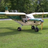
Hi all, today I flew for about 5 hours and landed at 14 California airports, including Clarksburg! See buzzlatka's photo above Here's the rundown:
MCC McClellan: GIANT slab. Made me want to puke!
L36 Rio Linda: Small field, lots of little hangars and tailwheel planes!
EDU Davis University: Antique tractor museum on field.
2Q3 Yolo County: BIG runway. Yawn.
2O3 Angwin: Airport run by 7th day adventists, Saturday is out!
STS Santa Rosa: Control tower, museum and flying warbirds.
O69 Petaluma: Great food at the Two Niner Diner. I know I'm taking a chance on disclosing this here, but my San Francisco sectional blew out of door. I saw it in middle of taxiway on departure. Probably get CA litter fine.
DVO Gnoss: Bought new San Francisco sectional chart.
0Q3 Schellville: DC3's, other warbirds, close to Infineon raceway.
0Q9 Sonoma Skypark: Turned and burned, not much of interest.
APC Napa County: Another control tower slab.
CCR Concord: See above description. LOTS of planes based here.
O88 Rio Vista: OK airport out in the flats
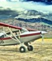
CN13 Clarksburg-Borges: Highlight of day, landing on grass!!! There was ramshackle hangars, 3 Funk airplanes, a J-3, cool old houses and who knows what treasures in the big hangar?!?
Rio Linda

Angwin

Former NAAS Santa Rosa, fighter, torpedo bombers WW2/Korea

Mothball Fleet Suisun Bay

MCC McClellan: GIANT slab. Made me want to puke!
L36 Rio Linda: Small field, lots of little hangars and tailwheel planes!
EDU Davis University: Antique tractor museum on field.
2Q3 Yolo County: BIG runway. Yawn.
2O3 Angwin: Airport run by 7th day adventists, Saturday is out!
STS Santa Rosa: Control tower, museum and flying warbirds.
O69 Petaluma: Great food at the Two Niner Diner. I know I'm taking a chance on disclosing this here, but my San Francisco sectional blew out of door. I saw it in middle of taxiway on departure. Probably get CA litter fine.
DVO Gnoss: Bought new San Francisco sectional chart.
0Q3 Schellville: DC3's, other warbirds, close to Infineon raceway.
0Q9 Sonoma Skypark: Turned and burned, not much of interest.
APC Napa County: Another control tower slab.
CCR Concord: See above description. LOTS of planes based here.
O88 Rio Vista: OK airport out in the flats
CN13 Clarksburg-Borges: Highlight of day, landing on grass!!! There was ramshackle hangars, 3 Funk airplanes, a J-3, cool old houses and who knows what treasures in the big hangar?!?
Rio Linda
Angwin
Former NAAS Santa Rosa, fighter, torpedo bombers WW2/Korea
Mothball Fleet Suisun Bay
Fri Oct 24, 2008 6:51 pm
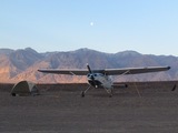
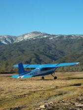
Hi all, today I hit 14 CA airports including the COOLEST CA public airport, 1C9 Frazier Lake, featuring a grass runway and a water runway!

I started out from Minden to Modesto, where I filled up with $4.22 100LL, the lowest price I've seen for awhile. This airport was right in my flight path:
O27 Oakdale!

I did not have time to collect my Coke. Upon leaving MOD I did what I can only describe as an "extremely low pass" at former NALF Crows Landing. Chart shows airport closed, but runways are not X'd, hmmm. From there Gustine, an old cropduster strip, then to South County which I think was Morgan Hill or Gilroy airport, Frazier Lake, Hollister with hangars full of warbirds, glider activity and fire fighting planes. Marina, which was Fort Ord airport, then along the Monterey Bay shorline to Watsonville, Half Moon Bay, and then the super-busy airports of: Palo Alto, Hayward and Livermore. Finally Byron and then home. I'll go back to Frazier Lakes grass strip with a tent and stay awhile next time!
Anyway, I'm up to 159 CA public airports including 76 in the Husky.
Bronco at CVH Hollister Muni

I started out from Minden to Modesto, where I filled up with $4.22 100LL, the lowest price I've seen for awhile. This airport was right in my flight path:
O27 Oakdale!
I did not have time to collect my Coke. Upon leaving MOD I did what I can only describe as an "extremely low pass" at former NALF Crows Landing. Chart shows airport closed, but runways are not X'd, hmmm. From there Gustine, an old cropduster strip, then to South County which I think was Morgan Hill or Gilroy airport, Frazier Lake, Hollister with hangars full of warbirds, glider activity and fire fighting planes. Marina, which was Fort Ord airport, then along the Monterey Bay shorline to Watsonville, Half Moon Bay, and then the super-busy airports of: Palo Alto, Hayward and Livermore. Finally Byron and then home. I'll go back to Frazier Lakes grass strip with a tent and stay awhile next time!
Anyway, I'm up to 159 CA public airports including 76 in the Husky.
Bronco at CVH Hollister Muni
Last edited by onthegas on Sat Oct 25, 2008 9:50 am, edited 1 time in total.
Fri Oct 24, 2008 9:03 pm
[quote="onthegas"]Hi all, today I hit 14 CA airports including the COOLEST CA public airport, Frazier Lake, featuring a grass runway and a water runway!
You're right! Used to fly down there from Napa airport, just to play on their smooth and irrigated grass . . . and to talk with the friendly folks you meet there.
bumper
You're right! Used to fly down there from Napa airport, just to play on their smooth and irrigated grass . . . and to talk with the friendly folks you meet there.
bumper

bumper
Minden, NV
Husky A1-B
Minden, NV
Husky A1-B
Sat Oct 25, 2008 9:04 am

vail
Sat Oct 25, 2008 9:34 am
I landed a spaulding about a year ago while diverting around some valley fog. It was real windy that day and we walked to a general store and had an ice cream and plotted out the rest of the trip.
Pretty much nothing but a portapotty on the field though.
Pretty much nothing but a portapotty on the field though.
- m7flyer offline
- Posts: 353
- Joined: Tue May 09, 2006 11:27 am
- Location: WHP, OG41
- FindMeSpot URL: http://share.findmespot.com/shared/face ... t7FIHuMd0G
Sat May 02, 2009 1:19 pm
Re: Landing at all CA Public Airports
Hi All,
Been awhile since I've got to do any CA airport collecting but last week I went on a bender and managed to bag 34 new airports bringing my total to 199. I would've had a good even 200 but Rosamond was closed while repaving. Here's the new ones:
Stovepipe Wells, Furnace Creek (First time to Death Valley: incredible), Shoshone, Baker, Barstow-Daggett, Southern CA Logistics (Victorville, former George AFB), Hesperia (cheap gas, good eats), Lake Arrowhead (still not sure if that's a public field or not...), Yucca Valley, Roy WIlliams-Joshua Tree (Dirt, yeah!), 29 Palms, Chemehuevi Valley, Desert Center, Chiriaco Summit (overflew the old Rice airfield also used in WW2 Desert Warfare training center and saw tank tracks), Salton Sea, French Valley, Perris Valley (sorry about dusting out the Otter!), San Bernardino (former Norton AFB), Rialto, Cable, Whiteman, Santa Paula, Oceano, New Cuyama, Tehachapi Mountain Valley, Mojave, California City, Trona, Lone Pine, Independence, and Bishop.
I stayed over at Imperial County Airport at the Airporter Inn. There is a new La Hacienda restaurant in Imperial within a 10 minute walk from the airport. You oldtimers may remember an eat joint by the same name right on the field that was really great but torn down many years ago. The new place has the same great food: shredded beef tacos and special quesadillas and more! I gave my nephew a tailwheel endorsement while in Imperial. We flew along the border out to Ocotillo and landed at a dirt strip in El Centro. Sad to see McConnell airport, a duster strip on the south side of Brawley lost to yet another WalMart.
The third night of the trip found me at Santa Maria's Radisson. Really nice hotel with view of plane on ramp out my third floor window! Now that I have just over 100 hours in the bird I feel pretty good about getting into some backcountry strips and will get to do some on my flight this summer to/from EAA Arlington fly-in this July. Hope to see some of you there.
Sat May 02, 2009 6:52 pm
Re: Landing at all CA Public Airports
Cool thread, I missed this the first time by.
I Minnesota, they have a program like this, they even have passport books and rubber stamps at each airport.
Have fun with your list!!
I Minnesota, they have a program like this, they even have passport books and rubber stamps at each airport.
Have fun with your list!!
Sat May 02, 2009 9:41 pm
Re: Landing at all CA Public Airports
Since this new version of PHPBB doesn't allow you to post direct HTML for security reasons, you must now use BBCode to post your Google maps. It's pretty simple though, and I updated the tutorial.
- Zzz offline


- Posts: 2854
- Joined: Fri Oct 08, 2004 11:09 pm
- Location: northern
- Aircraft: Swiveling desk chair
Half a century spent proving “it is better to be thought a fool than to open your mouth and remove all doubt.”
Sat May 02, 2009 10:41 pm
Re: Landing at all CA Public Airports
[googlemap]http://maps.google.com/maps/ms?ie=UTF8&hl=en&msa=0&msid=104091008394151354949.000468f7caab81b20fa68&ll=42.455888,-108.061523&spn=13.547348,39.550781&z=5[/googlemap]
My map. Just a start. Green is turf.
My map. Just a start. Green is turf.
- OregonMaule offline

- Posts: 6977
- Joined: Fri Sep 01, 2006 9:44 pm
- Location: Orygun
My SPOT page
"They who can give up essential liberty to obtain a little temporary safety, deserve neither liberty nor safety". Ben Franklin
http://en.wikiquote.org/wiki/Benjamin_Franklin
"They who can give up essential liberty to obtain a little temporary safety, deserve neither liberty nor safety". Ben Franklin
http://en.wikiquote.org/wiki/Benjamin_Franklin
Mon May 04, 2009 2:43 pm
Re: Landing at all CA Public Airports
Here's my up-to-date California public airports "been there" map:
[googlemap]http://maps.google.com/maps/ms?ie=UTF8&hl=en&msa=0&msid=114910891760836813293.000456470df69fc3b1d8e&t=h&z=6[/googlemap]
[googlemap]http://maps.google.com/maps/ms?ie=UTF8&hl=en&msa=0&msid=114910891760836813293.000456470df69fc3b1d8e&t=h&z=6[/googlemap]
Tue May 05, 2009 12:20 pm
Re: Landing at all CA Public Airports
[googlemap]http://maps.google.com/maps/ms?ie=UTF8&hl=en&msa=0&msid=101818750016433346721.0004691f9f7b73cd032f0&t=h&ll=38.169114,-107.929687&spn=0.328219,1.713867&z=7[/googlemap]
- shortfielder offline
- Posts: 2350
- Joined: Sun Mar 05, 2006 7:14 pm
- Location: Durango, Colorado
- FindMeSpot URL: http://share.findmespot.com/shared/face ... D263l9HKFb
If you want to go up, pull back on the controls. If you want to go down, pull back farther.
My SPOT page
My SPOT page
Mon Jun 22, 2009 7:48 pm
Re: Landing at all CA Public Airports
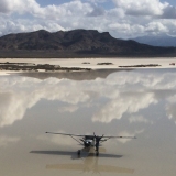
Hi All, today I added 6 more airports to my tally bringing the total to...205! 49 more to go. Today's airports: Tracy New Jerusalem, Tracy Muni, San Jose Reid-Hillview (no food on field), Turlock Muni, Mariposa-Yosemite (Airport Cafe and Bar (!) 5 minute walk...more like biker bar so I felt right at home there) and Pine Mountain Lake (Big $$$ hangar homes). Then I flew over some real backcountry over the Mokelumne Wilderness area on the way to Markleeville and then back to Minden.
USFS Heliport, I'm surprised that Bumper isn't parked next to the Helo!

Damn nice Dam, Donnell Lake, Middle Fork Stanislaus River, says Flynengr...verified by Google Maps

Iceberg Wilderness near Ebbets Pass, CA Hwy 4

Kinney Lakes, near Pacific Crest Trail, north of CA Hwy 4

"The Office"

Carson Valley, really green for 3rd week of June!

USFS Heliport, I'm surprised that Bumper isn't parked next to the Helo!
Damn nice Dam, Donnell Lake, Middle Fork Stanislaus River, says Flynengr...verified by Google Maps
Iceberg Wilderness near Ebbets Pass, CA Hwy 4
Kinney Lakes, near Pacific Crest Trail, north of CA Hwy 4
"The Office"
Carson Valley, really green for 3rd week of June!
Last edited by onthegas on Wed Jun 24, 2009 11:41 am, edited 1 time in total.
Tue Jun 23, 2009 6:40 am
Re: Landing at all CA Public Airports
Good stuff onthegas, keep it coming, and fly safe.
Rob
Rob
- OregonMaule offline
- Posts: 6977
- Joined: Fri Sep 01, 2006 9:44 pm
- Location: Orygun
My SPOT page
"They who can give up essential liberty to obtain a little temporary safety, deserve neither liberty nor safety". Ben Franklin
http://en.wikiquote.org/wiki/Benjamin_Franklin
"They who can give up essential liberty to obtain a little temporary safety, deserve neither liberty nor safety". Ben Franklin
http://en.wikiquote.org/wiki/Benjamin_Franklin
Tue Jun 23, 2009 2:18 pm
Re: Landing at all CA Public Airports
You know onthe gas, I thought that book laying on your office dash said "Right Guide" and I was thinking to myself "Well, I am glad he has the correct book with him!" 
Nice pictures!
Nice pictures!
- Skystrider offline
- Posts: 1232
- Joined: Wed Jan 24, 2007 1:44 pm
- Location: Saylorsburg
- Aircraft: Zenith CH701 w/ Jabiru 3300
Tue Jun 23, 2009 10:42 pm
Re: Landing at all CA Public Airports
Onthegas,
Wish I could help you with absolute certainty regarding the name of the lake, but if I had to take my best guess it looks like Donnell Lake, it is about 3 mi SE of Spicer. Spicer is an earthfill dam, and the terrain flattens out considerably on the north side (where the campground/boat ramp is). Do you have your SPOT track linked somewhere?
Flynengr
BTW keep up the good work, I have just passed my 90th CA public airport earlier this month.
Wed Jun 24, 2009 11:38 am
Re: Landing at all CA Public Airports
Flynengr, you have a really good eye! Yes, the photo is indeed that of Donnell Lake and I will correct the caption.  Thanks!
Fri Jul 24, 2009 2:03 pm
Re: Landing at all CA Public Airports
I now have only 30 airports to go for all the CA Public Airports! On July 10 I took off from Minden and landed at Willows CA for a fuel top off and breakfast at Nancy's Airport Cafe. The chicken fried steak and eggs would have to hold me until dinner at Bel Di's on the Rogue River. I had intended landing at Crescent City and the Arcata Eureka area airports but was stymied by fog. Same thing happened the next day, fog until just north of Shelter Cove, then OK down the coast to Little River. Made 19 more CA airports with 1 new OR airport (Illinois Valley) and 3 other landings for fuel/food/stayover (Beagle Sky Ranch OR).
Day 1: Minden to Willows (food/fuel) Upper Lake Gravelly Valley, Round Valley Covelo, Ruth, Hayfork, Hyampom, Dinsmore, Hoopa, Happy Camp, Gasquet, Illinois Valley, Beagle Sky Ranch (food, stay overnight, ride motorcycles).
Day 2: Garberville (some fuel), Shelter Cove, Little River, Willits, Ukiah, Boonville, Ocean Ridge, Healdsburg, Cloverdale, Lampson and Davis (top off fuel), Minden.
Long way back to catch Crescent City, and other 5 other coast airports. Will look for good wx forecast or get instrument current!
DISPLAY OPTIONS
Who is online
Users browsing this forum: No registered users and 0 guests
Latest Features
-
Live to Tell
A Minnesota pilot is surprised to learn that the sudden asymmetric drag of an out-of-rig ski can…Read More -
Creators
Working in some of the Yukon's most beautiful and remote environments, photographer Simon Blakesley captures aircraft in…Read More -
Aircraft Ownership and Maintenance
Upgrading to big tires can make a huge difference in backcountry performance, but with those gains come…Read More -
Tales from Yesteryear
In this tale from bush flying yesteryear, Don Cogger signs up to help Atlee Dodge Jr recovery…Read More


Latest Knowledge Base
-
Destinations
A regional guide with ideas for winter camping destinations in California, Nevada, New Mexico, and Arizona.Read More -
Aircraft
Finding an affordable aircraft that can handle the backcountry for $80K or less? A challenge for sure, but with the…Read More -
Aircraft
01.29.2018 - Zane - Updated tire diameter graphic to add 8.50x10 Guide to tires for use in the backcountry and off-airport landing…Read More -
Pilots
12.22.2013 - Initial article format Operating aircraft on skis and negotiating a snow-covered landscape is an entirely unique skillset and environment.…Read More


