Sun Sep 02, 2012 11:08 pm
Have been back and forth a few times lately, but failed to get any photos posted. Yesterday and today I didn't get many photos and haven't looked at any yet.
Today's trip was an early start, as soon as there was any hint on the webcam of the pass opening, in order to get through the mountains before the present ugliness moved in...
Here is the Area Forecast for the Cook Inlet/Susitna Valley
COOK INLET AND SUSITNA VLY AB...VALID UNTIL 03Cook 1400
...CLOUDS/WX...
***AIRMET MT OBSC***MTS OCNL OBSC IN CLOUDS AND PCPN. NC... OTRW
SCT015 BKN-SCT045 BKN090 TOPS FL300. OCNL VIS 5SM -RA. VCY AK RANGE
AND W SIDE OF COOK INLET OCNL BKN015 VIS 3SM -RA BR ISOL CIGS BLW
010 VIS BLW 3SM -RA BR. TURNAGAIN AND OVR HYR TRRN SFC WIND
SE 30G60 KTS. FM THE ANCHORAGE AREA TO THE MATANUSKA VLY AREAS OF
SFC WIND SE 20G40 KTS.
OTLK VALID 031400-032000...VFR SHRA WIND. VCY AK RANGE AND W SIDE
OF COOK INLET MVFR CIG RA.
PASSES...LK CLARK...MERRILL...RAINY...IFR CIG RA BR.
WINDY...MVFR CIG RA. PORTAGE...IFR CIG RA BR. ALL PASSES TURB.
...TURB...
***AIRMET TURB***OCNL MOD TURB BLW 120. NC...
***AIRMET LLWS***AREAS OF LLWS. NC...
...ICE AND FZLVL...
ISOL MOD RIME ICEIC BTN 100-FL200. FZLVL 050 N TO 090 S. BY 14Z
ALL AREAS FZLVL 080.
And for Bristol Bay:
BRISTOL BAY AH...VALID UNTIL 031400
...CLOUDS/WX...
***AIRMET STG SFC WIND***NE PAIG SUSTAINED SFC WND 30KTS OR GTR.
INTSF...
***AIRMET IFR***NW PAKN OCNL CIG BLW 010/VIS BLW 3SM -RA BR. NC...
***AIRMET MT OBSC***MTS OCNL OBSC CLDS/PCPN. NC... OTRW
NW PAKN SCT002 BKN015 BKN-OVC030 TOP FL180/VIS 3SM -RA BR.
ELSW SCT020 BKN035 BKN-OVC070 TOP FL180/-RA.
ISOL BKN020/VIS 4SM -RA BR.
NE PAIG SFC WND E 30G40 KTS.
ELSW SFC WND INCRG E-SE 20G30 KTS.
OTLK VALID 031400-032000...IFR CIG RA BR WND.
...TURB...
***AIRMET TURB***OCNL MOD TURB BLW 060. W PAIG ISOL SEV TURB WI
020AGL. NC...
***AIRMET LLWS***AREAS OF LLWS. NC...
...ICE AND FZLVL...
***AIRMET ICE***OCNL MOD RIME ICEIC BTN 080-FL180.
FZLVL 080. WKN FM S...
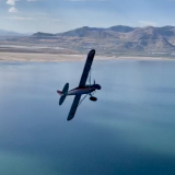
Major suckiness. The passes went IFR, but they started the day that way as well. But the winds weren't forecast to hit Iliamna until 10 am, so my goal was to get to Iliamna by 10, with the idea that it wouldn't hit in the mountains before it got to Iliamna. But with the weathercams in Lake Clark showing white cotton candy at sunrise this morning, I wandered around the Merrill Field airport manager's office and waited for better showings. No joy looking at Merrill Pass, Beluga indeterminate, the AVO weathercam showing good conditions on Augustine Island, but with no view of the mountains of the Aleutian Range, so not very helpful. After 7:40 the east entrance webcam at Lake Clark showed clear all the way to the coast with scattered clouds below, and great visibility, and the west webcam had been good the entire time, so I launched. Climbed to 4000 feet nearing the entrance, and could see that the layer below that had been socking the pass in was dissipating. Sure enough, I went through up high while somebody came through the other way down low, with a few scattered clouds in the 3000 ft range dissipating in the first 15 miles.
But when I came out the west end, visibility was dropping, probably around 10 miles, and occasional mist/rain was the primary obvious reason. The pass got a bit bumpy toward the western end, and I started to descend to stay under the clouds, emerging onto Lake Clark at 3000 feet, and then descending steadily as I went down the pass.
When I advised Port Alsworth traffic of my location, one of my friends called up...I had called in yesterday on a trip to take the kids home from the Fair, and raced back in the evening for the second load, which was happening now. He said..."Hey Troy, you haven't moved since yesterday!"
So I responded..."Slow airplane."
"All right..."
Around the end of Lake Clark where it dumps into Sixmile Lake I was at around 1800 feet and found the moderate turbulence that was in the area forecast. After a few exciting moments, I found myself in an elevator heading up up up, and it was starting to look like I was heading into a the bottom of a cloud if I didn't do something, so I cut the power completely, pulled on carb heat, and established a rapid descent. After that, the next 20 miles were full of excitement, but it got better as I got lower, so I settled in at around 800 feet after that. From there, the visibility was poor for a few miles along Lake Iliamna, but not bad, and I landed in King Salmon with wind 12012G20, not bad really.
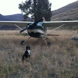
But no photos.