Backcountry Pilot • One missing near Johnson Crk/Yellow Pine

One missing near Johnson Crk/Yellow Pine

Debrief, share, and hopefully learn from the mistakes of others.
346 postsPage 13 of 181 ... 10, 11, 12, 13, 14, 15, 16 ... 18

Re: One missing near Johnson Crk/Yellow Pine

soyAnarchisto wrote:Did this plane have a 430 on it? If he was IFR rated - would he be flying only w/ the low altitude charts and not a VFR sectional?

Perhaps he is a Montana pilot? Is Dale a middle name?

Or maybe from Utah. Some of the news articles are coming from SLC.

Also, I might be confused again. But Flightaware had them going to Salmon, ID, not Montana like mentioned?
58Skylane offline
User avatar
Posts: 5297
Joined: Thu Oct 11, 2007 12:36 pm
Location: Cody Wyoming

Re: One missing near Johnson Crk/Yellow Pine

So I don't really post here, I’m actually not sure if I ever have, I figure I don't usually have much to add but I regularly follow the forum. Since this search started I've been following this thread and keeping up with the search efforts. Some of my snowmobiling/RZRing friends have been involved with the ground search since this started. Just for some more information about what’s been going on I figured that I would add a couple links to the search information that the family has been updating regularly.

Surprisingly some people have been able to find some things on the satellite imagery that has turned out to be planes involved in the search that were in the air when the pictures were taken. When you look at what people are finding, it’s pretty impressive that they were able to point out anything with the terrible image quality from the satellites. Here is a link to the Facebook group that the family is monitoring and people are posting screen shots of what they are seeing.

https://www.facebook.com/groups/5916098 ... 827578590/
Some are a little farfetched but some have some merit. Those of you with a lot of knowledge of flying in that area may be able to provide some insight to the people reviewing the images. Most of them are not pilots and they have some questions on emergency procedures etc. that Dale would have followed as they try to focus on an area to search. It sounds like ATC was trying to give him directions to get to Johnson Creek. The last radio transmission was 17 seconds after he declared engine trouble. ATC told him to make a right turn. Dale never responded and went off radar about that same time. The family feels like he would have made a left turn for normal traffic(if thats even normal traffic) into Johnson Creek (he was at the north end of the field and may have thought that the approach would have been shorter if he turned left) and is not sure if he ever received the ATC directions to turn right since he did not respond.

The site the family is using to update on the search and provide as much information as they know is here.
https://sites.google.com/site/searchfordalesplane/home

There is information on his plane complete with pictures of the instruments is posted on that site. It sounds like there are quite a few aircraft still being used to search the area but the ground search has scaled back significantly. Hope this helps answer a few questions I've seen asked on here.

In reference to the post above, the website says that he changed his flight plan mid-flight to Salmon Creek, Idaho(I'm assuming they mean KSMN as the flight plan says). Maybe due to the begining of mech problems, icing or someone had to pee. Not sure why he would have picked that airport instead of McCall if he was having problems??
JHG offline
Posts: 5
Joined: Thu Aug 11, 2011 11:52 am
Location: Montana

Re: One missing near Johnson Crk/Yellow Pine

Thanks for the update, this accident has a good amount of interest for many. Just hoping they find it for the sake of the family.

In reference to the J.C. traffic turns & direction. I can see him following an ATC suggested turn early on, especially with few other options available. I don't think he would be concerned with left or right traffic to the airport, just the most efficient way to get down.

That would all assume he was able to pick up the airport visually, which I think would be very hard with any cloud cover. That is reguardless of help from ATC or a GPS, factoring in high terrain just about all quadrants. I would think his problems may of been many before the J.C. airport was a viable option.
wiwarrior offline
User avatar
Posts: 33
Joined: Mon Feb 18, 2013 1:02 pm
Location: Wisconsin

Re: One missing near Johnson Crk/Yellow Pine

lowflyinG3 wrote:
On another note I have effected change in the interest of being able to be part of the solution in the future. I contacted Dan at ITD-Aeronautics and asked to be added to the SAR volunteer pilot list. He was very accommodating and informative about how SAR works in Idaho. I was cc'd in an email that went to my district coordinator asking that I be added. Last night I received an email from my district coordinator (NOT CAP, a county sheriff that happens to fly) with a pilot history form attached. I will have to attend training in Montana next October in order to go out on a search. They are also considering beginning a SAR training program right here in Idaho in the future. Again, although CAP is certainly involved in searches in Idaho, ITD-Aero is the point on the operation and the main coordinator of asset usage.
All seemed very cordial, inviting, and professional to me to this point but clearly these PRIOR preparatory steps are necessary if I expect to be allowed in later when something actually happens.


Just for your info the Montana search and rescue weekend is always early September. Next year it will be in Lewistown(LWT).
Bonanza Man offline
Posts: 909
Joined: Fri Jul 07, 2006 3:42 pm
Location: Seeley Lake

Re: One missing near Johnson Crk/Yellow Pine

On the Facebook page several of the people have posted pictures of what appears to be red smoke on a ridge top east of Johnson Creek. I asked a friend that's been working with the ground crew if anything had come of that lead and he said they are checking that area today. He did say that he’s not sure if anyone knows if they would have access to red smoke in a survival kit.
This brings me to my final and really only point I have to offer here as I don't want to lead the thread away from the topic. It's always a good idea to leave a list of what you are carrying with you in your survival kit somewhere where people have access to it. I spent a few years in the military working combat rescue(on the ground not as a pilot) in Iraq and Afghanistan and one thing we re-enforced to everyone in the squadron is carrying the standard equipment that was in our load list and using the standard protocol if something went wrong and you needed help. It greatly helps if the people that are looking for you to know what resources you have available...in a perfect situation...if there is such a thing. I'm now an avid snowmobiler and both fly and ride with mostly the same group of people. We have our SPOT's help button programed with each other’s numbers as well as their significant others phone numbers. We carry smoke and glow sticks with us when we ride and fly. Red means someone is hurt and purple means we are alive and can survive if someone needs to wait for weather or daylight to come help. This has only been used once but was a huge help when we found a friend that was lost in the Cooke City, MT area. We saw purple smoke from the air and we were able to tell the ground crew that they didn't need to pack a medical kit and stretcher in to the retrieve them. He waited a couple hours and then popped smoke when he heard aircraft circling overhead. If the HELP button is activated at the same time the 911 button is activated we have found that our friends can make it out and start looking long before S&R is dispatched and starts calling the shots. In a couple occasions we have used only the “help” button and it has kept our friends off the evening news. The nature of a snowmobiling is you are always screwed late in the afternoon and S&R cannot get mobilized while there is still daylight. Usually there is at least one cold night in the woods. You would also be surprised at what the military is willing to do to find you if they know what they are working with. I have spent many nights in the desert looking for people in the dark because we knew they were carrying IR strobe lights that we could see from the air at night. I carry the same strobe still today but you can remove the IR lens and have a white light strobe. Now in the civilian world, I have a list of what survival gear is in the plane tacked to a cork board in the hanger and in a note book in the top of my toolbox at home. My wife and friends all know where to find it if the call ever comes in to come find me.
JHG offline
Posts: 5
Joined: Thu Aug 11, 2011 11:52 am
Location: Montana

Re: One missing near Johnson Crk/Yellow Pine

Good post JHG. What are you using for smoke--standard grade fireworks stand stuff, or something more purpose-built?
RanchPilot offline
User avatar
Posts: 974
Joined: Mon Jan 24, 2011 5:18 pm
Location: Wyoming
Experience is the knowledge that enables you to recognize a mistake when you make it again.

RanchPilot Facebook Community: http://www.facebook.com/ranchpilot777

Re: One missing near Johnson Crk/Yellow Pine

Well unfortunately, there lies the problem with smoke. Law enforcement and military can still purchase M-18 smoke that is by far the best and has the largest volume of smoke. I think the 60MM is what most of us have. Ours have been around for a while(since my military days) and I hear that they are tough to get in the civilian market. The fuse is considered an explosive and regulated as such but I think this is a recent law. Boating stores and even paintball stores carry very similar products but have a little less smoke and don't burn as long. The chemical composition is different that the LE/Military grade but are honestly probably safer for carrying in an aircraft although I have jumped from and flown in several aircraft what are carrying large volumes of M-18/F-18 smoke. I've seen a few around that are smaller than the 60MM size and deploy smoke for a full 90 seconds. You don't have to have anything special to buy those. It’s probably worth a shot to ask someone in LE what it takes to get the real stuff now and if they can help you out. I have also heard of guys buying these and it looks like the fused ones burn for about 3 minutes but only come in white. I think I would take 90 seconds of red over 3 minutes of white.

http://www.firequest.com/smoke-generators.html

Search around on the internet and you can find a bunch of different types. Fire a few in the backyard and see what you think will work the best. I can tell you from experience that if you deploy an M-18 smoke grenade inside a HUMVEE you will quickly have to leave and redecorate the interior the color of the grenade. Probably want to keep the kids from playing with it in the backseat while you're flying.

You can try these guys and see what you need to buy them.
http://www.nonlethaltechnologies.com/SG-OV.htm

I know with Benchmade if you want to buy thier military/LE only products you just have to send them a copy of your military ID. If this is the same then a friend in LE might be able to help you out. There are some things that had to be purchased through our supply guys on a governement card and that might be the case with these.
JHG offline
Posts: 5
Joined: Thu Aug 11, 2011 11:52 am
Location: Montana

Re: One missing near Johnson Crk/Yellow Pine

Excellent info, tips, and update. Thanks JHG.
Grassstrippilot offline
Knowledge Base Author
User avatar
Posts: 3536
Joined: Wed May 31, 2006 6:17 am
Location: Syracuse, UT
FindMeSpot URL: https://share.garmin.com/WolfAdventures
Aircraft: Cessna 205

Re: One missing near Johnson Crk/Yellow Pine

We (Gadsden Air Corps) have played with many publicly available smoke canisters, I fly with a couple in my kit.

We use them to mark targets on the ground during our aerial resupply missions. (If we don't have someone on the ground, it's a sure way to get direction and estimate speed)

The ones we use burn for 4mins and put out something like 70,000cu/ft. Considered non-pyro. Not inexpensive, but being prepared rarely is.

We stock them and supply them for our pilots.

There are photos on our Facebook page.

Perhaps a new thread for SAR discussion is in order.

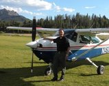
The GAC is all volunteer. We teach pilots how to interface with state/local responders. We also teach SAR skills, equipment recommendations, aerial resupply dropping, formation qualification (we do a lot of event/memorial flyovers).

We are new, but it's been very rewarding for me to be a part of it. I'm a much more aware and prepared aviator.

Find us at http://www.GadsdenAirCorps.com

You'll want to link to Facebook, lots more content there.

We meet every week with our guys here in Utah. If you are interested in getting something going in your area, we've done most of the startup work to help protect YOU as you engage in this effort.

What if we all were all trained in SAR? What if we all joined a nationwide network of aviators ready to provide a true FIRST response.

On our first actual search mission this last summer, we launched and located the target before state highway patrol chopper was even launched.

No red tape BS. Just get it done.

:)
Last edited by WilgaBeast on Thu Dec 12, 2013 7:50 pm, edited 1 time in total.
WilgaBeast offline
User avatar
Posts: 254
Joined: Sat Mar 24, 2012 7:54 am
Location: Riverton, Utah
FindMeSpot URL: http://share.findmespot.com/shared/face ... OvNBuHnxKg
Cory Robin
PZL 104 Wilga 35 'WilgaBeast'
http://wilgabeast.com

Re: One missing near Johnson Crk/Yellow Pine

Smoke is available at

http://sportsmoke.com/smoke-grenades/pa ... ke-grenade

70,000 cubic feet and 3-4min burn time.

PULL ring deploy.

Image

http://www.gadsdenaircorps.com
WilgaBeast offline
User avatar
Posts: 254
Joined: Sat Mar 24, 2012 7:54 am
Location: Riverton, Utah
FindMeSpot URL: http://share.findmespot.com/shared/face ... OvNBuHnxKg
Cory Robin
PZL 104 Wilga 35 'WilgaBeast'
http://wilgabeast.com

Re: One missing near Johnson Crk/Yellow Pine

The 26.5mm flare launchers (don't say gun, gets people anxious) have a fair variety of flares/smoke that can be used.

http://www.sportsmansguide.com/net/cb/n ... x?a=484008

They even have a parachute flare.

http://www.atlanticfirearms.com/compone ... l?Itemid=0
Swindler offline
User avatar
Posts: 80
Joined: Mon Apr 21, 2008 8:01 pm
Location: Logan
Aircraft: Cessna 140
Cessna 182
MH-60S Seahawk (2006-2017)

Re: One missing near Johnson Crk/Yellow Pine

Cary: 3U2 is on the 430W
Yup. Checked it last night and that's right.

As for what charts he might have carried, although it's not recommended, many IFR pilots carry only L charts. I always carried current WAC charts as well, except when I needed the extra clarity of a more detailed Sectional. Now the paper charts I carry are not current, as I'm relying on Foreflight for the most part, in addition to the database of the 430W. I have Foreflight in both my iPad Mini and iPhone (though I'd hate to have to navigate using the iPhone!

I can think of lots of places I don't want to be in IMC, and over the Idaho "wilderness" is high on the list. Even if icing wasn't an issue at all, losing an engine and trying to get down to a specific spot in the short time that would be available after breaking out of the cloud cover would be enormously difficult.

Realistically there is next to no hope of any survivors, but I can understand the angst of the family members. I hope that they can live with not knowing what happened for quite some time, because I think the likelihood of finding the Bonanza until next summer is pretty remote.

Cary
Cary offline
User avatar
Posts: 3801
Joined: Sun Jan 10, 2010 6:49 pm
Location: Fort Collins, CO
"I have slipped the surly bonds of earth..., put out my hand and touched the face of God." J.G. Magee

Re: One missing near Johnson Crk/Yellow Pine

JHG wrote:.......there are quite a few aircraft still being used to search the area but the ground search has scaled back significantly. Hope this helps answer a few questions I've seen asked on here.

In reference to the post above, the website says that he changed his flight plan mid-flight to Salmon Creek, Idaho(I'm assuming they mean KSMN as the flight plan says). Maybe due to the begining of mech problems, icing or someone had to pee. Not sure why he would have picked that airport instead of McCall if he was having problems??


I have been lurking for several days to see how this search pans out... I have a few comments...

1- After the recent snowfall the ground search is key to finding anything... With all the mountain sleds out there with VERY long tracks and paddled up, they can go just about everywhere.... Bookdocking through the trees is how the wreckage is going be found... They should invite EVERY snowmobiler within 100 miles to ride that country..

2- The 430 might show Johnson Creek but................... They can carry every map known to mankind and it won't do a bit of good because... when the motor fails or they iced it up and were coming down... The last thing a pilot would do is open a map and look for terrain... Without the Synthetic Vision our experiemental planes have and which the 430 DOESN'T.... He didn't stand a chance getting into Johnson Creek without hitting a ridgeline.. Especially if he had never been there before...IMHO...

Godspeed to the people on that plane... [-o<
Stol offline
User avatar
Posts: 1048
Joined: Wed Dec 07, 2005 8:32 pm
Location: Jackson Hole Wy

Re: One missing near Johnson Crk/Yellow Pine

so I have been doing a bit of research on this and looking at the data provided on the website for the family. I have found this.

- CAP mis-read the ELT which directed quite a bit of searching down south of his last known position (SHOCKING)
- The Ear witness heard the crash around the "stibnite" mine area. This is GREAT information. In looking at the area that the blackhawk helicopter covered, he didn't cover a ton of the stibnite mine area or the canyon to the north of his last known location. If I were in his shoes and lost an engine at 10,100 feet just northeast of Johnson Creek (pretty much due east of Yellowpine 2 or 3 miles) I would set it up for best glide ratio immediately. His heading was 035 according to the families website. He wouldn't have turned around and tried back for Johnson Creek. He has approximately 1500 feet of altitude and 4 miles east of Johnson Creek. Would you turn around? Your not going to clear the peak and how much altitude are you going to lose while turning around? You are going to continue straight. I would find a canyon and stick in that canyon as that gives me more time to try to get the engine running, find a better spot to land, etc. I think that this adds even more credibility to the ear witness.
- I believe that the ear witness needs to be interviewed and find out where he was standing when he heard the crash. Was it to the west, east, etc. from where the noise was coming from. Was it a crash, an explosion, a plane flying overhead, what kind of noise. Then go from there.

Does anyone know how much snow is on the ground up there? It doesn't look like much on the Johnson Creek webcam and with the weather being better in the next few days, maybe some of it will melt off.

Also does anyone know if the road into Stibnite is a good road that can be driven into, or is it snowmobile access only?

I am not familiar with the area, but the mountains around Stibnite are what need to be searched thoroughly and I am not sure that they were. Shocking that CAP messed this damn search up again and redirected how many people to the south looking for an ELT when it was a mis-reading. Another reason I am glad I left. We seriously need to start up a group of us to find these damn planes!
csstricker offline
User avatar
Posts: 67
Joined: Mon Jan 28, 2013 4:18 pm
Location: Ogden, UT
FindMeSpot URL: http://share.findmespot.com/shared/face ... HSiQDWEYn1

Re: One missing near Johnson Crk/Yellow Pine

csstriker you make some good observations. On sat the 13th I spent several hours searching the area between stibnite and Johnson creek. I over flew at 10,500 and it appeared a logical direction of search. My gps showed stibnite In a direct glide straight a head. The airport at Johnson creek was in good shape when I stopped to use the outhouse. The snow covered everything on the mountain sides. I hope to find time to go back and look some more . It feels like looking for a needle in a hay stack. All we can do is keep looking and praying.
Blown56 offline
Supporter
User avatar
Posts: 50
Joined: Wed Oct 10, 2012 10:00 pm
Location: Cottonwood Id.

Re: One missing near Johnson Crk/Yellow Pine

Blown56 wrote:csstriker you make some good observations. On sat the 13th I spent several hours searching the area between stibnite and Johnson creek. I over flew at 10,500 and it appeared a logical direction of search. .


Thank you. I wish I had some sleds and some friends to go up there and really cruise that mountain between Stibnite and Johnson Creek. I believe that is where they will be.

At 10,500 were you heading northeast? Would you have attempted to turn around for Johnson Creek or would you have gone straight towards Stibnite?

Thanks for the reply! I wish I wasn't 4 hours south. I would like to go up there and fly around, unfortunately I don't think I can afford it ;o(
csstricker offline
User avatar
Posts: 67
Joined: Mon Jan 28, 2013 4:18 pm
Location: Ogden, UT
FindMeSpot URL: http://share.findmespot.com/shared/face ... HSiQDWEYn1

Re: One missing near Johnson Crk/Yellow Pine

csstricker wrote:
Does anyone know how much snow is on the ground up there? It doesn't look like much on the Johnson Creek webcam and with the weather being better in the next few days, maybe some of it will melt off.

Also does anyone know if the road into Stibnite is a good road that can be driven into, or is it snowmobile access only?


I was in the neighborhood last weekend (1bout 20 miles south) getting a Christmas tree, at the same elevation as JC there was 5-7 inches on the ground.

The road to Stibnite is a pretty good dirt road but to my knowledge it is not plowed in the winter. A truck with good tiires/chains might be able to drive it, after the next storm probably not.
scottf offline
User avatar
Posts: 650
Joined: Fri Mar 23, 2012 9:56 am
Location: Meridian, ID
FindMeSpot URL: http://share.findmespot.com/shared/face ... cbQCpIqefS

Re: One missing near Johnson Crk/Yellow Pine

Interesting views of the countryside under the new photo section. http://www.midasgoldinc.com/s/photogallery.asp
n6zt offline
Posts: 49
Joined: Thu Mar 20, 2008 6:24 pm
Location: seattle, wa
Jim Wheat

Re: One missing near Johnson Crk/Yellow Pine

n6zt wrote:Interesting views of the countryside under the new photo section. http://www.midasgoldinc.com/s/photogallery.asp

I've been trying to keep a very close eye on the happenings up there. But heard it's may be tough to get through the permitting process because of the mines location and the rivers and creeks flowing out of that area.

From what I've read, there's supposedly a lot of gold and other minerals still there. If Midas was allowed to move forward, I think I remember reading that Stibnite could almost drawrf some of the largest gold mines in northern NV. But not sure if I believe that one. Maybe that's what Midas wants the investors to believe? I dunno. Sure hope so. I'd like to try to get a job there if it goes into production.
58Skylane offline
User avatar
Posts: 5297
Joined: Thu Oct 11, 2007 12:36 pm
Location: Cody Wyoming

Re: One missing near Johnson Crk/Yellow Pine

It's been 18 or 19 days since this plane went down. I am certain that all hope has now been extinguished from the hearts of the families and friends. :cry:

Deepest condolences to all those who loved these dear people.
norm offline
User avatar
Posts: 49
Joined: Mon Nov 26, 2007 6:59 pm
Location: Spokane, WA
Former CFII
Sold my 2001 Maule M7 260C
I wasn't ready to say goodbye:
http://www.shaunlunt.typepad.com

DISPLAY OPTIONS

PreviousNext
346 postsPage 13 of 181 ... 10, 11, 12, 13, 14, 15, 16 ... 18

Who is online

Users browsing this forum: No registered users and 0 guests

Latest Features

Latest Knowledge Base