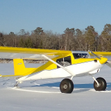
Hi all, this is my first posting so be kind. My dad, who is 88 and still flying, bought the very same Piper Vagabond I learned to fly in just this year. He lives in northern California and I'm in Indiana. So I went back home and flew the plane for the first time in 34 years. And yes I greased every landing! I'm not current but working on that. Not that I'm looking forward to the inevitable, but I'm going to need to fly this plane back to Indiana at some point in my life. We're talking 80kts and 6000' max altitude. How does one plan such a trip in an aircraft with short legs and limited altitude? All while playing by the LSA rules? I hope it's a trip dad and I can do together when hangs up his spurs. But you never know what tomorrow brings.
Thanks,
Jay
How do you plan a looooong cross country?
Sun Dec 23, 2018 2:57 pm
- beeryboats offline
- Posts: 8
- Joined: Fri Dec 21, 2018 5:51 pm
- Location: Brownsburg
- Aircraft: kitfox IV & Piper Vagabond
Sun Dec 23, 2018 4:18 pm
Re: How do you plan a looooong cross country?
Where in nor cal. I did a last May to Palm Springs area then on to Texas. Then to Florida up the east coast to New York then to home. But it was in a 182 so I could go a bit farther and a bit higher. Covered 7500 miles. Planned it as a bunch of short trips. Yours will be shorter. 6000 ft limit is a bummer.
You probably will need to head to southern cal then east from there. There was a book titles flight of Passage where two brothers flew to so cal from the east coast in a J-3. Study the charts and plan low.
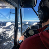
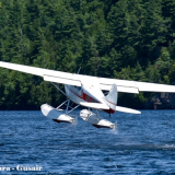
I took hundreds of pics but this was the best one. I flew solo

You probably will need to head to southern cal then east from there. There was a book titles flight of Passage where two brothers flew to so cal from the east coast in a J-3. Study the charts and plan low.
I took hundreds of pics but this was the best one. I flew solo
- qmdv offline

- Posts: 3633
- Joined: Wed Feb 15, 2006 10:22 pm
- Location: Payette
- FindMeSpot URL: http://share.findmespot.com/shared/face ... I5tqEOk0rc
- Aircraft: Cessna 182
Sun Dec 23, 2018 4:27 pm
Re: How do you plan a looooong cross country?
The best way to think of a long X/C is just as a series of really small short trips. Fuel stop to fuel stop. Be flexible, and dont have a huge agenda. No biggie.
Oh... and 6k is awfully high. LOL Stay low and enjoy!
Oh... and 6k is awfully high. LOL Stay low and enjoy!
- Bigrenna offline


- Posts: 2339
- Joined: Sun Sep 25, 2011 4:02 pm
- Location: New England
- Aircraft: C180H / C170B
www.bushwagoneast.com
www.avthreads.com
Sun Dec 23, 2018 4:30 pm
Re: How do you plan a looooong cross country?
Got an iPad? Get a subscription to ForeFlight. Basic flavor is all you need. Now, enter starting point, and destination. This will result in a magenta line.
Now, go out about as far as you’re comfy flying that plane, based on gas. Look around the line, and look for airports with gas. Rubber band the magenta line to that airport. Now, go down the track another distance close to fuel range, and look close to the line for airports with fuel, and rubber band the route to that airport. Repeat till you’re there.
ForeFlight makes this so easy it’s silly. Buy an iPad if you don’t have one. Really, it’s worth it.
MTV

Sun Dec 23, 2018 4:34 pm
Re: How do you plan a looooong cross country?
Welcome. You two sound like old stick and rudder guys who should have no trouble with the long, multi-day cross country. With patience and tailwinds, natural wind energy should take you over the southern Sierras and southern Rockies. Attempt climbing in updrafts and always know which way is down drainage. Maneuver so as to always have an easy descending turn to the nearest drainage. With small engine energy, the danger is attempting to maintain altitude in downdrafts. Take the upwind ridge and be willing to make the descending turn down drainage and out the other way if ridge lift won't safely get you over the pass.
If you plan your route with the above in mind, you may well have to descend out of 10,000 to get gas. Landing on a secondary road and hitching a ride to get gas is always a safe option. Lay up, airport is best, behind any bad weather and go again when ahead is good again.
Great adventure. I have been there many times.
- contactflying offline
- Posts: 4972
- Joined: Wed Apr 03, 2013 7:36 pm
- Location: Aurora, Missouri 2H2
Download my free "https://tinyurl.com/Safe-Maneuvering" e-book.
Sun Dec 23, 2018 4:36 pm
Re: How do you plan a looooong cross country?
Yep, get ForeFlight set up with the planes performance info, then set the map where it shows 100LL prices. I brought an Ag Cat from Georgia to South Texas in one day that way. 11 hours of 1.5-2 hour legs at 100 mph, got to see some different country in a fun way.
- CenterHillAg offline

- Posts: 204
- Joined: Sun Nov 09, 2014 3:13 pm
- Location: Texas Coast
- Aircraft: J3 Cub
'56 182
Sun Dec 23, 2018 4:42 pm
Re: How do you plan a looooong cross country?
I just picked up on the Northern California start point. With most prevailing westerly winds, you can go on course to first range, use that ridge system on southerly heading until high enough to cross, beyond, return to course and continue to next range, ridge ride south, etc etc. Will probably have to go down for gas between ranges.
- contactflying offline
- Posts: 4972
- Joined: Wed Apr 03, 2013 7:36 pm
- Location: Aurora, Missouri 2H2
Download my free "https://tinyurl.com/Safe-Maneuvering" e-book.
Sun Dec 23, 2018 5:10 pm
Re: How do you plan a looooong cross country?
I have flown my 172A from FL to MD. MD to northern MN. Northern MN to south AZ. AZ to East GA. GA to MN. All these flights were with paper maps (sectionals) and no nav aids other than the occasional VOR bearing. I would mark out the entire route on the sectional with a higlighter, write distances and frequencies needed for nav/com. I also kept a note pad with all the bearings and airport info in the order I would get to them.
I did have a handheld GPS that was my hunting/hiking unit (Garmin 12) for the flight from Douglas AZ to Augusta, GA. But it wasn't usable for a major portion of the flight due to the system being shut down (this was in 2002). All the flying was seat of the pants and in no hurry. I did what has been mentioned, planned the flight according to fuel stops. There can be a huge difference if fuel prices at airports within a few miles of each other. Yes, just a bunch of short flights taken one after another. Some of the best times you can have!!
I did have a handheld GPS that was my hunting/hiking unit (Garmin 12) for the flight from Douglas AZ to Augusta, GA. But it wasn't usable for a major portion of the flight due to the system being shut down (this was in 2002). All the flying was seat of the pants and in no hurry. I did what has been mentioned, planned the flight according to fuel stops. There can be a huge difference if fuel prices at airports within a few miles of each other. Yes, just a bunch of short flights taken one after another. Some of the best times you can have!!
Last edited by WWhunter on Mon Dec 24, 2018 7:10 pm, edited 1 time in total.

Sun Dec 23, 2018 5:20 pm
Re: How do you plan a looooong cross country?
SkyVector on the internet is a really good cross country planner. That is what I used to plan my long trip last May. Then Avare on a tablet for the flying.
- qmdv offline
- Posts: 3633
- Joined: Wed Feb 15, 2006 10:22 pm
- Location: Payette
- FindMeSpot URL: http://share.findmespot.com/shared/face ... I5tqEOk0rc
- Aircraft: Cessna 182
Sun Dec 23, 2018 6:43 pm
Re: How do you plan a looooong cross country?
Why no higher than 6000'? A Vagabond has a 10,000' service ceiling, fully loaded. Run light, and you can easily fly higher. It's a whole lot easier making the flight over the rocks if you can get up there.
As for planning, you can plan as you go, as has been suggested, using ForeFlight. I prefer to plan it out in advance, though. I plan each leg, with the understanding that the subsequent legs after the first one are likely to need tweaking--maybe a different destination, perhaps an unplanned layover.
The biggest problem with looooooooong cross countries is that the weather changes, sometimes dramatically, from the time it was checked before departure. So if you don't have cockpit weather, you'll need to check it carefully at each stop. But you can get a general flavor for the weather by looking at the big picture--and quite honestly, often TV weather is better for that than aviation-specific weather. Are there storms moving onto the west coast? How long is it between storms across the country? How fast are the storms moving? That's the big picture stuff. Then when you have the big picture and decide on your window of opportunity, nail the weather more specifically for each leg as you prepare to fly it.
Cary

"I have slipped the surly bonds of earth..., put out my hand and touched the face of God." J.G. Magee
Sun Dec 23, 2018 7:04 pm
Re: How do you plan a looooong cross country?
Foreflight, and schedule flexibility.
Last weekend, TJ (TxAgFisher) and I flew his new 180 home from Minneapolis. One fuel stop, no issues, perfect weather.
On Tuesday I flew from CO to KY, 2 fuel stops, dodged iffy weather, set back a few hours by a blown tire in Missouri.
I typically choose fuel stops by fuel prices in Foreflight, however that usually means rinky dink unmanned airports. An FBO/mechanic sure would have been nice when I blew a tire, though. For reference, a fuel price difference of $0.25/gal would only have been $25 over my 1000 mile, 8 hour trip. $25 isn't too much. However, at one of my cheap fuel stops, I happened to meet another BCP'er (ShadowAviator) who then notified me of an airport with a restaurant on the field which I will be stopping at on the return flight next week. So there's really no best way to pick your stops. Personally, I don't repeat airports on long XC's unless there is a good reason. There are so many cool places and I want to see them all. I fly CO-KY fairly often and have stopped different places each trip. Some stops are good, some are terrible. All are an adventure.
-asa
-
- Capture.PNG (856.12 KiB) Viewed 2241 times
Sun Dec 23, 2018 8:33 pm
Re: How do you plan a looooong cross country?
More inspiration than planning, but if you haven’t already read it “flight of passage” by Rinker Buck is a good read about a kid and his brother making a similar flight in a similar plane. With a compas and paper charts...
Sun Dec 23, 2018 8:41 pm
Re: How do you plan a looooong cross country?
mtv wrote:Got an iPad? Get a subscription to ForeFlight. Basic flavor is all you need. Now, enter starting point, and destination. This will result in a magenta line.
Now, go out about as far as you’re comfy flying that plane, based on gas. Look around the line, and look for airports with gas. Rubber band the magenta line to that airport. Now, go down the track another distance close to fuel range, and look close to the line for airports with fuel, and rubber band the route to that airport. Repeat till you’re there.
ForeFlight makes this so easy it’s silly. Buy an iPad if you don’t have one. Really, it’s worth it.
MTV
100% what he said.
When I planned my trip from Kenai, AK to North AL I waaaay overdid it. I had a spreadsheet with planned stops based on fuel legs and fuel prices and overnights and blah blah blah. That whole plan was O. B. E. by the end of the first leg. For the rest of the trip I did it MTV’s way and it was much easier.
To get a basic eyeball on routes, check out skyvector as well. Free web service for planning. Doesn’t work for real time gps guidance though.
- CamTom12 offline

- Posts: 3705
- Joined: Sun Jul 08, 2012 1:08 pm
- Location: Huntsville
- FindMeSpot URL: https://share.delorme.com/camtom12
- Aircraft: Ruppe Racer
Experimental Pacer
home hand jam "wizard"
Sun Dec 23, 2018 9:08 pm
Re: How do you plan a looooong cross country?
Paper map or GPS, greater than 1:500,000 scale (sectional) is inadequate to either plan or fly. We need to understand the terrain for favorable ridge lift and how much the valley ridge system narrows before the pass. We need have a fair idea how we will ingress and egress, including turn point should lift not be available.
The airplane ceiling may be 10,000' but a 65hp engine grind to that altitude in summer may not leave enough gas to get to the next fuel point. And it is inefficient.
The airplane ceiling may be 10,000' but a 65hp engine grind to that altitude in summer may not leave enough gas to get to the next fuel point. And it is inefficient.
- contactflying offline
- Posts: 4972
- Joined: Wed Apr 03, 2013 7:36 pm
- Location: Aurora, Missouri 2H2
Download my free "https://tinyurl.com/Safe-Maneuvering" e-book.
Mon Dec 24, 2018 12:08 am
Re: How do you plan a looooong cross country?
I start off with Skyvector, then move to Foreflight. Initially I go direct, then determine factors like terrain and find best ways through the mountains. Weather will change so this doesn’t mean you’ll actually go there! I find using Skyvector easier and faster than ForeFlight on a computer. I usually add places or friends to see along the way. Remember the journey is part of the fun, not just the destination.
The best advice is think of it as mini cross countries. Figure out where you want to get for the day. Give yourself some time for fuel and also plan for some extra days for weather. Be conservative on how many hours you want to fly a day. You’ll thank yourself when you have a weather day and have to fly more.
Honestly, have a general idea of where you can go, but be flexible. I flew a 2900 cross country in September. Sometimes I’ll overlay fuel prices, but eventually fuel prices don’t really matter too much. I stopped at places with the best weather, winds, and within my comfortable fuel range. I didn’t worry about hotels/couches/camp spots until I got where I needed to for the day.
What I highly recommend is
1) Foreflight or Garmin pilot with mount in plane
2) ADS-B for weather
3) USB Charger
There are some other helpful things, but really I always seem to end up planning on the go. That’s not to say I don’t research and learn places, but even along the way, plans change. Be flexible.
Sent from my iPhone using Tapatalk
Mon Dec 24, 2018 5:56 am
Re: How do you plan a looooong cross country?
I'd put together a reasonable general plan and for that I really like MTV's suggestion both for initial planning and on each day of flying. The rubber banding idea optimizes and epitomizes the general concept of being flexible, no two days will be the same. Know the limits of man and machine; set personal ones a notch or two below, play within them and it will be an adventure you will talk about for years to come.
Finally report back frequently on BCP so all can share the adventure and experience with you, LOTS of pictures please.
Finally report back frequently on BCP so all can share the adventure and experience with you, LOTS of pictures please.
Mon Dec 24, 2018 7:35 am
Re: How do you plan a looooong cross country?
Easiest, lowest route is to pickup I-40 and follow it to about Tucumcari.
Mon Dec 24, 2018 8:38 am
Re: How do you plan a looooong cross country?
Following I-10 is lower.

Mon Dec 24, 2018 10:40 am
Re: How do you plan a looooong cross country?
Sounds like fun! Not sure how committed you are to staying below 6000', but when i crossed in my Cessna 140, i was able to follow I-80 easy enough and never climb above 9000'. The only 2 spots where you need to be much higher than 7000 is across Wyoming (relatively flat, just high up), and crossing the rockies in Salt Lake City. If the winds are light, its easy to weave the passes and stay lower. Fuel is easy to find along the entire route. Good luck with the trip and let us know how it goes!
- jlacharite offline

- Posts: 271
- Joined: Fri Nov 04, 2016 4:27 pm
- Location: Grand Rapids
- Aircraft: Cessna 140 N89476
Cessna 170B N2693D
Mon Dec 24, 2018 11:13 am
Re: How do you plan a looooong cross country?
Ditto on the ForeFlight and IPad. It makes it soooo easy it feels like cheating, but it’s not cheating really, it’s safety, all the tools in your tool box at your disposal. My company actually pays for us pilots to utilize this service for full situational awareness in conjunction with other tools in the cockpit.
DISPLAY OPTIONS
Who is online
Users browsing this forum: No registered users and 0 guests
Latest Features
-
Live to Tell
A Minnesota pilot is surprised to learn that the sudden asymmetric drag of an out-of-rig ski can…Read More -
Creators
Working in some of the Yukon's most beautiful and remote environments, photographer Simon Blakesley captures aircraft in…Read More -
Aircraft Ownership and Maintenance
Upgrading to big tires can make a huge difference in backcountry performance, but with those gains come…Read More -
Tales from Yesteryear
In this tale from bush flying yesteryear, Don Cogger signs up to help Atlee Dodge Jr recovery…Read More


Latest Knowledge Base
-
Destinations
A regional guide with ideas for winter camping destinations in California, Nevada, New Mexico, and Arizona.Read More -
Aircraft
Finding an affordable aircraft that can handle the backcountry for $80K or less? A challenge for sure, but with the…Read More -
Aircraft
01.29.2018 - Zane - Updated tire diameter graphic to add 8.50x10 Guide to tires for use in the backcountry and off-airport landing…Read More -
Pilots
12.22.2013 - Initial article format Operating aircraft on skis and negotiating a snow-covered landscape is an entirely unique skillset and environment.…Read More


