How about that? After all spring is around the corner.
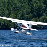
One more trip with my 170B?
Tue Mar 05, 2024 3:08 pm

Wed Mar 06, 2024 5:05 am
Re: One more trip with my 170B?
Hell yeah!

Wed Mar 06, 2024 5:44 am
Re: One more trip with my 170B?
Sweeeeeeeeet
Wed Mar 06, 2024 1:23 pm
Re: One more trip with my 170B?
Awesome Wolf
Enjoy!
MW
Enjoy!
MW
- 185Midwest offline

- Posts: 437
- Joined: Sun Sep 30, 2018 11:58 am
- Location: Fort Wayne
- Aircraft: C-185
Wed Mar 06, 2024 7:41 pm
Re: One more trip with my 170B?
Be sure to post videos

Sat Mar 09, 2024 3:00 am
Re: One more trip with my 170B?
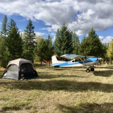
This is how the trip starts...
Sun Mar 10, 2024 3:09 pm
Re: One more trip with my 170B?
The weather came up with a surprise!
It reminded me how important a thorough wx-briefing is.
It reminded me how important a thorough wx-briefing is.
Tue Mar 12, 2024 2:10 am
Re: One more trip with my 170B?
Weather...how do you plan for it?
Hell yeah, weather can come up with surprises, as you saw in my last video.
Now I’m back indoors again, and I’ll continue by talking about meteorological planning and wx-briefings.
On my 5-week camping trip last fall I used the NOAA/NWS prog charts and wx-info and the briefing on foreflight to get a basic idea about the situation.
Since I was on a totally relaxed schedule, I could decide spontaneously when to depart just by looking at the sky, and although the general direction where I wanted to go was predetermined, I chose the final destination by checking out METAR’s along the route.
Now, when I plan my flight down to Sun ‘n Fun, the situation is different and it’s one with which I don’t have much experience.
First, the final destination is given, and second, I don’t have unlimited time to get there. Being a VFR-pilot, I thought I’d plot different routes with alternates for fuel stops that accommodate my personal limits for visibility, wind, cloud base, etc….
I’ll use the prog charts again, as well as the foreflight wx-briefing, but this time I’d like to include data from windy, the website or the app.
Now I’m really curious if anyone of you has used windy for flight planning, and if so, what was your experience? Did it help with planning, why…?
Also, do you use, or know of any other source of meteo-data , or app, which I should be checking out?
Interested in your answers and comments.
Sat Mar 16, 2024 1:44 am
Re: One more trip with my 170B?
In less than 4 weeks I’ll be flying from New England down to Sun ’n Fun and when I looked at the map and envisioned my flight, a sudden whiff of anxiety blew through my heart: ” Gee, you haven’t flown in almost 6 months, and now you want to go on a 1200 mile cross country trip? How is that supposed to work?”
“No problem”, says the internet, “ it’s easy and all is cool”.
Well, everything is easy and cool on the internet, but I’m talking about reality. And for some of us who don’t fly a lot, it is worrisome.
But I’m not going to let it stop me from taking this trip.
I flew about 120hrs in less than two months last fall, and that’s probably more than many of the 170 owners fly in an entire year.
So where does this anxiety come from, what do I make of it or with it?
Maybe it has something to do with my advanced age? LOL
Because back in my soaring days, there were many years with a 6 months hiatus where I didn’t fly due to winter and/or prolonged periods of bad weather in late fall or early spring. Not once was I the least preoccupied before my first flight of the season. On the contrary, I could hardly wait to get airborne and chase thermals again.
Nor did I have the slightest trepidation when I hopped in my car after a long year of pandemic isolation.
So I decided to take that shot of anxiety as a nudge to go out and fly an hour or two with my favorite instructor and then continue with some solo practice on nearby grass strips and get confident again.
That sounds like a lot of fun, actually, I’m really looking forward to it.
In the end it’s all about managing emotions, and that has always struck me as an interesting challenge in my flying endeavors.
Sat Mar 16, 2024 3:58 pm
Re: One more trip with my 170B?
Thanks for posting Wolf! Looks like your getting more comfortable with your videos... It sure is hard to produce content, so kudos. So glad you are gonna keep flying the 170 till it sells. It will be fun to see you again!
Greg-
Greg-
- Bigrenna offline


- Posts: 2339
- Joined: Sun Sep 25, 2011 4:02 pm
- Location: New England
- Aircraft: C180H / C170B
www.bushwagoneast.com
www.avthreads.com
Sun Mar 17, 2024 4:11 am
Re: One more trip with my 170B?
140eagles wrote:
I’ll use the prog charts again, as well as the foreflight wx-briefing, but this time I’d like to include data from windy, the website or the app.
Now I’m really curious if anyone of you has used windy for flight planning, and if so, what was your experience? Did it help with planning, why…?
I use the Windy app and I like it. There was a learning curve until I figured out where to look for information. Basically you have to open the menu, choose the weather information you would like (wind, low clouds, fog, etc.) then close the menu to focus on that weather. You can move the slider left or right to the date and time you want and get the forecast. If you touch a spot on the screen it will open a litte bullseye that you can move to a specific area for a precise forecast for that spot.
I like it because the forecasts seem to be very accurate. I'm using the free version of the app... there is more information in the paid version but for day-vfr flying the free version gives me everything I need.
Sun Mar 17, 2024 7:09 am
Re: One more trip with my 170B?
Created by a 28M pilot https://avxcwx.com/
For a quick look at weather rendered in cartoon form https://www.usairnet.com/cgi-bin/launch ... A&sta=KTAN
The proper FAA weather resources are OK if you get familiar with them.
And I probably use Windy most of all. I think the 20 bucks a year is worth it to get the longer range weather guesses.
For a quick look at weather rendered in cartoon form https://www.usairnet.com/cgi-bin/launch ... A&sta=KTAN
The proper FAA weather resources are OK if you get familiar with them.
And I probably use Windy most of all. I think the 20 bucks a year is worth it to get the longer range weather guesses.
Wed Mar 20, 2024 7:51 am
Re: One more trip with my 170B?
kg wrote:I use the Windy app and I like it...
Champ7 wrote:Created by a 28M pilot https://avxcwx.com/ ...
Thanks for the feedback!
I'll play with windy to get more familiar with its features and compare it to the avxcwx data/forecast.
Should be interesting.
Tue Mar 26, 2024 2:37 pm
Re: One more trip with my 170B?
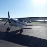
Nice 170, Wolf.
DISPLAY OPTIONS
Who is online
Users browsing this forum: No registered users and 0 guests
Latest Features
-
Live to Tell
A Minnesota pilot is surprised to learn that the sudden asymmetric drag of an out-of-rig ski can…Read More -
Creators
Working in some of the Yukon's most beautiful and remote environments, photographer Simon Blakesley captures aircraft in…Read More -
Aircraft Ownership and Maintenance
Upgrading to big tires can make a huge difference in backcountry performance, but with those gains come…Read More -
Tales from Yesteryear
In this tale from bush flying yesteryear, Don Cogger signs up to help Atlee Dodge Jr recovery…Read More


Latest Knowledge Base
-
Destinations
A regional guide with ideas for winter camping destinations in California, Nevada, New Mexico, and Arizona.Read More -
Aircraft
Finding an affordable aircraft that can handle the backcountry for $80K or less? A challenge for sure, but with the…Read More -
Aircraft
01.29.2018 - Zane - Updated tire diameter graphic to add 8.50x10 Guide to tires for use in the backcountry and off-airport landing…Read More -
Pilots
12.22.2013 - Initial article format Operating aircraft on skis and negotiating a snow-covered landscape is an entirely unique skillset and environment.…Read More


