Trip Summary
* 2,100+ statute miles, 17.7 hours
* Generally 30 to 40+ mph tailwinds at altitude for two days
* Average fuel burn ~ 6 gph
Fuel & Overnight Stops:
• Delta, CO, KAJZ
• Ogallala, NE, KOGA
• Ankeny, Iowa, KIKV
• Bult Field, Monee IL, C56—overnight
• Wayne County, Wooster OH, KBJJ
• Fulton County, New York. NY0
• Norridgewock, Maine, KOWK—home base
Key considerations:
• Looked for potential 2-day weather window; Did not want to get stuck in the middle-of-nowhere for day(s) due to weather or winds
Two day weather window all the way across the country almost impossible! I was dreaming!
• Ideal if upper winds were favorable with 2-day tailwinds
• Fuel capacity: 26 gallons; Expected fuel burn ~ 6 gph
Looking for 2.5 to 3.0 hour legs, leaving very conservative 1+ hour reserves
• Predicted surface winds were KEY. This is a light-sport with a maximum 12-knot crosswind capability—and I didn’t want to push the limits!
• Surface wind predictions, along with 2.5-3 hour desired legs, had me looking for airports whose runways ideally aligned with the forecast wind
Getting over the Continental Divide at any time of year can be challenging
o Wanted forecasted winds at 14,000’ to be less than 30 knots
o Looking ahead with https://windy.com in conjunction with the wind forecast tab within ForeFlight were key
o Also hugely useful are the actual wind reporting stations at:
Colorado AWOS map (https://www.codot.gov/programs/COMtnAWOSMap)
FAA weather cams (https://weathercams.faa.gov/map/-111.25917,36.1314,-104.59597,41.53136 zoomed in on Colorado)
Actual weather reports on Colorado (snow) avalanche site (https://avalanche.state.co.us/weather/weather-stations), particularly Berthoud Pass & Monarch Pass; at the time of writing this article the winds at Monarch Pass are 39G48
Every morning I’d look at all the above websites. I particularly like the user interface and easy-to-scroll-ahead predictions at https://windy.com. BTW, I subscribe to Windy at the “Premium” level.
Here’s the planned route, with some minor deviations early crossing Colorado passes then later getting around Mode-C veil (Cleveland) and various Class-D airspace areas.
We also had a few MOA’s to pass thru. Most, thankfully, started at 8,000’ or higher. I did talk to Boston Center to verify Yankee 1 & 2, which started at 100’ in New York, were inactive.

A view of the panel:

Things worked out for a departure on April 21st. Normally I like to takeoff at dawn, especially when travelling over the Continental Divide.
Winds at the passes are, as you’d expect, often the lowest early in the am. Low winds at a Continental Divide pass means less than 30 knots.
However, on this trip, I was trying to balance winds-at-the-passes with predicted winds enroute at the first and subsequent stops. A strong front passed thru Western Colorado on Saturday—I was basically chasing behind that front two days later across the country. Hence predicted surface winds were quite high, but lowering as each day progressed. So I balanced a later-than-normal departure (7:30 am) with arriving mid morning at my first estimated stop (Ogallala Nebraska).
I crossed near Crested Butte (picture below) at about 13,500’ I stayed at that altitude until well past the Colorado mountains.

I saw plumes of snow ahead over the Collegiate Range. I expected turbulence, but only experienced a few light burbles.

I had a great view of Mt Princeton (14,200’) near Buena Vista, Colorado that I hiked up many years ago.

Again, though I expected turbulence over the Continental Divide, it was largely fairly smooth. However, as soon as I dropped down to about 9,500’ over Colorado’s Front Range, it got quite choppy. Here’s a picture passing Akron, Colorado.

Welcome to the flat-as-a-pancake Midwest!
It has been many years, perhaps 15+, since I’ve flown Eastern Colorado thru Nebraska. I can assure you, Nebraska has NOT gotten any prettier! What do I mean (sorry if you’re from Nebraska)…well here is a picture looking North near North Platte, Nebraska.

I was debating whether to stop in Ogallala Nebraska or North Platte for fuel. Imperial Nebraska would have been ideal, as their grass runway aligned almost perfectly with surface winds. But there is a NOTAM closing the grass runway until June 1st—I suspect to preserve the grass. Sigh. Ogallala it was.
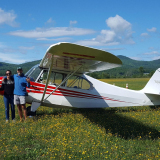
Thence onward to Ankeny, Iowa, just N of Des Moines, to pick up the aircraft owner. Fuel stops were just long enough to fill up, use the restroom, stretch for 30 seconds and keep on trucking.
Out of the Des Moines area we still had a few hours of daylight left…if we could get in another stop we’d have some chance of perhaps getting to Maine the next day, of course weather and winds cooperating.
The next day we were passing thru Illinois. I was amazed at the size of the below BNSF railway car park at Elwood, Illinois. There must be a zillion cars and tractor-trailers there!!

Surface winds generally weren’t too bad, often 10G15+, but close enough to the available runway directions as to not present undue difficulty. At one stop, Fulton County NY (identifier NY0) the winds were 15G25 about 30° crosswind; We did a go-around on our first approach. The actual landing on grass adjacent to the runway was a non-event.
However, one of us had to remain in the airplane with the brakes on while the other fueled up—the surface wind was actually pushing the plane backwards even with wheel chocks in place!
Upper winds cooperated nicely! At altitudes between 5,500’ and later 9,500’ we generally had 30+ to sometimes 45+ mph tailwinds. Look at our groundspeed in the below image:

Speaking of MOA’s…we were at about 7,500’ with (I think it was DUKE MOA) starting at 8,000’ above us. Then I noticed traffic below us—as in almost at the surface! It was two C-130 aircraft at low-level in trail. I hope they had us on radar! It’s hard to see in the below picture, as they were painted all gray and blended in well with the terrain.

We passed by Elmira, New York—home of early soaring history (https://www.soaringmuseum.org/). I grew up near Elmira—it was special flying in this section of the cross-county journey.

As we got closer to central Maine I saw what seemed to me to be a series of gray fields up ahead. We made a slight deviation to discover they are solar panels.

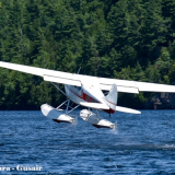
It was getting towards evening on the 2nd day of the trip. We landed on runway 33 at KOWK, Norridewock, Maine at about 6:30 pm.
It was almost a perfect “greaser” landing. In what was an unanticipated end to an otherwise perfect trip—just as we had slowed to almost taxi speed, the left tire went flat! Geesh! All was good though with no problems other than having to tow the plane to the hangar.


Actual route:

Thank you for reading thru this!