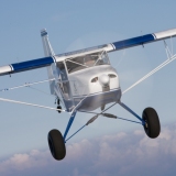
Backcountry Pilot • The Official 2010 BCP Johnson Creek Pic/Vid Thread

The Official 2010 BCP Johnson Creek Pic/Vid Thread

All topics related to the 2010 Annual Summer Fly-in
128 postsPage 5 of 71, 2, 3, 4, 5, 6, 7

Re: The Official 2010 BCP Johnson Creek Pic/Vid Thread

Landing at Deadwood Dam


That is very nice. I am curious if the glassy water created any issues on maintaining proper approach altitude.

That is a classic glassy water setting for a float plane and knowing when to flare in those conditions is really difficult.
TomD offline
User avatar
Posts: 1113
Joined: Mon Jul 03, 2006 5:17 pm
Location: Seattle
Aircraft: Maule M5-235C

Re: The Official 2010 BCP Johnson Creek Pic/Vid Thread

skymaule wrote:Bonanza Man, You didn't say hi when we flew by Billings this year! The Hot Springs you asked about is at Lower Loon. About a half mile hike up Loon Creek.


Don't recall you flying by. Thanks for the info on the hot spring.
Bonanza Man offline
Posts: 909
Joined: Fri Jul 07, 2006 3:42 pm
Location: Seeley Lake

Re: The Official 2010 BCP Johnson Creek Pic/Vid Thread

TomD wrote:
Landing at Deadwood Dam


That is very nice. I am curious if the glassy water created any issues on maintaining proper approach altitude.

That is a classic glassy water setting for a float plane and knowing when to flare in those conditions is really difficult.


I think as long as you are doing your flaring over the ground it shouldn't be a problem.

It would come into play if the engine were to quit and you found yourself heading for the water instead of the dirt. You generally can't tell how high you are so if you flare it is only an educated guess where to start the flare. Flare to high and you stall. Flare to low and the water can be as hard a concrete.
Because this is basically a one way strip so you have to approach over the lake and take of towards the lake.

Because a lot of pilots fly only wheels they are not taught about glassy water they might not know the approach should be high enough to let you land in the water along the shore so you have reference for your flare if the engine quits.
On the takeoff a turn should be made and the plane should fly along the shore until there is enough altitude to cross the lake within gliding distance of the nearest shore.

A float plane has to follow the same rules as a wheel plane here. Just because it has floats doesn't mean it you can ignore these basic rules. If the engine keeps putting out, no problem. If it quits it is a different story. Mostly you will see float planes approach and land along the shore just in case the cooling fan quits.

A glassy water landing is done with power and there is no flare (at least with the elevator). You can set your approach nose high and a decent rate of 500 feet a minute (or more) to start with. You trim the plane to your touch down speed maybe 50 mph in a lighter plane. As you get closer to the water (using the shore, ducks, pollen, cottonwood fluff... for reference) you would change your rate of decent with power maybe down to 50 feet per minute. You set yourself up with a decent you would like to touch down with. If you have a large enough lake you can come onto the power and slow your decent to a few feet a minute and grease it in very smoothly. For a new float pilot it is difficult to not use the elevator to flare. Set it up, then you then just keep the wings level until you touch the water. The only changes are power settings.
With no power gliding towards the centre of the lake you can't slow your decent with power so the only choice to arrest your decent is to flare with the elevator, and when to do that is a guess. (See Above)

My pucker factor tells me I would have approached this strip high closer to a power off glide angle of decent. Or along the shore with a turn to a very short final with the angle of decent in this video.

Very nice setting and video though.
:)
Gerry
Soup Campbell offline
Posts: 59
Joined: Sun Mar 21, 2010 2:59 pm
Location: BC

Re: The Official 2010 BCP Johnson Creek Pic/Vid Thread

The Staggerwing takeoff sunday morning:

Zzz offline
Janitorial Staff
User avatar
Posts: 2854
Joined: Fri Oct 08, 2004 11:09 pm
Location: northern
Aircraft: Swiveling desk chair
Half a century spent proving “it is better to be thought a fool than to open your mouth and remove all doubt.”

Re: The Official 2010 BCP Johnson Creek Pic/Vid Thread

What Matt doesn't say is that he was 30 feet off the deck in a tree when he snapped this shot:
Image

Or how crumbly this little pillar was:
Image
GroundLooper offline
User avatar
Posts: 1168
Joined: Wed Jun 13, 2007 6:52 pm
Location: Vancouver, WA
BCP Poser.
Life is good. Life is better with wings.

Re: The Official 2010 BCP Johnson Creek Pic/Vid Thread

1SeventyZ wrote:The Staggerwing takeoff sunday morning:


When you pause it at 26-27, it's almost as good as Vicks Skywagon picture.
58Skylane offline
User avatar
Posts: 5297
Joined: Thu Oct 11, 2007 12:36 pm
Location: Cody Wyoming

Re: The Official 2010 BCP Johnson Creek Pic/Vid Thread

thinwing wrote:hey Grassstripp...you missed all the excitement at seeley lake last monday night thunder storm with hail ...we watched under the wing of a 310 we were trying to protect with bedding,sleeping bags,etc while the poor old bird got hammered...fortunately no real damage...than discovered the joys of hangering the following night after at bozeman...car windows hailed out...thin


Oh man, that doesn't sound good. Glad we didn't have to do that. I like my bedding around me keeping me dry and warm.
Grassstrippilot offline
Knowledge Base Author
User avatar
Posts: 3536
Joined: Wed May 31, 2006 6:17 am
Location: Syracuse, UT
FindMeSpot URL: https://share.garmin.com/WolfAdventures
Aircraft: Cessna 205

Re: The Official 2010 BCP Johnson Creek Pic/Vid Thread

mountainmatt wrote:I'll add a few more.

High above JC
Image


Someone ate their Wheaties. That is a long way up!
Grassstrippilot offline
Knowledge Base Author
User avatar
Posts: 3536
Joined: Wed May 31, 2006 6:17 am
Location: Syracuse, UT
FindMeSpot URL: https://share.garmin.com/WolfAdventures
Aircraft: Cessna 205

Re: The Official 2010 BCP Johnson Creek Pic/Vid Thread

Matt and Bryan, great videos. I think that is the first I've seen of Deadwood and Lower Loon. Joe and Mark, great pics. We are headed up again next week for some more fun.

GSP
Grassstrippilot offline
Knowledge Base Author
User avatar
Posts: 3536
Joined: Wed May 31, 2006 6:17 am
Location: Syracuse, UT
FindMeSpot URL: https://share.garmin.com/WolfAdventures
Aircraft: Cessna 205

Re: The Official 2010 BCP Johnson Creek Pic/Vid Thread

Very jealous, Cory! You have a wonderful time with Dee and the Kids! Here is a Muvee video I did last night. I'm not thrilled with it , but what the heck. Take a look if you like.

skymaule offline
User avatar
Posts: 203
Joined: Sat May 24, 2008 11:22 am
Location: North Dakota

Re: The Official 2010 BCP Johnson Creek Pic/Vid Thread

Very cool Mark. We'll be thinking of you while we are up there. I'm still working on my vid. The captain I was flying with on the transcon was too chatty last night to get much work done on it.
Grassstrippilot offline
Knowledge Base Author
User avatar
Posts: 3536
Joined: Wed May 31, 2006 6:17 am
Location: Syracuse, UT
FindMeSpot URL: https://share.garmin.com/WolfAdventures
Aircraft: Cessna 205

Re: The Official 2010 BCP Johnson Creek Pic/Vid Thread

mountainmatt offline
User avatar
Posts: 2803
Joined: Sat Apr 11, 2009 2:43 pm
Location: Colorful Colorado
FlyingPoochProductions
FlyColorado.org

Re: The Official 2010 BCP Johnson Creek Pic/Vid Thread

Nice work Matt. It looks like there are small logs across the dirt strip or are they shadows or ??
SixTwoLeemer offline
User avatar
Posts: 1285
Joined: Thu Feb 07, 2008 10:53 am
Location: Wasatch Front
Altitude is Time…. Airspeed is Life!

Re: The Official 2010 BCP Johnson Creek Pic/Vid Thread

I like it lots.
Soup Campbell offline
Posts: 59
Joined: Sun Mar 21, 2010 2:59 pm
Location: BC

Re: The Official 2010 BCP Johnson Creek Pic/Vid Thread

SixTwoLeemer wrote:Nice work Matt. It looks like there are small logs across the dirt strip or are they shadows or ??


They are rubber weather strips to keep the dirt from eroding away the center of the strip. They are about 3" high and 3/8" thick. You can't tell they are there with the plane, but with the recent work on the strip, they packed dirt next to them and it is a little mounded up (>1" though). 85U is in a LOT better shape than last year, someone put a lot of work into it.
mountainmatt offline
User avatar
Posts: 2803
Joined: Sat Apr 11, 2009 2:43 pm
Location: Colorful Colorado
FlyingPoochProductions
FlyColorado.org

Re: The Official 2010 BCP Johnson Creek Pic/Vid Thread

here's a few pics of my short trip to JC.

Lookin kinda dark.
Image

Very cool view.
Image

Arriving JC while most were out to breakfast...and didn't get to see my stellar landing :oops:
Image

Flew over Mackay Bar with Z and his dad somewhere out in front...
Image

Wilson Bar and a couple cubs
Image

Mile Hi. taildrgfun, emflys, Avidflyer, and another guy are in this shot but you can't see 'em. They all just took off and were heading to dewy.
Image

Cabin Creek.
Image

Lots of puffy clouds indicating my ride home would be rough and miserable...which it was.
Image
whee offline
User avatar
Posts: 3386
Joined: Fri Jan 20, 2006 1:59 pm
Location: SE Idaho

Re: The Official 2010 BCP Johnson Creek Pic/Vid Thread

mountainmatt wrote:
They are rubber weather strips to keep the dirt from eroding away the center of the strip. They are about 3" high and 3/8" thick.


Don't they do a similar thing on logging roads in the west, also to prevent erosion? Does it seem effective? How much is buried in the ground? It it perpendicular to the fall line or slightly angled?

Thanks
denalipilot offline
Supporter
User avatar
Posts: 2789
Joined: Mon Oct 15, 2007 4:53 pm
Location: Denali
Aircraft: C-170B+

Re: The Official 2010 BCP Johnson Creek Pic/Vid Thread

OK, OK, I can't stand it....I missed this year, but I just bid my vacation for next year. You can bet I will be there, don't have a clue what I will fly.
HighlanderLynn offline
Supporter
User avatar
Posts: 66
Joined: Thu Apr 17, 2008 7:02 am
Location: Gainesville, FL
If your not living on the edge, you're taking up too much space.

Re: The Official 2010 BCP Johnson Creek Pic/Vid Thread

denalipilot wrote:
mountainmatt wrote:
They are rubber weather strips to keep the dirt from eroding away the center of the strip. They are about 3" high and 3/8" thick.


Don't they do a similar thing on logging roads in the west, also to prevent erosion? Does it seem effective? How much is buried in the ground? It it perpendicular to the fall line or slightly angled?

Thanks


Slightly angled to the downhill side. No idea how deep they go, but I'd suspect 6"+ deep, they seem pretty solid.
mountainmatt offline
User avatar
Posts: 2803
Joined: Sat Apr 11, 2009 2:43 pm
Location: Colorful Colorado
FlyingPoochProductions
FlyColorado.org

Re: The Official 2010 BCP Johnson Creek Pic/Vid Thread

Cool, AvWeb liked it. No blue ribbon but I'll take it - 4th pic down. Good press for bcp.org too...

http://www.avweb.com/avwebflash/potw/PictureOfTheWeek_202879-1.html
Vick offline
User avatar
Posts: 823
Joined: Fri Jan 06, 2006 2:21 pm
Location: Grass Valley, CA
FindMeSpot URL: http://share.findmespot.com/shared/face ... WUk8CX06AP
Solum Volamus

DISPLAY OPTIONS

PreviousNext
128 postsPage 5 of 71, 2, 3, 4, 5, 6, 7

Who is online

Users browsing this forum: No registered users and 0 guests

Latest Features

Latest Knowledge Base