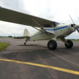
An airstrip VIDEO was updated by mountainmatt on Friday, December 16, 2011, 09:30:25 PM
http://www.shortfield.com/index.php?opt ... =-109.9833
UT75 - MINERAL CANYON STRIP, UT
Fri Dec 16, 2011 11:00 pm
- shortfield.com offline

- Posts: 104
- Joined: Mon Sep 19, 2011 1:02 pm
- Location: Idaho
shortfield.com is a free online resource for users to share information on backcountry and off-airport landing sites. All information is contributed by users like you. If you like the site, please set-up an account and join the project.
Fri Mar 02, 2012 1:18 pm
Re: UT75 - MINERAL CANYON STRIP, UT
Looking for a pierp and some info about mineral. We are thinking about floating labyrinth canyon at the end of this month. My wife has to be back to work the day after we get off the river so in order for her to go I'll need my dad to picker her up at mineral canyon. Is the strip still soft? Any info about flying in/out of there would be appreciated.

Fri Mar 02, 2012 1:40 pm
Re: UT75 - MINERAL CANYON STRIP, UT
Last time I was there was January 5th. It was in great shape then but don't know how much moisture the've had since.
Magnet
Sun Mar 04, 2012 10:37 am
Re: UT75 - MINERAL CANYON STRIP, UT
Magnet wrote:Last time I was there was January 5th. It was in great shape then but don't know how much moisture the've had since.
Thanks Magnet. guessing as long as they don't get too much moisture around the time we go then we should be fine.
Mon Mar 05, 2012 9:00 pm
Re: UT75 - MINERAL CANYON STRIP, UT
whee wrote:Looking for a pierp and some info about mineral. We are thinking about floating labyrinth canyon at the end of this month. My wife has to be back to work the day after we get off the river so in order for her to go I'll need my dad to picker her up at mineral canyon. Is the strip still soft? Any info about flying in/out of there would be appreciated.
We received this email in mid January:
Utah Back Country Pilots,
We thought we'd take this opportunity to up-date you on the condition and a short history of the Mineral Canyon Landing Strip.
For those who want "just the facts", the short story is the strip was recently inspected and conditioned as required and is currently in great shape. The dried weeds have been removed and ruts at the south end filled and smoothed over. The parking area was also cleared.
The long story is, well, a little longer.
Mineral Canyon is an enchanting place. There is no other place quite like it. Deep in the Green River, it is surrounded by vertical red rock. The river moves sedately by as it has for a millennia. The night sky displays uncountable stars and the Milky Way splashes diagonally from horizon to horizon like a huge electric banner. At night the air becomes so still one can hear the roar of jet airplanes as they pass overhead. Peregrine Falcons rear their young on the cliff faces and Big Horn Sheep raise lambs in the river bottoms.
The Mineral Canyon Landing Strip was built by the Excalibur Uranium Company in 1950 or 51. Excalibur discovered a small area of uranium mineralization in the lower Chile Formation a few hundred yards northeast of the present landing strip. Not much ore was removed and the mine was closed a short time later. The air strip lay somewhat idle and although a few pilots and hikers used it, it was largely forgotten. Sometime around 1990, the BLM declared the strip closed. This was about the same time as aviators were re-discovering the back country and Mineral Canyon became one of the reasons for the formation of UBCP as pilots wanted to access the landing strip for camping and recreation.
Through the efforts of UBCP and the cooperation of the BLM, an Environmental Impact report was prepared which indicated there would be no significant impacts to the land or wildlife if airplanes utilized the landing strip. The report recommended that the agency grant what is called a "Title 5 Right of Way". The right of way was given to what was then Redtail Aviation. The right of way was immediately challenged by environmental groups and put on hold by the BLM. You very early UBCP members may remember donating to a legal fund we established to fight this challenge. Redtail Aviation and UBCP were successful in this effort and the right of way granted. Redtail was sold some time later and changed its name to Aero West. The owner of Aero West, Mark Francis, still maintains the right of way for which he pays a yearly fee to the BLM. While Mark retains exclusive commercial access to the landing strip, he allows it to be open unrestricted for recreation. All pilots owe Mark a debt of gratitude for this.
The spring flooding of 2011 will go down in history as a seminal event. The Green River overflowed its banks and dry canyon dirt that had not seen the river for perhaps a century became river bottoms again. Places like Potato Bottom, Anderson Bottom, and yes, Mineral Bottom were under water for most of the spring and summer. From the air the river was incredible. We wondered at the time what would emerge at the landing strip when the waters receded. Would the landing strip be hard packed or filled with silt so fine that landings would be impossible? Would it even still be there?
It took well into July to tell the tale, but by late summer, there was the strip, looking as good as ever. The river had bathed the bottom lands in fresh rich nutrients and a fine crop of green weeds now covered the the area. A few intrepid aviators tried their hand at the landing strip while a little mud remained and barely escaped.
We visited the strip in November and tried to our best to smooth over the ruts but found it still too muddy to effect much good. What we found, though, was intriguing. A "high water" mark was evident on the surrounding vegetation indicating that the strip was under three to four feet of water. When the river receded, a lake remained for some time and the airplane parking area was found to be littered with thousands of small fish. Cut off from their habitat, they died when the lake faded once again to sun-baked dirt.
Finally, last week were were able to drive in once again. The runway is was found to be hard and firm. A few hundred feet at the extreme south end is now unusable due to the large amount of brush growing, but this is not a big concern. The balance of the runway is smooth and hard. There is some vegetation which will help control dust, especially at the north end. The ruts left in the soft mud were smoothed over and will leave no significant lasting scars, and the dried weeds were drug from the runway and parking area. The wind sock could be changed. If someone would take that task on, let us know and well get you a new sock.
The link below will open a photo album on the UBCP web site showing some of the interesting changes we have documented that the runway has gone through last year. We hope you enjoy the landing strip. We believe it to be a national treasure. Remember, it gets soft in the middle after a hard rain. We are working to possibly install a drain to mitigate this in the future.
Sincerely,
UBCP Board
http://www.utahbackcountrypilots.org/ga ... FLYINGUTAH
- SixTwoLeemer offline

- Posts: 1285
- Joined: Thu Feb 07, 2008 10:53 am
- Location: Wasatch Front
Altitude is Time…. Airspeed is Life!
Mon Mar 05, 2012 9:33 pm
Re: UT75 - MINERAL CANYON STRIP, UT
I will try to fly into Mineral next weekend weather permitting. Last time I was in was Early Feb. and it was in excellent shape. Still a couple of ruts on the downstream end from a jeep but not bad enough to worry about. Land upstream from the vegetation and you should be fine.
"In a world full of people, only a few want to fly"
Tue Mar 06, 2012 6:44 am
Re: UT75 - MINERAL CANYON STRIP, UT
Just there 3/4/12. Excellent shape. So is Mexican Mountain.
- flynbeekeeper offline
- Posts: 372
- Joined: Fri Oct 19, 2007 8:01 pm
- Location: southern colorado
Tom
Wed Mar 07, 2012 7:04 am
Re: UT75 - MINERAL CANYON STRIP, UT
Looking a little wet down thet direction this morning. I will try to get there sometime in the next week. We had plenty of wind yesterday. I was doing some work outside on the 205 and gave up because I was worried about the door getting ripped off. 

Keep the Greasy side down!
Tue Jun 27, 2017 1:42 pm
Re: UT75 - MINERAL CANYON STRIP, UT
Any recent PIREPs? No updates on this thread since 2012 or on Shortfield since 2015. I'm thinking about heading over there in a couple weeks for some camping/exploring, mainly interested if the surface is soft/hard etc. I'm in a Pacer on 6.00x6s so I can't handle very soft/muddy conditions!
Tue Jun 27, 2017 4:06 pm
Re: UT75 - MINERAL CANYON STRIP, UT
Flew over at canyon rim height a couple weeks ago, looked good. Haven't landed since late last October, was in good condition then. I have big tires/tailwheel though, so don't worry much bout soft surface conditions n could be misleading based on that perspective.
Those are pretty small tires, might get some 8.50's for that mission. It has been super hot there lately, be careful. We were gonna camp at Cedar Mountain a few nights back, it was so hot that even at that elevation it sounded like no fun, punted and went to Colorado where it was cooler.
Sent from my iPhone using Tapatalk
Tue Jun 27, 2017 8:53 pm
Re: UT75 - MINERAL CANYON STRIP, UT
WestTex wrote:Flew over at canyon rim height a couple weeks ago, looked good. Haven't landed since late last October, was in good condition then. I have big tires/tailwheel though, so don't worry much bout soft surface conditions n could be misleading based on that perspective.
Those are pretty small tires, might get some 8.50's for that mission. It has been super hot there lately, be careful. We were gonna camp at Cedar Mountain a few nights back, it was so hot that even at that elevation it sounded like no fun, punted and went to Colorado where it was cooler.
Sent from my iPhone using Tapatalk
I'd rather have some bigger rubber, my hangar mate even offered me his old 8.50s but I don't have the STC yet and my dad likes the smaller tires so we can throw on wheel pants for cross countries. The Pacer is our go-fast airplane
Wed Jun 28, 2017 5:32 am
Re: UT75 - MINERAL CANYON STRIP, UT
Kevin,
Getting pretty late in the year for Mineral. The heat will be an issue. The biggest issue though are the gnats and black flies. You will surrounded by a cloud as soon as you step out.
Tom
Getting pretty late in the year for Mineral. The heat will be an issue. The biggest issue though are the gnats and black flies. You will surrounded by a cloud as soon as you step out.
Tom
- flynbeekeeper offline
- Posts: 372
- Joined: Fri Oct 19, 2007 8:01 pm
- Location: southern colorado
Tom
Wed Jun 28, 2017 1:01 pm
Re: UT75 - MINERAL CANYON STRIP, UT
Gee, that sounds like a lot of fun
Magnet
Wed Jun 28, 2017 10:19 pm
Re: UT75 - MINERAL CANYON STRIP, UT
I was there end of May for two nights. Strip is in great shape for the most part, though the north end is very soft and dry - powder-like. I had no issues on 8.50s, but a Cherokee 140 on 6.00s got stuck twice. They had to get out and muscle the airplane around once they got to the north end.
Thu Jun 29, 2017 6:29 pm
Re: UT75 - MINERAL CANYON STRIP, UT
If you go alone, take a come-along, something to anchor it, and a pull strap!
Cary
Cary

"I have slipped the surly bonds of earth..., put out my hand and touched the face of God." J.G. Magee
Tue Sep 19, 2017 12:10 pm
Re: UT75 - MINERAL CANYON STRIP, UT
Planning on heading out to Utah next month. Mineral Canyon is listed as private but the contact info on Foreflight and Airnav is for a BLM office and the phone goes unanswered. Is permission required to land here?
- Bender offline
- Posts: 118
- Joined: Sat Oct 05, 2013 9:39 pm
- Location: Weatherford
- FindMeSpot URL: http://share.findmespot.com/shared/face ... QWUi6dqfEQ
- Aircraft: PA-22/20
Tue Sep 19, 2017 2:16 pm
Re: UT75 - MINERAL CANYON STRIP, UT
Update. A nice old lady called me back from the number listed on Foreflight and Airnav for Mineral Canyon. Unfortunately, she has no affiliation with Mineral Canyon or BLM.
- Bender offline
- Posts: 118
- Joined: Sat Oct 05, 2013 9:39 pm
- Location: Weatherford
- FindMeSpot URL: http://share.findmespot.com/shared/face ... QWUi6dqfEQ
- Aircraft: PA-22/20
Tue Sep 19, 2017 2:19 pm
Re: UT75 - MINERAL CANYON STRIP, UT
It’s frequently used and on BLM land, so no issue that I’m aware of.
Tue Sep 19, 2017 10:54 pm
Re: UT75 - MINERAL CANYON STRIP, UT
Bender, Wish my plane was done and I'd meet you there. You still flying the Pacer?
Wed Sep 20, 2017 4:50 am
Re: UT75 - MINERAL CANYON STRIP, UT
I was there in May. Good condition, but soft at the north end. OK on 8.50s, but a guy in a Cherokee 140 got stuck and had to shut down to pull himself out.
No problems landing there. It's private in as much as one company (Redtail, perhaps?) owns the commercial rights to fly in there, but if you're going in on a personal flight, you're good to go.
Chris
No problems landing there. It's private in as much as one company (Redtail, perhaps?) owns the commercial rights to fly in there, but if you're going in on a personal flight, you're good to go.
Chris
DISPLAY OPTIONS
Who is online
Users browsing this forum: No registered users and 0 guests
Latest Features
-
Live to Tell
A Minnesota pilot is surprised to learn that the sudden asymmetric drag of an out-of-rig ski can…Read More -
Creators
Working in some of the Yukon's most beautiful and remote environments, photographer Simon Blakesley captures aircraft in…Read More -
Aircraft Ownership and Maintenance
Upgrading to big tires can make a huge difference in backcountry performance, but with those gains come…Read More -
Tales from Yesteryear
In this tale from bush flying yesteryear, Don Cogger signs up to help Atlee Dodge Jr recovery…Read More


Latest Knowledge Base
-
Safety and Survival
Hope that you never have to use your survival vest but knowing you have it and knowing how to use…Read More -
Destinations
A regional guide with ideas for winter camping destinations in California, Nevada, New Mexico, and Arizona.Read More -
Aircraft
Finding an affordable aircraft that can handle the backcountry for $80K or less? A challenge for sure, but with the…Read More -


